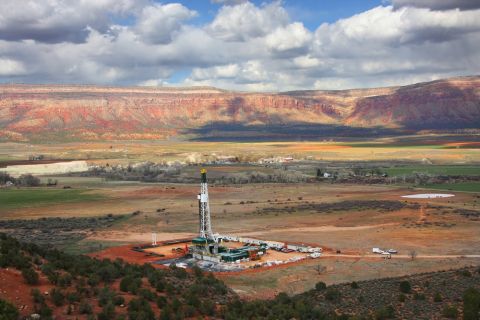
?1 Petrohawk Energy Corp. confirmed Eagle Ford Shale discovery details from its #1 Dora Martin in southern La Salle County (RRC Dist. 1), Texas. The discovery was tested flowing 8.3 million cu. ft. of gas equivalent per day. The flowing casing pressure was 4,610 psi on a 22/64-in. choke. The horizontal well was drilled to a true vertical depth of approximately 11,000 ft. with a 4,300-ft. lateral fractured in 12 stages. The new well is located in Section 735, HE&WT RR Co. Survey, A-875. The Houston-based company believes that the Eagle Ford Shale quality in this well appears superior to that found in the initial discovery, #1 STS. Petrohawk owns a 90% working interest in the project, with 10% owned by undisclosed industry partners.
2 Sugar Land, Texas-based C&E Operating Inc. has completed a Wilcox discovery in the central portion of Colorado County (RRC Dist. 3), north of Rock Island, Texas. The #3 Glasscock Ranch “A” was tested flowing more than 2.18 million cu. ft. of gas, 216 bbl. of 54.7-degree condensate and 29 bbl. of water per day through perforations at 10,774-82 ft. Gauged on a 12/64-in. choke, flowing and shut-in tubing pressures were 3,200 psi and 3,300 psi, respectively, and the absolute open flow was calculated at more than 28.25 million cu. ft. daily. The well was drilled to a total depth of 11,600 ft. on a 704-acre lease in the John Collier Survey, A-148.
3 A Wilcox completion by San Antonio-based Kaler Energy Corp. was tested flowing 1.48 million cu. ft. of gas, 39 bbl. of 57.9-degree condensate and 60 bbl. of water per day through fracture-treated perforations at 9,777 to 9,900 ft. The #2 O.A. Goebel Heirs was drilled in east Live Oak County (RRC Dist. 2), about three miles northeast of Oakville, Texas. On a 12/64-in. choke, flowing and shut-in casing pressures were 2,815 psi and 4,615 psi, respectively. The absolute open flow was calculated at 2.39 million cu. ft. per day. The #2 O.A. Goebel Heirs was drilled to a total depth of 10,500 ft. on a 1,064-acre lease in Section 6, Refugio CSL Survey, A-398. Reported log tops include Yegua at 5,550 ft., Upper Wilcox at 6,600 ft. and Middle Wilcox at 8,500 ft.
4 Houston-based Tri-C Resources Inc. has additional details on an 8,600-ft. Texas state waters 2008 discovery located just off the coast of Jefferson County (RRC Dist. 3). The #1 State Tract 10-L, on High Island Block 10-L, was tested flowing 5 million cu. ft. of gas per day through perforations in the Siphonina davisi (Lower Miocene) at 8,290-8,333 ft. Block 10-L Field was on line from the mid-1950s through 1993. The Miocene reservoir recovered a cumulative 32.3 billion cu. ft. of gas, 1.05 million bbl. of crude and condensate and 2.06 million bbl. of water.
5 Mariner Energy Inc. has made a deepwater gas find in Garden Banks Block 463. Mariner’s Bushwood prospect, #1 OCS G26655, was drilled to a total depth of 25,270 ft. The well logged more than 260 ft. of net gas pay in multiple sands, and more than 150 ft. of net gas pay was found in the deeper exploratory section. The #1 OCS G26655 bottomed on Block 463 to the east in 2,815 ft. of water. Houston-based Mariner operates and holds a 30% working interest in the gas discovery. Partners include Energy Resource Technology GOM Inc., 35%; Apache Corp., 20%; Deep Gulf Energy II LLC, 10%, and Deep Gulf Energy LP, 5%.
6 A Nadel & Gussman LLC Haynesville producer has been completed in Shongaloo Field near Shongaloo, La. The well is located in Section 36-23n-10w, Webster Parish, 1.5 miles west of the town of Shongaloo. The #1 Haynesville Mercantile “36” was tested flowing 3.15 million cu. ft. of gas and 260 bbl. of 62-degree condensate per day through perforations at 10,514-26 ft. Using a 12/64-in. choke, flowing and shut-in tubing pressures were gauged at 4,100 psi and 4,650 psi, respectively. The new producer was drilled to a total depth of 10,640 ft. Nadel & Gussman’s headquarters are in Tulsa.
7 A Lower Tertiary oil discovery with 300 ft. of net pay on Keathley Canyon Block 872 has been reported by Repsol E&P USA Inc. The #1 (BP) OCS G25823, known as the Buckskin discovery, was drilled by a drillship to a total depth of 29,404 ft. in 6,978 ft. of water. Spanish firm Repsol, with a 12.5% interest, operated the discovery. Chevron Corp., holding a 55% stake, will become operator and conduct all future tract work. Other Buckskin co-owners are Maersk Oil America, 20%, and Samson Offshore Co., 12.5%. Chevron will continue testing and gathering data, and performing additional work needed to determine the extent and commercial viability of the discovery.
8 In Green Canyon Block 859, Anadarko Petroleum Corp., The Woodlands, Texas, has announced a significant oil discovery at its deepwater Heidelberg prospect. The well hit more than 200 ft. of net oil pay in high-quality Miocene sands. Additional well details were not released. Heidelberg is adjacent to four 100% Cobalt working-interest leases (Green Canyon blocks 813, 814, 858, 902) acquired in a March 2008 OCS Lease sale. Heidelberg is located in approximately 5,000 ft. of water and was drilled to a total depth of approximately 30,000 ft. Anadarko operates Heidelberg with a 44.25% working interest; Mariner Energy Inc. holds 12.5%; ENI, 12.5%; StatoilHydro, 12%; and ExxonMobil, 9.375%; and Cobalt International Energy LP has 9.375% working interest.
9 A second discovery by Anadarko Petroleum Corp. has been reported at its Shenandoah well on Walker Ridge Block 52. IHS Inc. reports that #1 (BP2) OCS G25232 encountered net oil pay approaching 300 ft. in the Wilcox. Located in 5,815 ft. of water, the well was drilled to a total depth of approximately 30,000 ft. The discovery was permitted as the 1 OCS G20259, with a proposed bottomhole location on Block 8 immediately to the north. According to the Minerals Management Service, however, the oil find bottomed on Block 52. Anadarko and partners are evaluating the well results and future appraisal activity. Anadarko operates Shenandoah with a 30% working interest. Co-owners of the discovery include ConocoPhillips, with 40%; Cobalt International Energy LP, 20%; and Marathon Oil Corp., 10%.
10 A Shoreline Southeast LLC directional Miocene well has been completed in Clovelly Field in Lafourche Parish, two miles northeast of Galliano, La. IHS Inc. reports that the #2 Allain-Lebreton was tested flowing 224 bbl. of 40-degree crude, 166,000 cu. ft. of gas and 126 bbl. of water per day through perforations at 12,952-13,236 ft. The well’s total depth is 13,308 ft., with a true vertical depth of 13,257 ft., and it is located in Section 7-19s-22e. The #2 Allain-Lebreton is an offset to #1 Allain-Lebreton to the northwest in the same section. The #1 Allain-Lebreton produced 1.87 million cu. ft. of gas and 45 bbl. of condensate during its first month online. Shoreline Energy’s headquarters are in Houston.
11 A?deepwater Friesian discovery by?Plains Exploration & Production Co. of Houston has logged nearly 400 net ft. of oil pay at a confirmation well in the deepwater Gulf of Mexico. Plain’s #1 OCS G16772 on Green Canyon Block 643 was drilled to a total depth of 28,989 ft. and encountered approximately 389 net ft. of oil-saturated Miocene-aged sands with three main sand lobes encountering more than 210 net ft. of high-quality oil pay plus a fourth sand lobe with an additional 179 ft. of oil pay that was not fully evaluated.
Recommended Reading

Athabasca Oil, Cenovus Energy Close Deal Creating Duvernay Pureplay
2024-02-08 - Athabasca Oil and Cenovus Energy plan to ramp up production from about 2,000 boe/d to 6,000 boe/d by 2025.

Novo II Reloads, Aims for Delaware Deals After $1.5B Exit Last Year
2024-04-24 - After Novo I sold its Delaware Basin position for $1.5 billion last year, Novo Oil & Gas II is reloading with EnCap backing and aiming for more Delaware deals.

CEO Darren Woods: What’s Driving Permian M&A for Exxon, Other E&Ps
2024-03-18 - Since acquiring XTO for $36 billion in 2010, Exxon Mobil has gotten better at drilling unconventional shale plays. But it needed Pioneer’s high-quality acreage to keep running in the Permian Basin, CEO Darren Woods said at CERAWeek by S&P Global.
Uinta Basin's XCL Seeks FTC OK to Buy Altamont Energy
2024-03-07 - XCL Resources is seeking approval from the Federal Trade Commission to acquire fellow Utah producer Altamont Energy LLC.
Analysts: Why Are Investors Snapping Up Gulfport Energy Stock?
2024-02-29 - Shares for Oklahoma City-based Gulfport Energy massively outperformed market peers over the past year—and analysts think the natural gas-weighted name has even more upside.