A few years back, the Gas Research Institute (now the Gas Technology Institute) released a major study of oil and gas drilling costs in the U.S. The study found that drilling costs accounted for about one-third of the total cost of finding and developing new onshore gas resources and about 40% of the cost of new offshore resources. Clearly, advances in drilling technology that allow operators to reduce rig time and well costs translate directly into more robust returns. And, the newer technologies also deliver higher quality wellbores and allow wells to be drilled to greater lengths and depths. But perhaps the most striking change in drilling technology these days is in the process of drilling-how information from the drillsite is obtained, transmitted and acted upon. Borrowing a page from geophysicists and geologists, drilling engineers are increasingly employing technologies that allow visualization, collaboration and immediate response to real-time data. In the old days, wells were logged after they were drilled, and the wireline suite was an after-the-fact assessment of whether or not the objective formation was productive. Today, thanks to the new generation of measurement-while-drilling (MWD) and logging-while-drilling (LWD) tools, information about the subsurface is available while a well is drilling. And new drilling tools allow engineers to steer from the surface, guiding a well path exactly where they wish it to go. "The focus is now on real-time decision-making, using data from a downhole tool that is transmitted to surface via mud-pulse telemetry, then sent to town via a fiber link or a satellite link, and using that to improve the drilling process," says Bob MacDonald, Baker Hughes Inteq vice president, marketing. Enabling tools The development of rotary steering tools in the late 1990s marked a watershed in directional-drilling technology. In rotary steering, the bit is turned by rotation of the pipe during drilling. It replaces the conventional method of directional drilling, in which the bit was sometimes rotated by the pipe and sometimes powered by a downhole mud motor, depending on whether the driller was changing directions or building angle. Added to the basic mechanics of the technology were steadily evolving control systems suitable for the downhole environment, electronics and microprocessors, says MacDonald. "The last piece was the ability to control the system, which initially was done from the rig floor. We gained the ability to communicate with the downhole tool and change its programming. Now, because of new communication capabilities, a drilling engineer sitting in downtown Houston can change the programming on a downhole tool." Today's rotary steering tools allow operators to continually steer wellbores in three dimensions; they also drastically cut drilling time and deliver smooth wellbores. Rotary steering works hand-in-glove with MWD and LWD tools, which have also made leaps in the past few years. These tools use sensors to measure pressure, temperature, lithology, rock properties and the presence of hydrocarbons in the wellbore and surrounding formations. "To have an early-warning capability, the tools have to be able to read some distance away from the wellbore," says MacDonald. The push has been to continually enhance MWD and LWD capabilities by adapting traditional wireline technologies to the new systems. For instance, it recently became possible to obtain real-time formation pressures using MWD tools. "For the first time, we can get a real understanding of the actual formation pressures downhole during the drilling process," says Tim Probert, Halliburton senior vice president, drilling and formation evaluation division. The pressure information is crucial for various purposes, including discerning if a particular reservoir is connected to another or identifying abnormally pressured zones. Nowadays, the use of directional drilling technology is widespread, and systems can combine directional drilling and MWD into a single service. "With the downhole tools, we can see ahead of the bit, around the bit and around the borehole," says Marwan Moufarrej, Schlumberger measurements technology manager, drilling and measurements group. Subsurface models The ability to collect abundant real-time data during drilling is marvelous, but these data have to be placed in a context to be properly understood. That's the role of interactive earth models. These models integrate all the available information into a coherent picture of the subsurface, measuring expectations against reality. Certainly, the use of earth models to aid well planning and execution is still in its early stages in the drilling industry, but interest in this approach is growing rapidly, especially for expensive and complex wells. In the past, industry used seismic data on a very macro scale, says Moufarrej. "The best seismic accuracy is plus or minus 50 feet. We created models out of seismic, and tied these models to depths. We had very big-scale plans of where a reservoir was, and we would then geometrically draw a line from the surface to the coordinates of the reservoir." There was no way to know if a well was out of zone until after it was already drilled. Now, the measurements from the downhole tools are used to update the subsurface models, and wells can be steered dynamically in real time. "Field operations are meeting the earth model," says Bill Sanstrom, Landmark vice president, drilling and systems. "Traditionally, a geologist and geophysicist would work together to come up with a target. That target would be thrown over the wall to the drilling department, and its objective was to hit those coordinates cheaply and safely." These days, drilling engineers are involved in the earth model from the beginning of the well-planning process. State-of-the-art software allows a user to view 3-D visualization data on a laptop, and an engineer can view an entire subsurface earth model. As a well is being drilled, the software tools receive real-time data from the drilling tools. "We have the ability to interact with the bottomhole assemblies, and drilling engineers are steering the wells in real time and hitting their targets," says Probert. "We are now steering well paths geologically rather than geometrically." Decisions in real time Operations centers are the step above individual use of earth models. In the latest generation of these operations centers, people can gather and quickly grasp data from a wellbore and make collaborative, proactive decisions about that wellbore. The modern drilling environment is one of constant evaluations and repetitive integration of data. While tremendous computing power and sophisticated software programs aid the nuts and bolts of drilling, companies also must adapt their workflows to benefit from the real-time capability. "With the advances of the Internet and the networking capabilities that exist today, we have eliminated remoteness," says Moufarrej. "But that isn't enough unless we change the way we process the information and act upon it." Complex processes have to be distilled into a form that a person can absorb very quickly. "Today, with a cup of coffee and 45 minutes, you can make decisions on trajectories that used to take three days of meetings while rigs were standing by, circulating." Schlumberger calls its facilities iCenters; Halliburton names its centers RTOCs (real-time operations centers); and Baker Hughes uses Beacon centers for its facilities. What they have in common is the goal of delivering expert decisions quickly. The operations centers receive data from wellsites that can be anywhere in the world. "The days of putting a magnetic tape on a helicopter or faxing a copy of a log to the main office are gone," says Probert. "The data now come in directly and go directly into the databases." A center can also monitor a number of wells at once, and as many as nine deepwater wells have been simultaneously monitored from a single central location. The approach offers many benefits. Communication among team members is improved; the amount of unproductive time a specialist has to devote to a single well is cut dramatically; and the technical talent within an organization can be used to its fullest extent. "It's no secret that this is a graying industry, and that the ability to get a true expert on a wellsite is a challenge," says Probert. A major selling point is that money can be saved, as downhole problems can be dealt with immediately. And, the money that is spent can yield a superior well, one steered to intersect the most productive part of a reservoir, to hit multiple targets, or to avoid a water contact. In an example cited by Halliburton, an operator drilled a large number of "fishbone" multilateral wells. From surface to total depth, the company had drilled 162,000 feet of hole; of that total, 125,000 feet was drilled through net pay. "Essentially, 77% of the drilled footage was through pay zones," says Sanstrom. "This would be unheard of without the drilling improvements of being able to visualize the earth model and react in real time, and of being able to change the direction of the hole with the drilling tools." Companies also use the centers for training purposes, says Moufarrej. "At our center in Houston, we select a few of the 700 or so jobs that are going on around the world and train our young engineers." Mentoring of employees can be done remotely as well. Further, collaborative post-mortems on projects can involve people from many disciplines and ensure that everyone learns from the experience. Another push, especially in Norway, is to try to de-man offshore platforms. "De-manning is a cost issue, as well as a health and safety issue," says MacDonald. "We've been able to accomplish that ourselves, in terms of the number of service personnel we no longer need to send to the rig." An expanding role Currently, some 100 operations centers have been built around the world, by major oil companies, large independents and service companies. The hot spots for the use of the real-time centers are currently the deepwater Gulf of Mexico, the North Sea, offshore West Africa, the Middle East and Venezuela. Operator-built centers are clustered in the Gulf Coast and North Sea countries, and generally also provide some remote support capability to single-string ventures a company may be handling off the coast of Africa or Brazil. Service-company centers are used for high-profile applications both on the drilling and completion sides. "It's common for us to host an oil company in our center in Denver to allow us to witness and support a very important frac job being run several hours away," says Probert. Independents are also embracing real-time drilling capability. "We have a mobile RTOC that is all rack-mounted and has a very small footprint. We can set it up in less than a day," says Landmark's Sanstrom. "The technology is very scalable- a company can have anything from a floor of a building to the corner of an office." "In the not-too-distant future you will see this technology become routine, even on land wells. Operators can drill safer, cheaper and more productive wells with it, and it's a matter of time before this becomes a standard in well drilling."
Recommended Reading

Exxon Versus Chevron: The Fight for Hess’ 30% Guyana Interest
2024-03-04 - Chevron's plan to buy Hess Corp. and assume a 30% foothold in Guyana has been complicated by Exxon Mobil and CNOOC's claims that they have the right of first refusal for the interest.
US Raises Crude Production Growth Forecast for 2024
2024-03-12 - U.S. crude oil production will rise by 260,000 bbl/d to 13.19 MMbbl/d this year, the EIA said in its Short-Term Energy Outlook.
US Drillers Cut Oil, Gas Rigs for Fourth Week in a Row-Baker Hughes
2024-04-12 - The oil and gas rig count, an early indicator of future output, fell by three to 617 in the week to April 12, the lowest since November.
Petrobras to Step Up Exploration with $7.5B in Capex, CEO Says
2024-03-26 - Petrobras CEO Jean Paul Prates said the company is considering exploration opportunities from the Equatorial margin of South America to West Africa.
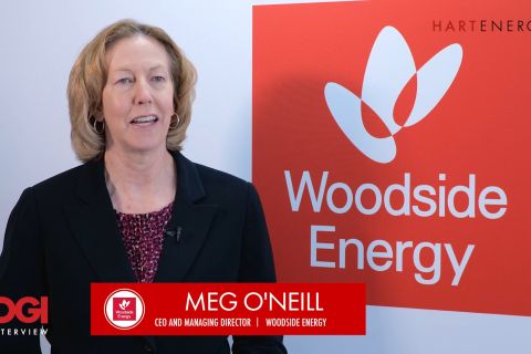
The OGInterview: How do Woodside's Growth Projects Fit into its Portfolio?
2024-04-01 - Woodside Energy CEO Meg O'Neill discusses the company's current growth projects across the globe and the impact they will have on the company's future with Hart Energy's Pietro Pitts.