1 Blake Exploration LLC completed a wildcat in northwestern Ellis County, Kan., about eight miles southwest of Zurich, pumping 127 bbl. of 28-gravity oil with 16 bbl. of water daily. The #1 Wendling, in Section 2-11s-20w, reached a total depth of 3,704 ft. It is producing through untreated perforations in the Lansing-Kansas City between 3,542-82 ft. The company, based in Bogue, Kan., also staked a discovery about 3.5 miles south of its headquarters in eastern Graham County. The #1 Stephen, in Section 5-9s-21w, reached a total depth of 3,850 ft. to test the Arbuckle. It's 0.67-mile east of the nearest previous producer in Hatcher Field, a three-well pool at about 3,725 ft. in the Arbuckle. Discovered in 1956, it produced 52,000 bbl. of oil until it was abandoned in 1985. 2 Wichita, Kan.-based Vess Oil Corp. staked a 2,880-ft. wildcat in northwestern Elk County approximately 10 miles north of Grenola, Kan. The #1-20 Perkins, in Section 20-29s-9e, is set to reach the Layton sand and Hertha lime members of the Kansas City and Arbuckle. The discovery is about 1.5 miles east of largely abandoned Bush-Denton Field, which has produced a cumulative 1.27 million bbl. of oil from the Shawnee, Stalnaker, Layton, Peru and Mississippian, reports IHS Energy. 3 The Seeco Inc. unit of Southwestern Energy, Houston, permitted a 3,550-ft. wildcat in a new area of southwestern Van Buren County in the northwestern Arkansas portion of the Arkoma Basin. The #1-17 Black, in Section 17-10n-15w about 3.5 miles north of the Conway County line, is part of the company's widening Fayetteville shale-gas play. The discovery is the first of four exploratory tests that were proposed by the operator in cases heard before the Arkansas Oil & Gas Commission. It is about two miles south-southwest of Scotland Field, which opened with the completion of the #1-4 Hankins in late 2004. That well flowed 326,000 cu. ft. of gas daily through fracture-stimulated intervals between 1,820 and 2,076 ft. in the Fayetteville shale. Flowing tubing pressures was gauged at 233 psi on a 16/64-in. choke. 4 Hanna Oil & Gas Co., an independent based in Fort Smith, Ark., staked an Arkoma Basin wildcat in southwestern Logan County, 1.5 miles south of Booneville, Ark. It will target formations through the Borum at a depth of 8,000 ft. The #1 Wooldridge, in Section 18-5n-27w, will be drilled a mile east-southeast of the #1 Hopewell. That 7,606-ft. wildcat initially flowed 420,000 cu. ft. of gas in the Nichols between 5,651-69 ft. with 29 bbl. of water per day. The well was tested in the Basham flowing 362,000 cu. ft. of gas per day through fracture-stimulated perforations between 4,881 and 4,916 ft. 5 Tulsa, Okla.-based Sanguine Gas Exploration LLC completed a 20,655-ft. wildcat 14 miles north-northwest of Erick, Okla. The #1-15 Banks, in Section 15-11n-26w in southwestern Roger Mills County, flowed gas at an aggregate rate of 2.3 million cu. ft. with 149 bbl. of water daily through three fracture-stimulated intervals between 15,250 and 16,590 ft. in the Atoka. A mile north is the #1-22 Blevins, which has produced 440 million cu. ft. of gas during its first six months online. At last report the 16,678-ft. well was averaging 1.32 million cu. ft. of gas daily. 6 BP America Production Co. submitted two cases to the Oklahoma Corporation Commission involving a section in a nonproducing area of southeastern Oklahoma about nine miles east-southeast of Talihina. The company wants pooling and spacing orders for Section 27-3n-23e in southwestern LeFlore County. It covers essentially all the potentially productive formations from the Upper Atoka to the Arbuckle. The section includes BP's #1 Woods Creek, a proposed 9,000-ft. well designed to evaluate the several formations from 3,700 to more than 6,000 ft., according to IHS Energy. 7 Artesia, N.M.-based Yates Petroleum Corp. completed a Morrow wildcat more than 12 miles west-northwest of the town of Tatum, N.M., in Lea County. The #2 Lacy J State Unit, in Section 6-12s-34e, was drilled to a total depth of 12,660 ft. It flowed 4.2 million cu. ft. of gas, 240 bbl. of condensate and no water daily through intervals between 12,158 and 12,207 ft. Flowing tubing pressure was gauged at 2,000 psi on 21/64-in. choke. The well offsets to the north to a Bagley East Field well in the same section. The 11,180-ft. Wolfcamp producer, the #1 Barbera Boren State "A," had a cumulative recovery of 30,324 bbl. of crude, 21.4 million cu. ft. of casinghead gas and 55,190 bbl. of water through perforations between 9,972-76 ft. 8 Chesapeake Operating Inc., Oklahoma City, completed a wildcat more than four miles north-northwest of the town of Lovington, N.M., in southeastern Lea County. The #1 William "14" Federal, in Section 14-15s-35e, was tested flowing 1.5 million cu. ft. of gas, 30 bbl. of condensate and four bbl. of water per day through stimulated perforations in the Atoka between 12,414 and 12,554 ft. Flowing tubing pressure was gauged at 1,075 psi on a 17/64-in. choke. Total depth of the well is 13,920 ft. A 13,060-ft. Austin Southwest Field well is almost a mile northeast. The #1 Goodrich Unit produced 38.56 million cu. ft. of gas and 352 bbl. of condensate until 1998. 9 Plano, Texas-based Grayhawk Operating Inc. staked a wildcat in central Roberts County (RRC 10) about 17 miles northwest of Miami, Texas. The #102 Lard Ranch, in Section 2, BBB&C Survey, A-1033, is to reach a total depth of 11,000 ft., but objectives have not been reported. Cree-Flowers Field, which is between one and 2.5 miles east, has produced 78 billion cu. ft. of gas with 287,000 bbl. of oil from 60 wells since its discovery in 1955. 10 Chesapeake Operating Inc. permitted a wildcat in northwestern Grayson County, Texas, (RRC 9) a mile south of Big Indian Field. The #1 R.V. Anderson, in James Coryelle Survey, A-261, is set to reach 12,000 ft. A mile south is the #1 Hill-Anderson, which was tested flowing 498 bbl. of 47-degree crude and 1.02 million cu. ft. of gas per day through fracture-treated perforations between 9,732 and 11,348 ft. Flowing tubing pressure was gauged at 1,450 psi on a 12/64-in. choke. 11 William R. Guffey, Dallas, scheduled a Bend Arch wildcat in northeastern Concho County, Texas, (RRC 7C) about nine miles east of the town of Paint Rock, Texas. The #1 Alexander, in Section 12, Friedrich Schubert Survey, A-817, will drill to a total depth of 3,600 ft. Two miles east-southeast is the one-well Edwin Field. The #1968 Tickle has yielded a cumulative 26.84 million cu. ft. of gas, 251 bbl. of condensate and 227 bbl. of water between 1980 and 1982. 12 Midland, Texas, independent Mulloy Operating Inc. completed a wildcat in northern Crane County (RRC 8) 1.5 miles south of the Ector County line about 15 miles southwest of Odessa, Texas. The #1 Blair-TXL "7" was tested flowing 560 bbl. of 46.8-gravity crude, 750,000 cu. ft. of gas and no water daily. Flowing tubing pressure was gauged at 930 psi on an 18/64-in. choke. The 11,635-ft. well, in Section 7, Block 43, T4S, T&P Survey, A-181, yielded 4,875 bbl. of oil prior to completion. More than a half-mile west-southwest is an Edwards Field producer, the #40 W.P. Edwards. That 3,717-ft. well served as an injection well on a unitized lease that produced more than 3.38 million bbl. of crude, 2.6 billion cu. ft. of casinghead gas and 783,336 bbl. of water since the mid-1940s through perforations in the San Andres between 3,378 and 3,548 ft. 13 South Oil Inc., Houston, staked a wildcat more than 25 miles south-southwest of Fort Stockton, Texas, in southern Pecos County (RRC 8). The #1 Kennedy "11," in Section 11, Block 170, TT RR Survey, A-4718, is scheduled to a total depth of 10,000 ft. The 14,020-ft. #10 Montgomery-Fulk is about a quarter-mile east in Elsinore Field. It yielded a cumulative 787.94 million cu. ft. of gas, 235 bbl. of condensate and 2,806 bbl. of water from the Wolfcamp through perforations between 5,426 and 5,560 ft. 14 Midland, Texas, independent Henry Petroleum LP tested a discovery about 25 miles southwest of San Angelo, Texas, in southwestern Tom Green County (RRC 7C). The #1 Anna, in Section 11, Block 21, H&TC Survey, A-1198, pumped 24 bbl. of 38-gravity oil daily, with no gas or water, from perforations in the Wolfcamp between 4,135 and 4,856 ft. that were acid- and fracture-treated. The well was drilled to a total depth of 5,000 ft. Less than a half-mile west-northwest in the same section is one-well Allen Field, where the #1 AMV Allen has produced 45,078 bbl. of oil, 110,000 cu. ft. of casinghead gas and 6,753 bbl. of water since its completion in 1985, reports IHS Energy. 15 Momentum Energy Corp., Midland, permitted a wildcat in northwestern Crockett County (RRC 7C) more than 10 miles northeast of the town of Iraan in West Texas. The #1 Harris Ranch "9P," Section 9, Block BB2, John Parker Survey, A-3384, is set to reach 9,650 ft. The #1 C.T. Harris is 2.5 miles south in Que Suerte Field. There, a 10,075-ft. well yielded a cumulative 14,735 bbl. of crude through perforations in the Pennsylvanian Detrital between 8,391 and 8,401 ft. It was onstream for only six months. 16 Rio-Tex Inc., San Antonio, permitted a wildcat in northwestern Edwards County, Texas, (RRC 1) about a half-mile east of the Val Verde County line. The #8901 Whitehead, in Section 89, Block D, GC&SF R.R. Co. Survey, A-918, is more than 25 miles west of Rocksprings, Texas. Almost a mile southwest is the #7907 Whitehead "A," which was completed last year as part of Langtry Field. The 12,200-ft. Canyon well flowed 509,000 cu. ft. of gas, 16 bbl. of water and no condensate per day from fracture-stimulated perforations between 11,496 and 11,748 ft.
Recommended Reading
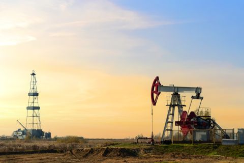
The Secret to Record US Oil Output? Drilling Efficiencies—EIA
2024-03-06 - Advances in horizontal drilling and fracking technologies are yielding more efficient oil wells in the U.S. even as the rig count plummets, the Energy Information Administration reported.
US Gulf Coast Heavy Crude Oil Prices Firm as Supplies Tighten
2024-04-10 - Pushing up heavy crude prices are falling oil exports from Mexico, the potential for resumption of sanctions on Venezuelan crude, the imminent startup of a Canadian pipeline and continued output cuts by OPEC+.
WTI Delivered to East Houston Hits Highest Premium in Nearly Three Years
2024-05-01 - Oil takeaway capacity from the Permian Basin will tighten next month due to scheduled pipeline maintenance.
Russia Orders Companies to Cut Oil Output to Meet OPEC+ Target
2024-03-25 - Russia plans to gradually ease the export cuts and focus on only reducing output.
Segrist: The LNG Pause and a Big, Dumb Question
2024-04-25 - In trying to understand the White House’s decision to pause LNG export permits and wondering if it’s just a red herring, one big, dumb question must be asked.