1 Wichita, Kan., independent Coral Coast Petroleum is permitting a remote Mississippian wildcat in the Hugoton Embayment to 5,600 ft. The #1-3 Dana Marie is in Section 3-27s-41w in Stanton County, 11 miles north of Johnson City. Nearly 11 miles south is a three-well Morrow oil pool, Johnson City Townsite Field, which has produced more than 175,000 bbl. of oil from a depth of 5,460 ft. since its discovery in 1995. 2 HT Oil LLC, based in Dublin, Calif., staked three wildcats in southwestern Ellis County in the Central Kansas Uplift. The well are the #1 Kraus, in Section 21-15s-19w; the #1 Werth, in Section 22-15s-19w; and the #2 Werth, in Section 22-15s-19w. They are all projected to 3,600 ft. to evaluate formations through the Arbuckle. Zimm Field sits a mile south-southeast of HT's prospects. Discovered in 1969, Zimm has produced 549,000 bbl. of oil from Lansing-Kansas City, Basal Pennsylvanian Conglomerate and Arbuckle. 3 Hanna Oil & Gas Co., based in Fort Smith, Ark., has staked a wildcat in eastern Logan County. The #1 Mullican, in Section 14-7n-23w, is projected to 7,000 ft. and has been primarily designed to test the Areci. The closest well is 1.75 miles north in Brock Creek Field, a seven-well accumulation discovered in 1991. The field has produced a total of 1.12 billion cu. ft. of gas from Hartshorne, Alma and Upper Tackett. 4 Oklahoma City-based Chesapeake Operating Inc. began operations at a proposed 13,300-ft. wildcat in Sebastian County, Ark., just east of the Oklahoma border. The #1-34 McCuistion is in Section 34-5n-32w. The nearest comparable drilling is almost four miles west-southwest in LaFlore County, Okla., where a 13,870-ft. well was abandoned in 1962. 5 Continental Resources Inc., based in Enid, Okla., has completed a Springer discovery in Blaine County, Okla. The #1-22 Bryson, in Section 22-17n-12w, was tested flowing at a rate of 2.5 million cu. ft. of gas and 110 bbl. of oil per day from a channel sand at 8,800 ft. Brigham Exploration Co., which has 29% net revenue interest in the 9,026-ft. well, reported that flowing tubing pressure was 3,300 psi, and that there are additional potential pay intervals behind pipe. The closest Springer producer is the #1-15 Edsall, in Section 15-17n-12w. Completed in 1995, it was initially tested flowing 737,000 cu. ft. of gas and 400 bbl. of water per day from the Morrow-Springer at 8,822-76 ft. Currently, it is operated by Anadarko Basin Production Service Co. and has recovered 293 million cu. ft. of gas along with 3,000 bbl. of condensate. 6 Chesapeake Operating Inc. completed a discovery two miles east of Marlow, Okla. The #1-23 Kovar, in Section 23-2n-7w, Stephens County, flowed oil at an initial daily rate of 425 bbl., along with 1.5 million cu. ft. of gas and 45 bbl. of water, from the Dornick Hills (Atoka) at 13,800 to 14,052 ft. The nearest production from the Atoka is four miles west at a deeper-pool discovery drilled in 2000 on the western outskirts of Marlow. The #1-24 Defender, in Section 24-2n-8w, has produced 1.62 billion cu. ft. of gas and 14,000 bbl. of condensate during 27 months online. 7 Deka Exploration Inc., Oklahoma City, reported that the #1-25 Kroll flowed at an initial rate of 249 bbl. of oil and 286,000 cu. ft. of gas per day with no water. The discovery is in Section 25-21n-1e in southeastern Noble County, Okla., on the eastern flank of the Nemaha Uplift. It is producing from an untreated interval in the Misener between 4,926-32 ft. Initial testing was conducted on a 18/64-in. choke. Deka drilled the prospect a half-mile south of Sumner Southwest Field. The one-well field, discovered in 1986, was onstream until 1999 and recovered 2,455 bbl. of crude. 8 Yates Petroleum Corp., Artesia, N.M., completed two Wolfcamp wildcats in northern Chaves County, N.M. The #1 Sterne "BCS" Com, in Section 11-6s-26e, was tested flowing 792,000 cu. ft. of gas daily, with no liquids, through perforations between 5,152 and 5,232 ft. Flowing tubing pressure was 220 psi on a 24/64-in. choke. Total depth of the new producer is 5,930 ft. Almost 1.5 miles southeast, the operator drilled the #2 Sterne "BCS" Com to 5,970 ft. That wildcat flowed 724,000 cu. ft. of gas per day from the Wolfcamp B between 5,352-60 ft. Flowing tubing pressure was gauged at 200 psi on a 24/64-in. choke. 9 Yates Petroleum Corp. also completed a discovery in the Wolfcamp and Cisco in the northern portion of Eddy County, N.M. The #1 Gem Dandy "BCG" State Com, in Section 35-16s-27e, reached a total depth of 9,420 ft., but was plugged back to 7,830 ft. for completion. It was tested for 35,000 cu. ft. of gas, 10 bbl. of condensate and 120 bbl. of water per day through Wolfcamp perforations between 6,064 and 6,172 ft. The Cisco had an initial potential of 35,000 cu. ft. of gas, four bbl. of condensate and 20 bbl. of water per day. Both intervals were tested on an 8/64-in. choke with a flowing tubing pressure of 100 psi. Within a half-mile southwest is the 9,150-ft. #1 Bleu Pearl "BAF" State Com, also operated by Yates. The producer was completed late last year flowing gas from the Morrow between 8,844-58 ft. It is in Crow Flat Field. 10 Matador Operations Co., Dallas, (now Tom Brown Inc.) is drilling a deep exploratory test in southeastern Lea County, N.M., more than 10 miles south of Eunice. The #1 Robeme "16" State, in Section 16-23s-36e, is projected to 11,700 ft. in Morrow. In the same section is a 3,300-ft. Jalmat Field well. The #1 Texas-State was tested in 1951 flowing oil from the Tansill-Yates-Steven Rivers between 3,084 and 3,300 ft. 11 Fort Worth-based independent Burnett Oil Co. Inc. has completed a discovery in the Texas Panhandle pumping 70 bbl. of oil and 200,000 cu. ft. of gas per day. The #1R-496 Coble, in Section 9, Block M-22, TCRR Survey, A-496, Hutchinson County, is producing from Cleveland between 6,412 and 6,518 ft. The 9,000-ft. well is a replacement for Burnett's #1-496 Coble, which was abandoned in April at a depth of 4,560 ft., about 40 ft. south. 12 Foree Oil Co., Dallas, completed a North Texas wildcat in southern Hardeman County, about six miles southwest of the town of Medicine Mound. Located in the Hopkins County School Land Survey, A-14, the #1 Sauls "1" was tested flowing 102 bbl. of oil per day, with a trace of gas. Flowing tubing pressure was 540 psi on a 6/64-in. choke. The nearest producer is a third-mile northeast in the same survey, in two-well Cassie Field. 13 Gunn Oil Co., Wichita Falls, has tested a discovery in southwestern Dickens County, Texas. The #1 Conner, in Section 223, Block 1, H&GN Survey, A-118, was drilled to a total depth of 5,480 ft. It pumped oil at the rate of 45 bbl. per day, along with 7,000 cu. ft. of gas and two bbl. of water. The nearest production is 1.75 miles south-southwest. The #1 Williams, which opened Dalwood Field, was drilled to a total depth of 6,259 ft. and had an initial potential of 75 bbl. of oil per day in the Woods Lime. 14 J&J Trading, an independent from Abilene, completed a wildcat in central Taylor County, Texas. The #1 Ledbetter, in Section 143, Goliad County School Land Survey, A-85, tested 84 bbl. of oil per day on pump, with a trace of gas, through an openhole interval between 3,370-94 ft. (total depth). The nearest well in Ledbetter Ranch Field is just over a half-mile northwest. Completed in January 2002, the #2K Ledbetter was completed pumping 26 bbl. of oil per day from the Cook Sand between 2,974-82 ft. 15 Ruwco Oil & Gas Corp., based out of Austin, completed a Wolfcamp wildcat in Pecos County, Texas. The #1 Cascabel was tested flowing 1.02 million cu. ft. of gas per day, with no liquids, through perforations between 6,236-56 ft. The wildcat, drilled to a total depth of 6,600 ft., is in Section 16, Block 125, T&STL Survey, A-6504. It is a third-mile west-southwest of Upper Wolfcamp production in Bob-Rob Field. 16 Houston-based Pogo Producing Co. has completed an oil discovery in northern Crockett County, Texas. The #2 Ranch Hand "7," in Section 7, Block A, BS&F Survey, A-1882, was tested flowing 192 bbl. of oil and 1.31 million cu. ft. of gas per day through a commingled openhole interval. Productive zones are the Wolfcamp Detrital between 7,998 and 8,033 ft. and the Ellenburger between 8,034 and 8,116 ft.
Recommended Reading

Kimmeridge Fast Forwards on SilverBow with Takeover Bid
2024-03-13 - Investment firm Kimmeridge Energy Management, which first asked for additional SilverBow Resources board seats, has followed up with a buyout offer. A deal would make a nearly 1 Bcfe/d Eagle Ford pureplay.
M4E Lithium Closes Funding for Brazilian Lithium Exploration
2024-03-15 - M4E’s financing package includes an equity investment, a royalty purchase and an option for a strategic offtake agreement.
Laredo Oil Subsidiary, Erehwon Enter Into Drilling Agreement with Texakoma
2024-03-14 - The agreement with Lustre Oil and Erehwon Oil & Gas would allow Texakoma to participate in the development of 7,375 net acres of mineral rights in Valley County, Montana.

California Resources Corp. Nominates Christian Kendall to Board of Directors
2024-03-21 - California Resources Corp. has nominated Christian Kendall, former president and CEO of Denbury, to serve on its board.
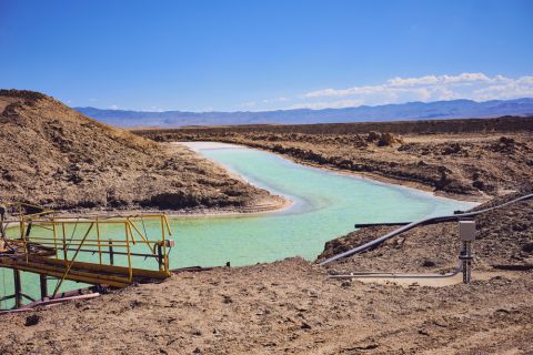
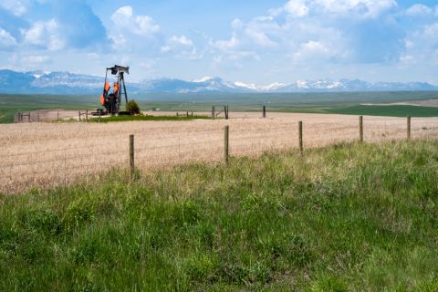
Uinta Basin: 50% More Oil for Twice the Proppant
2024-03-06 - The higher-intensity completions are costing an average of 35% fewer dollars spent per barrel of oil equivalent of output, Crescent Energy told investors and analysts on March 5.