1 R.E. Blaik Inc. , Oklahoma City, is moving in rotary tools to drill the #1-4 Comstock, a wildcat in Clark County, Kan. IHS Energy Group says the venture is scheduled to go to 5,900 ft. to test Cambro-Ordovician Arbuckle. The drillsite is in Section 4-32s-22w, about 1.5 miles north and slightly west of Comstock Field. 2 Work has been started at another Kansas wildcat, the Red Oak Energy Inc. #1-35 Akers Trust in Section 35-15s-41w, Wallace County. Wichita independent Red Oak is moving in rotary tools at the test, projected to a depth of 5,250 ft. Pennsylvanian Morrow sands are the primary objectives at the venture, located in a lightly drilled area three miles east of the closest Morrow wells in Mount Sunflower Southeast Field. 3 Two new fields have been established in the southern Anadarko Basin in Oklahoma, reports IHS Energy Group. K. Stewart Petroleum Corp. , Oklahoma City, recorded a gauge of 380 bbl. of oil and 500,000 cu. ft. of gas per day at the #1-4 Bermejo in Section 4-8n-21w, Beckham County. The discovery is producing through perforations at 4,536-99 ft. in an undisclosed formation. In Washita County, the Marathon Oil Co. #1-17 Wanda, Section 17-9n-20w, flowed 6.77 million cu. ft. of gas, 83 bbl. of condensate and 77 bbl. of water per day at completion. The well was tested on a 26/64-in. choke through four perforated intervals between 12,000-66 ft. in Pennsylvanian Granite Wash. 4 Formations from Pennsylvanian Atoka through Ordovician Bromide are scheduled to be tested at the #1-11 Buckmaster, a new 17,000-ft. test staked by Marathon Oil Co. in Oklahoma's sprawling Cement Field. The directional test, which is to have a true vertical depth of 16,995 ft., is in Section 11-5n-9w, Caddo County, about 1.5 miles west-northwest of the closest Cement Field well (operated by Marathon) that produces from Ordovician zones. Also in Caddo County, Houston independent Apache Corp. 's deep drilling program in the Verden Field region has yielded another producer, the #1-2 Irene that flowed 8.43 million cu. ft. of gas, 36 bbl. of condensate and 95 bbl. of water per day at completion. Located in Section 2-6n-9w, the 18,550-ft. well was tested on a 14/64-in. choke through perforations at 18,380-90 ft. and 18,432-38 ft. in McComas (Pennsylvanian Springer). 5 KCS Medallion Resources Inc. , Tulsa, and The GHK Co. LLC , Oklahoma City, have each added a Lower Mississippian Jackfork producer to Potato Hills Field in Latimer County, Okla. The KCS well, the #1-26 Tami, Section 26-3n-20e, flowed 8.43 million cu. ft. of gas and 30 bbl. of water per day on a 48/64-in. choke through three sets of perforations between 5,340-5,485 ft. In Section 33-3n-20e, the GHK #3-33 Cedar Creek flowed 8.26 million cu. ft. of gas per day through perforations at 5,292-5,302 ft. during preliminary tests. A shallower Jackfork zone is now being tested. 6 Participant TBX Resources Inc. , Dallas, reports the #2-11 Lillie, in Section 11-10n-23w, Beckham County, Okla., and operated by Denver-based St. Mary Operating Co. , flowed an estimated 3.462 million cu. ft. of gas and 33 bbl. of oil per day on a 16/64-in. choke. The well, on the west flank of Elk City Field, was drilled to a total depth of 13,200 ft. It's producing from Granite Wash at 12,778-84 ft. and 12,808-14 ft. 7 A Texas Panhandle discovery made by J.M. Huber Corp. , Houston, yielded 1.06 million cu. ft. of gas, 30 bbl. of condensate and 78 bbl. of water per day. IHS Energy Group says the shallower-pool opener in Shreikey Field, the #1014 Locke Cattle, yielded the flow on a 32/64-in. choke through perforations at 4,420-52 ft. in Permian Brown Dolomite. It's in Section 14, Block M-2, H&GN Survey, A-957, Roberts County. About three miles to the southwest in Section 62 of Block M-2, Huber has staked a 14,200-ft. wildcat at the #1-62 Gill. 8 Phillips Petroleum Co. tested a stepout nearly a mile west-northwest of a Morrow pool in Sherman County, Texas, for a flow of 1.02 million cu. ft. of gas per day. Phillips perforated at 6,654-68 ft. in Lower Morrow at the #1 Sher "A" in Section 49, Block 1-C, GH&H Survey, A-62. 9 Texas' Terrell County is seeing new exploration, with at least one remote wildcat being drilled and another one scheduled to be drilled. David H. Arrington Oil & Gas Inc. , Midland, is making a trip after drilling to 4,900 ft. at the #1 Yellow Sally, a 9,000-ft. test in Section 80, Block 3, CCSD&RGNG Survey, A-1412. Meanwhile, San Antonio-based Nutek Oil Inc. plans to drill to 3,000 ft. at a remote wildcat it staked at the #1 Clark in Section 35, Block D4, MK&TE Survey, A-832. IHS Energy Group notes there are no producing wells within 30 miles of the venture. 10 A Devonian discovery completed by Southwestern Energy Production Co. , Houston, near Roepke Field in Crane County, Texas, yielded 126 bbl. of oil and three bbl. of water, with 50,000 cu. ft. of gas, per day on pump. The company's #7 Cowden Ranch is in Section 48, Block X, CCSD&RGNG Survey, A-232. It's producing through perforations at 7,250-65 ft. and 7,295-99 ft. The new well is a quarter-mile southeast of the sole producer in Roepke Field, where the discovery produced from Silurian at 7,425 ft. and now produces from Permian Wolfcamp at 6,058 ft. 11 Activity is under way at several deeper-pool exploratory ventures on the Wink Project in Winkler County, Texas, reports Houston-based Touchstone Resources USA, a partner in the project. Blue Star Operating Co. , Midland, is shown on the permits as operator of the tests. Touchstone says the #1 Morton/Halley 23/24 is drilling at 14,800 ft. on the way to test Devonian Fusselman and Ordovician Ellenburger to a depth of 18,500 ft. Oil pay zones have been encountered in Permian, Pennsylvanian and Devonian formations. Nearby, the #2 Morton 23 is drilling at 3,400 ft. toward a projected depth of 6,500 ft., to develop the Permian pay discovered at the initial test. Both prospects are in Section 23, Block B12, PSL (S.M. Halley) Survey, A-712. In Section 11 of Block B12, the partners are testing six potential oil and gas pay zones in Pennsylvanian at the 10,000-ft. #1 Morton 11. And, nearly a mile southeast, drilling has been stopped at 6,000 ft. at the #2 Morton 11. There, the partners are now waiting on a rig to deepen the test to 10,000 ft. in Upper Pennsylvanian Cisco Reef. 12 TMBR/Sharp Drilling Inc. , Midland, is nearing 9,000 ft. at an 18,000-ft. wildcat it's drilling in Reeves County, Texas, and BTA Oil Producers , also headquartered in Midland, has revealed the projected depth is 19,800 ft. at a wildcat it plans in the county. According to IHS Energy Group, the test that's under way is the #2 Ligon "22" in Section 22, Block 7, H&GN Survey, A-4355. BTA's project is the #1 20001 JV-P Penwell, in Section 17, Block 55, T4S, T&P Survey, A-801. 13 Remote exploratory work has been set up by Roswell independent Harvey E. Yates Co. in Culberson County, Texas. Target depth is 8,800 ft. at the #1 Cowden "2" in Section 2, Block 63, T2, T&P Survey, A-6579. 14 Bass Enterprises Production Co. , Fort Worth, recorded a flow of 2.64 million cu. ft. of gas, 23 bbl. of condensate and 190 bbl. of water per day from Wolfcamp at the #147 Poker Lake, to establish a new producing area nearly a mile west of Big Sinks Field in Eddy County, N.M. The new producer, in Section 5-25s-31e, was tested on a 12/64-in. choke through perforations between 12,910-13,019 ft., reports IHS Energy Group. 15 Also in Eddy County, Devon SFS Operating Inc. , Oklahoma City, is waiting on completion tools after setting pipe on bottom at 12,300 ft. at the #2 Hackberry "6" Federal Com, a Morrow test in Section 6-19s-31e. The prospect, a deeper-pool venture in an area of 3,144-ft. Permian Queen production in Shugart Field, lies about 3.5 miles south-southwest of the closest Morrow production in Shugart North Field. 16 Drilling depth is nearing 9,900 ft. at the Yates Petroleum Corp. #1 Avian "AYA" State, set up as a 12,550-ft. Mississippian test in Lea County, N.M. Yates, of Artesia, is drilling the exploratory test in Section 20-15s-32e, about a third-mile northeast of Morrow production in Feather Field. A mile west of the drilling venture, Yates has staked a wildcat at the #1 Alar "AYL" State in Section 19. It also has a target depth of 12,550 ft.
Recommended Reading
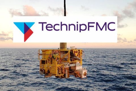
TechnipFMC Eyes $30B in Subsea Orders by 2025
2024-02-23 - TechnipFMC is capitalizing on an industry shift in spending to offshore projects from land projects.
Exxon Mobil, Chevron See Profits Fall in 1Q Earnings
2024-04-26 - Chevron and Exxon Mobil are feeling the pinch of weak energy prices, particularly natural gas, and fuels margins that have cooled in the last year.
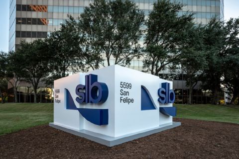
SLB’s ChampionX Acquisition Key to Production Recovery Market
2024-04-21 - During a quarterly earnings call, SLB CEO Olivier Le Peuch highlighted the production recovery market as a key part of the company’s growth strategy.

W&T Offshore Adds John D. Buchanan to Board
2024-04-12 - W&T Offshore’s appointment of John D. Buchanan brings the number of company directors to six.

Flame Acquisition Holders Approve Merger with Sable Offshore
2024-02-14 - The business combination among Flame Acquisition Corp., Sable Offshore Holdings and Sable Offshore Corp. will be renamed Sable Offshore Corp.