Weather forecasters expect this year's heating season to be colder than normal, more closely approximating last year's weather, compared with the unusually warm winters of the late 1990s. This news may bode well for natural gas demand. Calling for an "eastern winter," most forecasters advise the eastern and central U.S. to brace for the biggest variance from normal temperatures, with above-normal snowfall in the Great Lakes, Ohio Valley and Northeast. Forecasters have to be careful about terminology such as the subjective word "normal." For example, the National Oceanic and Atmospheric Administration (NOAA) calculates what is normal every 10 years by determining the average temperature from the prior 30-year period. This year, for example, temperatures are being compared with averages from 1971-2000, whereas last year, the comparison was with 1961-90. Colder-than-normal forecasts have been released by several private weather vendors, including <$iSalomon Smith Barney >, <$iWeather Services International > (WSI), <$iMeterologix > (formerly known as DTN Weather Services) and energy broker <$iAPB Energy >. There was some disagreement on which regions would be cooler than normal, with most of the dispute centered on the West. WSI and Meterologix forecast colder temperatures than their colleagues for that region. They all point to four main factors in predicting this winter's weather, and all of these factors indicate cooler temperatures. • LaNiña/El Niño This is a measurement of the sea-surface temperatures across the tropical Pacific. La Niña occurs when sea temperatures are cooler than normal, El Niño indicates temperatures are warmer. The consensus this year is that the condition is neutral, which indicates cooler temperatures. • Pacific Decadal Oscillation (PDO) This measures sea temperatures in the northern Pacific. Meteorologists say there is a negative PDO, indicating sea temperatures are colder than in the previous phase, thus indicating cooler temperatures. • North Atlantic Oscillation (NAO) Its current negative reading means the atmospheric pressure over Canada is higher than that over the Atlantic, which again indicates cooler temperatures as well. • Arctic Oscillation (AO) Comparing the pressure over the Arctic relative to normal indicates cooler temperatures. The National Oceanic and Atmospheric Administration expects most of Winter 2001-02 will feel like a sequel to last year's cold season, with sharp swings in temperature and precipitation, including heavy lake-effect snows in the Northeast and Midwest, cold-air outbreaks in the South and the potential for Nor'easters along the East Coast. "We don't expect a repeat of the record-breaking cold temperatures of November and December of last year, but this winter should be cooler than the winters of the late 1990s," says Scott Gudes, NOAA acting administrator. NOAA has issued the following regional outlooks: • Northeast Colder-than-normal temperatures. • Mid-Atlantic States Equal chances of above-normal, normal or below-normal temperatures and precipitation. Storm tracks could bring more snow than in the winters of the late 1990s. • Southeast Drier than normal, with an equal chance of averaging above-normal, normal or below-normal temperatures. • Upper-Midwest and Great Lakes Colder than normal, with more subzero days than the average winter. • Northern Great Plains and Rockies Below-normal temperatures, with more subzero days than experienced on average during the winters of the late 1990s, but wet and mild weather is more likely for the southern Plains. • Northwest Heavy coastal rain events are more likely compared with the previous three winters. A repeat of last winter's near-record dry spell is unlikely. • Southwest Warmer-than-normal temperatures for most of the region, except western California. • Alaska and Hawaii Southwestern Alaska can expect a wet winter. The rest of Alaska and all of Hawaii can expect an equal chance of above-normal, normal, or below-normal temperatures and precipitation. Jon Davis, meteorologist with Salomon Smith Barney, says the coming winter will rank near or in the coldest third of winters historically (for the last 106 years). "We do not think it will be an exceptionally wet winter, but the colder bias should cause much of the precipitation that does occur to be in the form of snow in those areas of the country that are snow-favored." The winter is more likely to resemble the 1960s and 1970s than the warm winters of the 1980s and 1990s. He expects above-normal heating demand across much of the country this winter. "As a result, overall natural gas and heating-oil demand is expected to be on the high side. In terms of supply, an abundant reserve of gas and an adequate supply of heating oil should temper any dramatic price movements." APB Energy meteorologist Andy Weingarten says, "My biggest concern is a belief that it is very difficult to forecast NAO/AO. By definition they are oscillations, moving between positive and negative. They are strongly negative now, hence the forecast for a cold Eastern winter." NOAA says its snowfall forecasts for the Northeast and the Mid-Atlantic states are highly dependent on fluctuations of the Arctic Oscillation. Todd Crawford, senior meteorologist for WSI, says, "The coldest areas this winter will be the northern Plains states [Minneapolis to Kansas City]. The other region where we expect below-normal temperatures is along the Pacific Coast, where the effects of the cool phase of the PDO will be the most strongly felt." Other areas in the West should experience near or slightly above-normal temperatures. "Contrary to what most are saying, we feel that much of the East Coast will experience warmer-than-normal temperatures [as defined by statistical analysis of 1971-2000], especially during the first half of the winter." Meterologix senior meterologist Scott Yuknis predicts a cold December across the Upper Midwest, but a national January thaw with the mildest temperature anomalies centered in Nebraska and Pennsylvania, followed by a milder-than-normal February across the East. Most of the West finishes winter on a colder-than-normal note.
Recommended Reading

NOV Announces $1B Repurchase Program, Ups Dividend
2024-04-26 - NOV expects to increase its quarterly cash dividend on its common stock by 50% to $0.075 per share from $0.05 per share.

Initiative Equity Partners Acquires Equity in Renewable Firm ArtIn Energy
2024-04-26 - Initiative Equity Partners is taking steps to accelerate deployment of renewable energy globally, including in North America.
Repsol to Drop Marcellus Rig in June
2024-04-26 - Spain’s Repsol plans to drop its Marcellus Shale rig in June and reduce capex in the play due to the current U.S. gas price environment, CEO Josu Jon Imaz told analysts during a quarterly webcast.

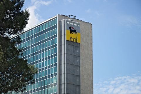
Ithaca Deal ‘Ticks All the Boxes,’ Eni’s CFO Says
2024-04-26 - Eni’s deal to acquire Ithaca Energy marks a “strategic move to significantly strengthen its presence” on the U.K. Continental Shelf and “ticks all of the boxes” for the Italian energy company.

Exxon’s Guyana Gas Project a “Win-Win,” Set for Hook-up by Year-end ‘24
2024-04-26 - Exxon Mobil Corp. CEO Darren Woods said the company’s gas-to-power project in Guyana as a “win-win proposition particularly for the people of Guyana” when completed and hooked-up by year-end 2024.