1 Hanson Production Co., Cuero, Texas, gauged a flow of 2.9 million cu. ft. of gas per day at its #2 Clark-Sain, a discovery in Theodore Garza Survey, A-38, Kenedy County, Texas. According to 20% interest holder DevX Energy Inc., the wildcat logged more than 65 ft. of pay in Oligocene Vicksburg. Pipe is set on bottom at 12,732 ft. at the well, which was tested on a 12/64-in. choke. 2 An exploratory test being drilled to an approximate projected depth of 18,000 ft. by Allegro Investments Inc., Victoria, Texas, in Jackson County, Texas, has reached an intermediate depth of about 13,500 ft. Parallel Petroleum Corp., Midland, owner of a 27% working interest in the test, reports openhole logs indicate the #1 Signal Hill, Juan Fernandez Survey, A-21, has approximately 15 ft. of Eocene Yegua Sand at about 10,350 ft. that may contain hydrocarbons. Drilling to the Eocene Wilcox objective is to be resumed after intermediate pipe is set. Beta Oil & Gas Inc., Tulsa, has a 12.5% working interest and Republic Resources Inc. owns a 3.125% working interest. Private industry partners own the remaining interest. 3 A flow gauge of 1.421 million cu. ft. of gas, 37 bbl. of condensate and four bbl. of water per day has been reported by IHS Energy Group for a Live Oak County, Texas, discovery completed by First Rock Inc., Corpus Christi. First Rock's #1-A Rollins Ranch, Michael Boren Survey, A-75, flowed on a 10/64-in. choke through perforations at 5,495-5,500 ft. in Yegua. A little more than 0.25-mile southeast, the company has set pipe at a total depth of 4,900 ft. at the #2-A Rollins Ranch. 4 Esenjay Exploration Inc., Houston, tested a flow of 21 million cu. ft. of gas and 710 bbl. of condensate per day at the #5 Runnells in the deep geopressured Frio Trend in Matagorda County, Texas. The well, which was projected to 17,000 ft. and is in Christopher G. Cox Survey, A-18, in Esenjay's Duncan Slough 3-D seismic project, was tested on a 25/64-in. choke in the Claughton "A" portion of Oligocene Frio. It's the first delineation well to Esenjay's #3 Runnels discovery. Esenjay, as operator, owns a 33% working interest in the prospect. Its partners are Samedan Oil Corp., with a 24%, and Santos USA Corp., 30%. Private parties including JLC Enterprises Inc., Trijon Exploration Inc. and Brazos Resources Inc. own the remaining interest. 5 Texas' Fort Bend County is the site of a Wilcox discovery-the Phillips Petroleum Co. #1 Meadowbrook Farms-that flowed 5.28 million cu. ft. of gas, 20 bbl. of condensate and 41 bbl. of water per day at completion. The well, in L.A. Patillo #3 Survey, A-307, flowed on a 9/64-in. choke through perforations at 15,354-74 ft. 6 A Yegua discovery, completed by HS Resources Inc., Denver, in Hardin County, Texas, was finaled for a flow of 1.851 million cu. ft. of gas, 407 bbl. of condensate and three bbl. of water per day on an 11/64-in. choke. Perforations are at 9,020-36 ft. at the #3 Arriola in Edward Arriola Survey, A-1, reports IHS Energy Group. The operator is drilling the 9,500-ft. #4 Arriola less than a half-mile west. 7 Ivanhoe Energy Inc., Vancouver, and Unocal will explore for oil and gas in East Texas on a 50-50 joint-venture basis, subject to finalization of an agreement. The firms plans to drill Jurassic Bossier Sand prospects over approximately 46,000 gross (37,000 net) acres primarily in Henderson, Freestone and Anderson counties. Unocal will be operator and fund drilling costs for the first exploration wells to offset the $10 million in leasehold, seismic and processing costs incurred by Ivanhoe. After investment equilibrium is reached, the companies will share exploration and development costs equally. 8 Drilling depth is below 9,400 ft. at the #1 Delacroix, a wildcat that Houston independent Swift Energy Co. has under way in Section 25-15s-13e. Plaquemines Parish, La. According to Swift, the wildcat has a proposed target depth of 16,500 ft. 9 A flow of 4.369 million cu. ft. of gas, 317 bbl. of condensate and 10 bbl. of water per day has been reported by IHS Energy Group for a well completed by Cabot Oil & Gas Corp., Houston, in state waters offshore Louisiana's Terrebonne Parish. Cabot's #1 State Lease 16970 was tested on a 14/64-in. choke through perforations at 15,998-16,060 ft. It's about a mile east-southeast of a well on the eastern edge of Lake Pelto Field that was online from 1965-80, producing from Miocene at 15,788-15,800 ft. 10 Meridian Resource & Exploration Co., Houston, has completed a development well in Louisiana's Jeff Davis Parish flowing 10 million cu. ft. of gas and 399 bbl. of condensate per day. The #1 Addison 28, Section 28-11s-4w, is producing from Marginulina, perforated at 11,593-11,624 ft. 11 Houston independent Spinnaker Exploration Co. has discovered gas and condensate at its Resolute Prospect on High Island Block 197, Gulf of Mexico, in an average water depth of 40 ft. The #1 OCS-G-22238 was drilled to a total depth of 13,956 ft. and encountered approximately 140 ft. (true vertical depth) of high-quality hydrocarbon-bearing section in two intervals within the Miocene Robulus sequence. Spinnaker says the discovery appears capable of sustaining high flow rates. Additional drilling is planned for the discovery area. Spinnaker operates the discovery and block, and owns a 50% working interest and 42% net revenue interest. Partners include Continental Land & Fur and <$iWestport Resources Corp. >, each with 25%. 12 The first production from the two wells-the #1 and #3 OCS-G-15891-that make up Houston-based ATP Oil & Gas Corp.'s Ladybug Field on Garden Banks Block 409 is estimated at 8,000 bbl. of oil and 6 million cu. ft. of gas per day, according to ATP. Ladybug, in about 1,360 ft. of water, is the company's first deepwater subsea development project. ATP and Unocal each hold a 50% working interest. ATP is operator. 13 Westport Resources Corp., Denver, has tested 8.8 million cu. ft. of gas equivalent per day at a discovery, the #1 OCS-G-18948, on High Island Block 84. The wildcat was drilled to a total depth of 13,900 ft. and encountered more than 100 net ft. of pay. The drillsite is in 40 ft. of water. Westport operates the well with a 52% working interest. 14 IHS Energy Group reports Conoco Inc. is active at a depth of 21,385 ft. at the #1 OCS-G-16838, a remote wildcat it's drilling on Green Canyon Block 942. Target depth is not reported. The venture, which is being drilled in 6,608 ft. of water, is only the third test to be drilled in a 25-mile radius. 15 The #1 Miller-Price, a discovery drilled by Miller Exploration Co., Houston, in Mississippi's Jones County, yielded a flow of 636 bbl. of oil and 775,000 cu. ft. of gas per day during testing, reports the Southeastern Oil Review. Miller used a 14/64-in. choke to test through perforations between 15,354-15,446 ft. in Lower Cretaceous Basal Hosston. The Houston firm's well is in Section 10-7n-13w, a mile northwest of Blackburn Field. The publication notes Miller initially perforated a Jurassic Upper Cotton Valley Sand at 16,022-40 ft. and tested for a short period of time. A decision was then made to move uphole to the Hosston and more completely evaluate the Cotton Valley in later wells. Miller has a 35% working interest in the discovery and a scheduled south offset. KCS Energy Inc. > and <$iBean Resources Inc. (and its partners) have the balance of the working interest. 16 Land & Natural Resources Development, Northport, Ala., is set to drill to 15,000 ft. at a remote wildcat in Harrison County, Miss. According to IHS Energy Group, the company's #1 Jane Byrne 501 is in Section 27-7s-13w. The nearest production is in Hancock County's Waveland Field a little more than nine miles west-southwest of the new location.
Recommended Reading
Energy Transfer Asks FERC to Weigh in on Williams Gas Project
2024-04-08 - Energy Transfer's filing continues the dispute over Williams’ development of the Louisiana Energy Gateway.

Apollo Buys Out New Fortress Energy’s 20% Stake in LNG Firm Energos
2024-02-15 - New Fortress Energy will sell its 20% stake in Energos Infrastructure, created by the company and Apollo, but maintain charters with LNG vessels.
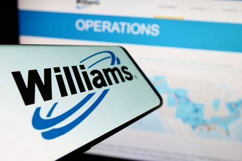
Williams CEO: Louisiana Energy Gateway Start Temporarily in Limbo
2024-03-21 - Williams CEO Alan Armstrong said the project still moving forward after hitting a snag in a dispute with Energy Transfer but lacks a definitive start date.

Canada’s First FLNG Project Gets Underway
2024-04-12 - Black & Veatch and Samsung Heavy Industries have been given notice to proceed with a floating LNG facility near Kitimat, British Columbia, Canada.

Venture Global Acquires Nine LNG-powered Vessels
2024-03-18 - Venture Global plans to deliver the vessels, which are currently under construction in South Korea, starting later this year.