1 Gas flow rate was 17.6 million cu. ft. per day on a 22/64-in. choke at the #2 Pereira Children's Trust, a discovery Esenjay Exploration Inc. says it completed in Goliad County, Texas. Esenjay, of Houston, drilled the 13,505-ft. well on its 25-square-mile Hordes Creek 3-D seismic project, encountering approximately 95 ft. of net pay in two sand sections of Eocene Middle Wilcox. Judy Sand, which is the lower of the two sections and has about 70 ft. of net pay, was perforated and tested. Betty Sand, the upper section, has a total of 25 ft. of net pay and is behind pipe. It's to be tested, completed and commingled with Judy Sand. The discovery is in Vincente Ramos Survey, A-241. 2 Texas' Lavaca County is the site of a deep Wilcox discovery completed by Oklahoma City independent Louis Dreyfus Natural Gas Corp. flowing 3.412 million cu. ft. of gas and 175 bbl. of water per day. IHS Energy Group reports the well, in the Speaks Southwest Field area in H&TB #7 Survey, A-248, was tested on a 17/64-in. choke through perforations at 15,860-80 ft. in Lower Sibley Sand. The operator has requested the new producing area be named Rubie Field. 3 Helmerich & Payne Inc. , Tulsa, and Aspect Resources LLC , Denver, have each finaled a discovery in Jefferson County, Texas. Helmerich & Payne perforated at 8,735-64 ft. in Cibicides Hazzardi and tested a flow of 382 bbl. of oil and 101,000 cu. ft. of gas per day on a 10/64-in. choke at the #2 Walter Co. located in J. Lawhon Survey, A-35. Meanwhile, Aspect recorded a daily flow rate of 3.693 million cu. ft. of gas, 38 bbl. of condensate and five bbl. of water on a 14/64-in. choke from Oligocene Frio at its #1 Pipkin Ranch. The company perforated at 10,286-98 ft. at the discovery, in T&NO #185 Survey, A-347. 4 A discovery completed by Dallas-based Matador Operating Co. -the #1 Aultman in William B. Reed #207 Survey, A-24, Freestone County, Texas-was tested at a daily rate of 1.568 million cu. ft. of gas and 139 bbl. of water. Matador used a 15/64-in. choke to test Jurassic Bossier Sand, perforated between 11,808-11,960 ft. 5 Two exploratory wells in South Louisiana have been completed as Oligocene Hackberry producers, reports IHS Energy Group. In Beauregard Parish, the Hunt Oil Co. #1 Dorothy Reeves-Leslie discovery was completed flowing 3.037 million cu. ft. of gas and 160 bbl. of condensate per day. The Dallas-based company tested on a 17/64-in. choke through perforations at 7,740-52 ft. at the well in Section 21-7s-8w. The other successful Hackberry exploratory test in the parish is the #1 Cagle, completed by New Orleans independent Dragon Energy Corp. flowing 480 bbl. of oil and 315,000 cu. ft. of gas per day. The well, near Fenton West Field in Section 2-8n-6w, yielded the flow on a 9/64-in. choke through perforations at 9,035-38 ft. 6 Southwestern Energy Co. , Houston, reports a flow gauge of 8.1 million cu. ft. of gas and 187 bbl. of condensate at its previously announced new-field opener and the completion a second well on its Malone Prospect in Assumption Parish, La. The discovery is the 15,798-ft. #1 State Lease 16626 that was tested on an 11/64-in. choke in Planulina at approximately 14,600 ft. It encountered five separate productive sands in Miocene totaling about 260 ft. of gas pay. Within a quarter-mile northwest, the second well, the #1 State Lease 16625, yielded 9.5 million cu. ft. of gas and 70 bbl. of condensate per day on a 21/64-in. choke from Marg A. The company says it logged approximately 62 ft. of gas pay at the 12,600-ft. well. The well was drilled to develop a shallower sand seen in the discovery. Southwestern is the operator of both wells, located in Section 33-13s-13e, and holds a 33.33% working interest. Century Royalty LLC has a 16.67% working interest and Petro-Hunt LLC holds the remaining 50% working interest. 7 The North Lake Pelto discovery in Terrebonne Parish, La.- Cabot Oil & Gas Corp. 's #1 State Lease 16705 in Section 32-22s-8e-encountered 236 ft. of net pay, recording average porosity of 22% and a 65% hydrocarbon saturation, reports Cabot. Preliminary results show the well encountered pay in 14 sands. Houston-based Cabot has a 76% working interest (58.7% net revenue interest) and is the operator of the well. The remaining working interest is held by Palace Exploration Co. 8 On Eugene Island Block 7 offshore Iberia Parish, La., Ocean Energy Inc. gauged a flow of 11.602 million cu. ft. of gas and 165 bbl. of condensate per day at the #2 State Lease 16194 to confirm its opener of Eugene Island Block 7 Field. IHS Energy Group reports the new well was tested on a 33/64-in. choke through perforations at 12,059-86 ft. in Textularia warreni. A few feet to the north, Houston-based Ocean recorded an initial potential of 15 million cu. ft. of gas, 467 bbl. of condensate and 19 bbl. of water per day from 11,400-25 ft. in the same formation at the discovery #1 State Lease 16194. 9 The Minerals Management Service received $505,468,501 in high bids from 90 companies at the Central Gulf of Mexico oil and gas lease Sale 178 held in New Orleans in March, reports IHS Energy Group. This is $204.9 million, or 68.2%, more than the $300.57 million received at a similar sale held a year ago. This year, the MMS received 780 bids on 547 tracts of the 4,390 tracts comprising about 23.19 million acres that were offered. The total of all bids was $663,406,963. Bidding was very heavy on tracts in shallow waters, where 338 tracts in less than 200 meters (about 656 ft.) of water attracted 502 bids. The highest bid received on a block was $26 million submitted by Exxon Asset Management Co. for Mississippi Canyon Block 912. The per-acre bid of $4,533.85 for the block was also the sale's highest. 10 Kerr-McGee Corp. , Oklahoma City, says appraisal drilling on the Gunnison Prospect on Garden Banks Block 668 has resulted in the confirmation and westerly extension of the field. The #2 OCS-G-17407, drilled a mile west of the discovery in 3,152 ft. of water, and a follow-up sidetrack, the #2 (ST1), drilled in an updip position 1.5 miles from the discovery, confirmed the lateral extent and continuity of the Gunnison reservoirs. The company notes the results to date of the appraisal program for Gunnison Field confirm its original estimate of reserves in the range of 150 million to 250 million equivalent bbl. Drilling is under way at the #3 OCS-G-17407, about 2.5 miles west of the discovery. A planned sidetrack will test a separate satellite prospect, Durango, on adjacent Block 667. The Gunnison sub-basin includes Garden Banks blocks 667, 668 and 669, all operated by Kerr-McGee Oil & Gas Corp. , a wholly owned subsidiary of Kerr-McGee Corp., with 50% interest. Partners in the blocks are Nexen Petroleum USA Inc. , 30%, and Cal Dive International Inc. , 20%. 11 The results of an exploratory well being tested by Murphy Exploration & Production Co. on the Front Runner prospect on Green Canyon Block 338 put reserves at or over the predrill estimate of 80- to 120 million bbl. of oil equivalent, according to El Dorado, Ark.-based Murphy Oil Corp. The prospect, a sidetrack out of the #1 OCS-G-21790 was drilled to a total depth of 22,925 ft. in about 3,500 ft. of water and encountered more than 850 ft. (true vertical thickness) of pay. Murphy owns a 37.5% working interest in Block 338 and serves as operator. Partners include Dominion Resources Inc. with 37.5% and Spinnaker Exploration Co. , 25%. 12 Edmonton, Alberta, independent Chieftain International Inc. says an exploratory well on West Cameron Block 300, which it operates with a 35% working interest, tested 11.5 million cu. ft. of gas and 300 bbl. of condensate per day. The #3 OCS-G-15078 was drilled to a total depth of 11,900 ft. and logged 66 net ft. of gas bearing Miocene sands. This is Chieftain's second prospect on Block 300, the first being the #1 OCS-G-15078, about 2.5 miles north. 13 TotalFinaElf E&P USA Inc. , Houston, has obtained a permit to drill a wildcat in 7,549 ft. of water on Atwater Valley Block 430. IHS Energy Group reports the #1 OCS-G-18604 is to be drilled on the Ray Prospect, which is 50% owned by Chevron USA Inc. 14 In Mississippi, Canadian Delta Inc. , Jackson, Miss., logged gas shows in several intervals in Smackover and has run intermediate liner to 17,000 ft. at the #1 Harold Karges 18-3, a deep Jurassic test in Pelahatchie Field in Section 18-5n-5e, Rankin County. The Southeastern Oil Review notes that prior to drilling into Norphlet, logs were run from 15,994 ft. to 17,000 ft. Due to high pressures at this depth in the area, Canadian Delta elected to run the intermediate liner. Drilling is to resume toward the projected depth of 17,250 ft.
Recommended Reading
TGS Starts Up Multiclient Wind, Metaocean North Sea Campaign
2024-05-07 - TGS is utilizing two laser imaging and ranging buoys to receive detailed wind measurements and metaocean data, with the goal of supporting decision-making in wind lease rounds in the German Bright.

Spate of New Contracts Boosts TechnipFMC's Subsea Profits
2024-04-30 - TechnipFMC's operational profits are growing as the company heightened its focus on “quality” subsea orders, which earned $2.4 billion for the first quarter.
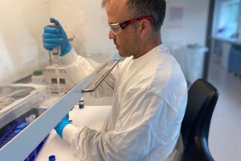
Message in a Bottle: Tracing Production from Zone to Wellhead
2024-04-30 - New tracers by RESMAN Energy Technology enable measurement while a well is still producing.
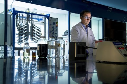
Defeating the ‘Four Horsemen’ of Flow Assurance
2024-04-18 - Service companies combine processes and techniques to mitigate the impact of paraffin, asphaltenes, hydrates and scale on production—and keep the cash flowing.

Tech Trends: AI Increasing Data Center Demand for Energy
2024-04-16 - In this month’s Tech Trends, new technologies equipped with artificial intelligence take the forefront, as they assist with safety and seismic fault detection. Also, independent contractor Stena Drilling begins upgrades for their Evolution drillship.