 |
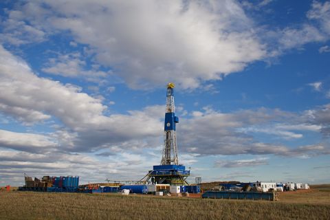
| Field acquisition system in staging area. (All graphics courtesy of ION Geophysical) |
The need to increase hydrocarbon production is especially acute in China. As the country’s second largest energy company, Sinopec plays a key role in addressing China’s energy supply challenges. Forty percent of Sinopec’s gas production is in Sichuan Province, where much of the production comes from low permeability, fractured reservoirs.
One of the larger fields in the Sichuan basin is XinChang, an asset targeted for a multiyear exploitation and step-out drilling program by the managers at Sinopec. Although seismic data existed for the field, it was believed to be not the quality needed to image the deeper reservoir intervals and to target fracture “sweet spots” that correlated with the highest producing wells.
In 2003, geophysicists from Sinopec’s local operating company — Southwest Petroleum Branch (SWPB) — began considering alternatives for improving seismic data quality at XinChang. Over the next several years, SWPB undertook the largest full-wave imaging program on record, with impressive results. Both success rates and well productivity have shown dramatic improvements.
The ivestment mandate
China produces nearly 5 Bcf/d of natural gas, and demand is expected to reach nearly 11 Bcf/d by 2010. To meet the demand, pressure is being brought to bear on the two main domestic producers, CNPC and Sinopec, to increase in-country production. The government has set a target to nearly double gas usage within the country’s energy mix to 5.3% in 2010 from 3% today.
Exploration and production
Discovered in 2000, the XinChang gas field is one of the larger fields in the western Sichuan Basin, an area that collectively produces 260 MMcf/d of gas. XinChang produces 39 MMcf/d from four wells. Eight wells have been drilled in the field. Gas production comes from multiple pay zones ranging in thickness from several meters to several tens of meters and depths of 2,997 to 16,405 ft (700 to 5,000 m). Deeper, proximal gas reservoirs produce from the Upper Triassic, while shallower, distal gas reservoirs are of Jurassic-Cretaceous age. Productivity of individual wells varies significantly, even within the same geologic horizon, due to variations in the intensity of naturally occurring fractures in the reservoir.
Legacy seismic datasets exist for the field, but SWPB wanted higher quality data to optimize an exploitation and step-out drilling program for the deep Triassic reservoirs. Geophysical challenges of the basin and the objectives of management helped to frame the goals of the full-wave imaging project:
• Obtain high-resolution images for the deeper reservoir targets;
• Optimize images despite challenging (near-)surface conditions that range from grassy plains to urban centers, and clastic slope deposits to carbonate outcrops to pebbled river beds;
• Increase the signal-to-noise ratio and bandwidth of the entire dataset;
• Eliminate background noise, especially from manmade sources in the survey area; and
• Characterize key properties in the reservoir intervals, including the distributions of lithology, sand thickness, porosity, gas saturation and especially fractures.
Early full-wave assessments
In 2003, SWPB geoscientists assessed various geophysical alternatives that could deliver on these objectives. Using wave equation models, SWPB evaluated different survey parameters — including shot density, spread geometry, offset, and in-line and cross-line sensor separation (sampling density) – to deliver the requisite trace density and fold at a reasonable cost.
During the evaluation, SWPB geophysicists noted high levels of converted wave energy on the shot records of legacy datasets. In partnership with ION Geophysical Corp., SWPB modeled improvements that full-wave (multicomponent) imaging techniques might provide and determined that recording converted wave energy could improve the bandwidth of the entire seismic dataset. Given an expectation that converted wave data could also add insights into lithology and fracture detection, SWPB geophysicists made the recommendation to acquire the survey using densely spaced, full-wave sensors.
SWPB hoped to use 3C MEMS sensors to obtain broadband data with a significant low-frequency component that would improve resolution and advanced geophysical analyses, including seismic inversion. By applying vector filtering to the 3C data, SWPB sought to attenuate ambient and near-surface noise and to use the non-vertical shear components to enhance the bandwidth of the new P-wave data. They also believed combining P-wave and S-wave data would allow them to assess shear-wave splitting to ascertain fracture intensity and compare variations in lithology and fluid content within reservoir intervals.
Designing a survey
The topography of the field poses two survey design challenges. Most of the area is relatively flat with a surface layer that has been tilled for hundreds of years, which introduces challenges with attenuation of both frequencies and signal.
Targeted acquisition objectives varies from 6,562 to 19,686 ft depth (2,000 to 6,000 m), with the zone of interest at 16,405 ft (5,000 m). Illumination of the complex subsurface and the requirement to collect data in the deeper Triassic reservoirs required broadband, wide-azimuth, densely sampled data.
Imaging complex subsurface fractures wasn’t the only challenge in Sichuan. Significant surface obstructions, both natural and man-made, cut across the landscape. The area is densely populated and several highways and railways, as well as a network of pipelines and rivers exist throughout the survey area. As a result, the seismic acquisition system needed to be flexible to ensure the health, safety, and environmental (HSE) requirements of both seismic field workers and nearby residents.
Data acquisition
In October 2004, SWPB commissioned BGP to commence acquisition using 6,000 VectorSeis full-wave (3C) stations (18,000 channels) connected to an I/O System Four acquisition platform. The survey size, amount of data acquired, and magnitude of the operation make XinChang the largest full-wave program ever undertaken with 1,466 crew and 133 vehicles.
Data processing
Using full-wave (3-C) sensors, it was possible to apply several advanced processing techniques to extract maximum value from the data. Unlike a conventional geophone which records energy along a vertical axis, a 3-C sensor contains three components — one vertical and two paired horizontals. The horizontal components record ‘converted’ wave (C-wave) energy, i.e., acoustic energy that has converted from a pressure wave (P-wave) on the downward-traveling wavefield to shear wave (S-wave) energy on the upcoming wavefield.
The P-wave data was processed in a fairly conventional manner. After the application of a standard, amplitude-preserving pre-stack time migration method, high-resolution images were developed. In addition to the images, the P-wave processing helped to determine the appropriate Vp/Vs ratios that were subsequently used in several attribute volumes for interpretation purposes.
SWPB’s goals were to:
• Obtain a high-resolution structural image that had compatible detail and frequency content when stretched to P-wave time;
• Extract geophysical information such as shear impedance and Vp/Vs ratios that would be useful in characterizing reservoir lithology; and
• Map fracture patterns within and around the reservoir interval by assessing shear-wave splitting along the predominantly fast and slow velocity directions
Horizontal rotation
Data were acquired with one horizontal accelerometer aligned with the receiver cable and the other aligned orthogonal to the cable direction.
Horizontal rotation was performed to align one of the horizontal components with the source-receiver azimuth (radial component) and the other orthogonal to the source receiver azimuth (transverse component). After rotation, all of the reflected energy should be concentrated onto the radial component, while the transverse component should consist only of random noise only. For azimuthally anisotropic data and where shear-splitting is prevalent a further series of rotations is required later in the processing workflow.
Shear wave splitting
Azimuthal properties were preserved though the migration process. Under normal isotropic circumstances, rotating multicomponent data from in-line and cross-line to radial and transverse isolates the usable energy onto the radial component. After this, the transverse can usually be discarded. Because XinChang is affected by significant azimuthally varying anisotropy, a considerable amount of energy remains on the transverse after the initial rotation.
To deal with this effect, a method referred to as “2-C forward and reverse rotation” was applied to the data. This effectively removes the anisotropy and concentrates all of the energy onto the radial component, thereby simulating an isotropic dataset. For each layer, this process yields detailed fracture orientation and fracture magnitude information.
Integrated reservoir interpretation
With data processing complete, the Reservoir Solutions group from ION subsidiary GX Technology (GXT) integrated available well data, outcrop and core analyses with the newly acquired seismic data to define the geologic and tectonic history, build structural and stratigraphic models, map fracture patterns and intensity, and determine the best locations for future drilling.
The Sichuan Basin encountered some of the world’s most dramatic subsidence rates during the Mesozoic. The reservoir was buried to depths of 19,686 ft (6,000 m) or more soon after deposition and before gas was generated in the surrounding and underlying source rocks. Compaction reduced reservoir porosities to less than 4% on average and rendered the reservoir rocks almost impermeable. As a result, production is totally fracture-dependent. The fracture network not only made gas charge possible under conditions of extreme overpressure, but also affords a major part of the gas storage capacity and the only mechanism by which gas stored in the matrix porosity can be accessed during production. Storage capacity of pools in the reservoir is dependent on interconnected fractures in fault zones, and the connections that damage zones around faults make with the naturally fractured sandstone reservoir beds. The most attractive exploitation targets are thin-bedded, brittle clastic rock types interconnected by faults across the entire reservoir interval.
The densely sampled, full-azimuth P-wave data provided higher frequencies than the legacy seismic data; providing an improved structural picture with excellent fault resolution. However, lithology could not be determined from the P-wave wave alone.
Converted (S-wave) data was needed to complete reservoir characterization. The converted wave data delivered vital insights into risk reduction and drill-well target optimization during exploitation and provided a means of targeting interbedded, sand-shale sequences and areas of optimal fracture intensity.
Structural features, stratigraphic plays and fracture trends that were interpreted from the densely sampled, full-wave seismic data were used to determine locations for new prospects in the survey area. The integration of interpretations from all disciplines enabled a full risking of the drill-well prospects being considered and a re-prioritization of the list.
Early results from drilling
As processing and reservoir analysis progressed, SWPB geoscientists had more insights into the primary drivers of well productivity, including sand thickness, reservoir gas
saturation, and fracture intensity near the well bore. These insights have improved well placement. Since the delivery of the final results in September 2007, three wells have been drilled and all completed as producers. One of these, at 18 MMcf/d of gas, is now the most productive well in the entire Sichuan Province. An additional 16 well locations have been identified from this integrated, full-wave imaging and reservoir analysis project.
Acknowledgements
The authors wish to thank the management of Sinopec and Southwest Petroleum Branch for granting permission to publish this paper. In particular, it is important to acknowledge Mr. Xu Xiangrong, president of Southwest Petroleum Branch Co., whose commitment to cutting-edge technologies and ongoing leadership ensured the ultimate success of this full-wave imaging project.
Recommended Reading
Marketed: Wylease AFE Asset Packages in Johnson County, Wyoming
2024-04-29 - Wylease LLC has retained EnergyNet for the sale of three Niobrara Shale AFE (authorization for expenditure) packages in Johnson County, Wyoming.
M&A Spotlight Shifts from Permian to Bakken, Marcellus
2024-04-29 - Potential deals-in-waiting include the Bakken’s Grayson Mill Energy, EQT's remaining non-operated Marcellus portfolio and some Shell and BP assets in the Haynesville, Rystad said.

C-NLOPB Issues Call for Bids in Eastern Newfoundland
2024-04-29 - Winners of the Call for Bids No. NL24-CFB01 will be selected based on the highest total of money the bidder commits to spend on exploration of a parcel during the first six years of a nine-year license.

Tivoli Midstream Buys Southeast Texas Coast Infrastructure
2024-04-29 - Tivoli Midstream acquired the Chocolate Bayou from Ascend Performance Materials, including storage and land for development.

Phoenix Capital Group Acquires Uinta Basin Royalty Interests
2024-04-29 - Phoenix Capital Group’s acquisition of 1,500 net royalty acres in Duchesne County, Utah, brings the company's investment in the Uinta Basin to more than $60 million, the company said.