2 Newaygo County in western Michigan will host an 8,000-ft. wildcat scheduled by Savoy Energy LP, Traverse City, Mich. The company will drill #1-4 USA-Lincoln directionally to the south in Section 4-14n-13w to look for gas in Prairie du Chien. The action will take place in nonproducing Lincoln Township about seven miles northwest of White Cloud. The nearest similar production is six miles west in Huber Field, which produces from Traverse, Clinton and Prairie du Chien. The #1-5A Venterley & Milis discovery well in that field tested for 2.2 million cu. ft. of gas, 24 bbl. of condensate and 120 bbl. of water a day from Prairie du Chien.
3 Traverse City, Mich.-based independent West Bay Exploration Co. permitted #1-61 Labert, a 2,600-ft. wildcat aimed at Trenton and Black River in a remote, nonproducing township in Monroe County in southeastern Michigan. The rank wildcat is scheduled in irregular Section 6-7s-8e, Rainsinville Township, about 4.5 miles west of West More and 12 miles east of Trenton production in Deerfield Field. Operators drilled four dry holes within 1.5 miles of the West Bay test.
4 McKinney Oil Producer Inc., Louisville, Ill., will drill the exploratory #1 Kruse in Section 34-8n-5e in central Effingham County, Ill., to 3,800 ft. in a search for Devonian Geneva pay. The company's well will be about 3.5 miles west of Effingham about 1.5 miles north of #1 Decker Comm discovery completed last year in Geneva for 174 bbl. of oil and 5,000 cu. ft. of gas a day from an openhole section between 3,740-47 ft. That well produced 16,127 bbl. of oil through April and averaged 71 bbl. a day for the month.
5 Midland, Texas-based RK Petroleum Corp. will look for Cypress oil at its #3 Gray Farms B in Section 14-3s-7w in southeastern Pike County, Ind., reports IHS Energy. The wildcat is almost six miles east of Spurgeon and 1.75 miles southwest of Cypress gas production in Stendal Field. The proposed 1,300-ft. well is a northwest offset to the company's #2 Gray Farms B, completed recently in the same section as a 1,280-ft. dry hole. The company recovered 90 ft. of gas- and oil-cut mud and 90 ft. of mud on a drillstem test in Cypress. RK plans to drill the #1 Luker & Katter wildcat in the same section about 2.4 miles southwest of Stendal Field and some 5.7 miles east of Spurgeon.
6 Dee Drilling Co., Mt. Carmel, Ill., plans a three-well wildcat program in Warrick County in southwestern Indiana. It will drill #1 Hendrickson and #2 Hendrickson in Section 24-5s-7w, about 1.5 miles west-southwest of Tennyson. Both will go to 2,400 ft. and both are generally 1.5 miles east of Deonia Springs North Field. That abandoned field produced from Cypress, Bethel and St. Genevieve at depths shallower than 1,450 ft. The company's third wildcat is #2 Newmaster in Section 34-5s-9w. That well will target McClosky to 2,200 ft. about 3.5 miles west of Chandler Field and two miles west of the town of Chandler. That field produced 38,000 bbl. of oil from 11 wells drilled to Beth, Benois and Aux Vases above 1,850 ft.
7 Bass Energy Co. Inc., Fairlawn, Ohio, plans two new-field wildcats in Cuyahoga County, Ohio. The company's #1-D A&T Doody will look for oil and gas to the Clinton Sand at 3,700 ft. in Lot 9, Orange Township, Chagrin Falls Quad. The well is nearly two miles north of the town of Hunting Valley and 1.6 miles east of Chester Field, a Clinton pool. The other well is #1-D Alexander Unit, scheduled to Clinton at 3,800 ft. That well is in Lot 10, Mayfield Township, Mayfield Heights Quad, about 1.2 miles south of Gates Mills and 1.2 miles southwest of an unnamed Clinton field.
8 The Riley family of Norwalk, Ohio, plans two wildcats, both with the #1 Riley name and both scheduled to Ohio Shale at 600 ft. in Huron County, Ohio. John & Sue Riley will drill their #1 Riley in Lot 9, Section 2, Milan Quad, Norwalk Township, about 4.5 miles east of Norwalk and 2.9 miles west of Collins South Field, a Trempealeau producer. Howard & Dolores M. Riley will drill their #1 Riley in Lot 4, Section 2, Norwalk Quad, Bronson Township. That well is 3.5 miles south of Norwalk and 5.8 miles northwest of an unknown Field, which produces from Sylvania Sand.
9 Chesapeake Appalachia LLC, Oklahoma City, will drill #1 Richards Farms wildcat to Queenston Shale at 3,170 ft. in Section D, Marcellus Quad, Marcellus Township, 4.2 miles south of Marcellus in Onondaga County, N.Y. The closest production comes from the Queenston formation in Auburn Field some nine miles northwest.
10 Tioga County, Pa., provided a discovery for Ultra Resources Inc., a subsidiary of Ultra Petroleum Corp. of Houston. The company's #1 Marshlands Unit, in Gaines Township, Marshlands Quad, some 4.5 miles southeast of Galeton, produced at a stabilized rate of 3 million cu. ft. of gas a day with 3,800 psi of flowing casing pressure. Ultra drilled the well to 11,143 ft. and completed it a year ago with an initial potential of 4.1 million cu. ft. of gas a day from Silurian Tuscarora perforations between 8,925 and 9,144 ft, Ordovician Juniata from 9,752 to 9,812 ft. and Ordovician Oswego from 10,174 to 10,728 ft. The well is four miles southeast of a 1,245-ft. Upper Devonian gas well and 11 miles south of Sabinsville Field, which produces primarily from Lower Devonian Oriskany. The parent company is better known for production on the Pinedale Anticline in the Greater Green River Basin of southwestern Wyoming and in Bohai Bay, China. It has leased 246,617 acres in the Pennsylvania play.
11 Texas Keystone Inc., Pittsburgh, will drill four wildcats to Upper Devonian at 5,500 ft. in Snow Shoe Quad, Snow Shoe Township, in Centre County, Pa. The #133-Cen Gulf USA is in Section D, about 1.1 miles south of Council Run Field, which produces from Elk sands. The remaining wells are in Section E. The #145-Cen Gulf USA is 2.1 miles south of Council Run Field and two miles northeast of Snow Shoe; #150-Cen Gulf USA is 1.2 miles south of the field and 2.6 miles north of the town; and #151-Cen Gulf USA is 1.3 miles south of the field and 2.4 miles north of the same town.
12 Charleston, W.Va.-based Hard Rock Exploration Co. permitted #62 James D. & Pauline M. Kiser in Washington District, Kentuck Quad, in Jackson County, W.Va. It will drill the new-field wildcat to 4,400 ft. to Devonian Shale about 1.5 miles west of an unnamed Oriskany field and 12 miles southeast of the town of Ripley.
13 Chesapeake Appalachia LLC staked #824731 (HCS-31) Richardson & Charles Estate wildcat to 6,118 ft. to look for gas in Onondaga Lime in Buchanan County, Va. The company will drill in Rock Lick District, Grundy Quad, more than a mile southeast of an unnamed Big Lime field and 7.1 miles northeast of the town of Grundy.
14 Lower Devonian in Tilford Quad in Perry County in eastern Kentucky is the target for three wildcats scheduled by Equitable Production Co. of Charleston, W.Va., according to IHS Energy. The company's #566703 Arthur Minard Heirs et al. will drill to 4,500 ft. in Section 12-G-77e less than two miles northeast of an unnamed Lower Devonian field and 7.8 miles northwest of the town of Cumberland. The second wildcat, #566706 Equitable Production Co., is planned to 4,600 ft. in Section 22-G-77e and is 1.3 miles east of the unnamed field and 7.4 miles west of Cumberland. The #566926 Kentucky River Properties LLC is scheduled to 4,900 ft. in Section 17-G-78e. That well is 2.1 miles southeast of Big Sandy Field, an Upper Devonian Producer, and 4.7 miles northwest of Cumberland.
15 Petrotech Resources Corp., Glasgow, Ky., will drill three wildcats in Summer Shade Quad in Metcalfe County in central Kentucky. It scheduled #2 Howard Coffey to look for Knox oil at 2,500 ft. in Section 6-F-47e, some two miles southwest of Edmonton Consolidated Field, a Laurel producer, and two miles west of the town of Edmonton. The company also plans to drill its #11 Ernestine Bell and #12 Ernestine Bell tests to look for oil in Fort Payne at 500 ft. Both wells are in Section 7-F-47e. The #11 well is 1.6 miles south of Edmonton North Consolidated Field, a Lower Devonian pool, and 1.4 miles west of Edmonton, while #12 is 1.3 miles south of the same field and also 1.4 miles west of the town.
Recommended Reading
Marketed: EnCore Permian Holdings 17 Asset Packages
2024-03-05 - EnCore Permian Holdings LP has retained EnergyNet for the sale of 17 asset packages available on EnergyNet's platform.

APA Corp. Sells $700MM in Non-core Permian, Eagle Ford Assets
2024-05-20 - APA Corp. and subsidiary Apache are selling more than $700 million in non-core assets in the Permian Basin and Eagle Ford Shale—part of a plan to reduce debt after a $4.5 billion acquisition of Callon Petroleum.
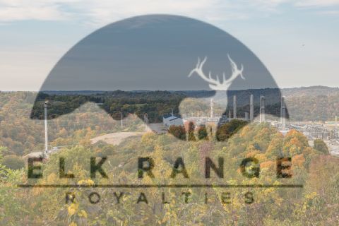
Elk Range Royalties Makes Entry in Appalachia with Three-state Deal
2024-03-28 - NGP-backed Elk Range Royalties signed its first deal for mineral and royalty interests in Appalachia, including locations in Pennsylvania, Ohio and West Virginia.

WildFire Energy I Buys Apache’s Eagle Ford, Austin Chalk Assets
2024-05-21 - Private producer WildFire Energy I, backed by Warburg Pincus and Kayne Anderson, scooped up Apache’s portfolio in the eastern Eagle Ford and Austin Chalk plays.

Exxon Shale Exec Details Plans for Pioneer’s Acreage, 4-mile Laterals
2024-05-03 - Exxon Mobil plans to drill longer, more capital efficient wells in the Midland Basin after a major boost from the $60 billion Pioneer Natural Resources acquisition. Data shows that Exxon is a leading operator drilling 4-mile laterals in the Permian’s Delaware Basin.