Imagine that you are the skipper of a motorboat in a waterski-jumping competition. A skier is towed behind your boat at a fixed speed on the run toward a floating ramp. You swing the boat across to the ramp and launch the skier into the air. The skier successfully and gracefully lands far and beyond the ramp, and retains control of the ski rope without getting wet — a perfect 10!
Do it three times. How can you be sure that you can put the skier on the same spot every
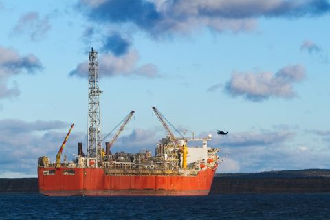
 |
|
| Figure 1. The concepts. (Images courtesy of WesternGeco) |
What if there was a technology that duplicated your experience, one that allowed you to replicate the exact conditions? A technology that took you where you went before? The key is repeatability.
Time-lapse seismic
Four-dimensional (4-D) seismic acquisition is all about repeating the vintage survey conditions so that a comparison of the two surveys will show the difference (time-lapse) signal.
The advent of 4-D seismic technology and the requirement for a high level of acquisition repeatability bring with it another level of complexity: to reduce non-repeatable noise in congested areas as well as in areas with strong and rapidly changing currents. There is a need to bridge this level of complexity. We must evolve.
Research has indicated that one of the major contributors to non-repeatable noise is the
 |
|
| Figure 2. Results of the integrated system test showing the position difference between actual and desired shot positions. |
Research further indicates that the other limiting factor is the non-repeatable noise originating from the non-target zone such as the seismic signal energy that reverberates between the seafloor and the sea surface, obscuring the seismic signal from the target. To reduce such non-repeatable noise, higher repeatability is required.
Precise repeatability
Repeatability needs to taken to a higher level of precision and accuracy. The synergy between man and machine is necessary to achieve the required level. First and foremost, the way forward is automation; it is not possible for an operator to accurately predict the behavior of the towed spread and vessel in a dynamic marine environment.
Next, to achieve very tight source repeatability specifications, there is a need for intelligent
 |
|
| Figure 3. Displays of statistical analysis and 4-D attributes. |
Finally, to be prepared is only half the battle. It cannot be overstressed that successful 4-D projects start with good strategic planning. The information obtained must be:
• Relevant: It must change your beliefs about another uncertainty.
• Material: The information must have the ability to change decisions.
• Economical: The cost of the information must be less than its value.
Synergy
With these requirements in mind, WesternGeco has developed Q-Marine 4-D technology (summarized in Figure 1). The navigation plan created in this module, REPEAT, contains the desired source and receiver positions based on the data from the vintage survey or surveys. The information in the navigation plan is also used to control the source firing for accurate inline position control. The same application is also be used to evaluate and analyze the 4-D results.
The intelligent automated steering controller (Q-Pilot) is the heart of the system, and it
 |
|
| Figure 4. Composite reports generated by REPEAT and published through SuperVision. |
The first test of the fully integrated system was carried out on the Q-Marine vessel Western Regent in the Moray Firth area offshore Scotland at the end of 2006. Initial results showed a very good match between the actual and the desired shot positions. The test results are illustrated in Figure 2.
As with any other system, there is a need to tie all of the results together in near-real time to enable fast decisions regarding 4-D acceptability. This integrated module minimizes data handling and management risk.
The planning and quality evaluation module allows the user to evaluate all 4-D acquisition strategies. Using this module in conjunction with the Q-Xpress tool, a proprietary integrated data acquisition and processing workflow for near real-time data analysis, operators can evaluate the 4-D quality in both the shot and common midpoint domains. In addition, the module provides statistical analysis and flexible displays of all relevant 4-D attributes. Examples of screen shots are given in Figure 3.
Composite reports are automatically published to WesternGeco’s Internet-based remote viewing and monitoring system between offshore and onshore, which allows remote project monitoring from design to delivery. It supports onshore teams who can make rapid decisions from remote locations at any time, thereby controlling the 4-D project cost and quality by monitoring up-to-date information. Figure 4 shows examples of composite reports viewed through the SuperVision remote viewing and monitoring system for offshore and onshore.
Conclusions
Seismic surveys can be repeated accurately through integrated automated proactive steering of vessels, sources and streamers. With intelligent planning and quality control tools, 4-D seismic challenges can be met with advanced applications and technology.
Recommended Reading
US Raises Crude Production Growth Forecast for 2024
2024-03-12 - U.S. crude oil production will rise by 260,000 bbl/d to 13.19 MMbbl/d this year, the EIA said in its Short-Term Energy Outlook.
Iraq to Seek Bids for Oil, Gas Contracts April 27
2024-04-18 - Iraq will auction 30 new oil and gas projects in two licensing rounds distributed across the country.
TotalEnergies Starts Production at Akpo West Offshore Nigeria
2024-02-07 - Subsea tieback expected to add 14,000 bbl/d of condensate by mid-year, and up to 4 MMcm/d of gas by 2028.
US Drillers Add Oil, Gas Rigs for Third Time in Four Weeks
2024-02-09 - Despite this week's rig increase, Baker Hughes said the total count was still down 138 rigs, or 18%, below this time last year.

NAPE: Turning Orphan Wells From a Hot Mess Into a Hot Opportunity
2024-02-09 - Certain orphaned wells across the U.S. could be plugged to earn carbon credits.