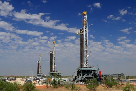
As with other industries in the energy sector, E&P companies have well-established geographic information system (GIS) technology and have employed these for many years in their asset management programs. Over time these systems have improved substantially in the quantity and quality of data. In fact, the employment of GIS data and general location technology capabilities in field worker management is gaining traction in other industries and presents similar opportunities to drive productivity in the upstream energy sector.
Tracking individuals
The first example of a productivity opportunity is tracking field workers. Traditionally, this was applied in logistics through in-vehicle solutions that could show a vehicle’s location on a map. More recently, these solutions have moved to tracking the individual as GPS technologies have evolved in mobile devices. In field service, tracking individuals gained favor in scenarios where workers are not operating out of a vehicle or are moving great distances from their vehicles. As a result, personnel geolocation opportunities are now available in the oil field.
Mobile device-based tracking allows automation of activities based on location through the use of radial and polygon “geo-fences.” Time of arrival can be automatically captured on a mobile device as the field worker passes through a geo-fence spanning the entire site. Geo-fences within the site and around break rooms can automate data collection of field worker location on site and, as a result, automatically capture field worker status. If required, a distinction can be made between automatically captured “implicit” statuses and statuses explicitly entered by the field worker. Variances between the two can be used to manage compliance and provide reporting on field resource use.
The automatic collection of time and attendance information improves the quality of data collected and provides greater accountability of field resources, which in turn provides a higher level of cost management.
By activating location-based features, workflow enforcement is better managed. Safety checks and hazard notifications can be triggered by geo-fences as workers enter hazardous locations within the site. Rather than relying on the vigilance of personnel in an organization’s safety program, these mobile solutions offer enhanced situational awareness to ensure safety programs are adhered to and relevant safety metrics captured. Notifications can include audible alarms indicating required personal protective equipment and prompting employee acknowledgment that these have been applied. Enforced safety checks ensure that field workers are made aware of potential hazards, even those that are inconspicuous, within the job site and that these hazards are adequately recorded and quantified.
Location-based notifications extend beyond safety programs to other workflows and data recording by automatically presenting relevant work order and asset details based solely on geolocation. The benefit? The risk of missing required tasks is greatly reduced.
An additional benefit of a location-aware maintenance application is the fact that nearby due tasks are indicated while the operators are onsite. This allows operators to improve productivity in their maintenance programs by addressing all scheduled tasks in a particular location. This minimizes repeat travel to sites and proactively encourages operators and maintenance staff to improve their productivity.
Data correlation
The use of mobile solutions also provides a great method of ensuring accurate correlation between geospatial information and collected data. An example of this is the collection of readings and samples in the field for both exploration and environmental management. An environmental management example is water contamination testing. When a water sample has been collected, field workers can indicate the sample source such as a dam, reservoir, or tank with the latitude, longitude, and timestamp automatically recorded by the mobile device. Following this, workers can attach a preprinted barcode with an identifier to the sample, scan this into the collected information, record results of field tests, and attach photographs if relevant. The direct linking of location, time and date, field tests, and photographs that are recorded to an identifier physically attached to the sample provides a simpler way of sample management from collection to results. This workflow is universal for any type of field sample collection.
The workflows discussed above often occur in environments with limited to no connectivity or mobile coverage. By delivering automated workflows in a native client application using offline databases, this information can be collected regardless of network connection while still supporting location-based notifications. Relevant asset locations and geo-fence points can be synchronized to the mobile device, timestamped, cached in the mobile database, and sent when a connection is available.
Information collected in native applications can feed back to existing GIS systems and be represented in commercially available maps. There also are opportunities to integrate data between these systems allowing both public and private roads to be presented to management and field staff for the purpose of routing and location. The ability to reflect the last known location of field resources in a map view also offers clear safety benefits when managing field resources in isolated areas.
Mobile applications have been employed in many industry sectors to reduce costs and improve productivity. Improvements have largely been seen in:
• Cost accounting through automated time and attendance;
• Asset maintenance compliance;
• Safety compliance; and
• Productivity of field staff through simplified collection and consolidation of information.
Other advantages are seen in areas concerning tracking of consumables usage and improving quality of work order information through collection at the job site.
These examples have only scratched the surface on potential benefits of mobile automation for field resources. Oftentimes the challenge is not finding a process to automate but rather determining a starting point. In most cases there is a clear business case in automating one process group and growing from there, and by including usage of an operator’s GIS assets, additional productivity impacts can be achieved from the outset.
Recommended Reading
NAPE: Chevron’s Chris Powers Talks Traditional Oil, Gas Role in CCUS
2024-02-12 - Policy, innovation and partnership are among the areas needed to help grow the emerging CCUS sector, a Chevron executive said.
Sangomar FPSO Arrives Offshore Senegal
2024-02-13 - Woodside’s Sangomar Field on track to start production in mid-2024.
CNOOC Makes 100 MMton Oilfield Discovery in Bohai Sea
2024-03-18 - CNOOC said the Qinhuangdao 27-3 oilfield has been tested to produce approximately 742 bbl/d of oil from a single well.
TPH: Lower 48 to Shed Rigs Through 3Q Before Gas Plays Rebound
2024-03-13 - TPH&Co. analysis shows the Permian Basin will lose rigs near term, but as activity in gassy plays ticks up later this year, the Permian may be headed towards muted activity into 2025.
Proven Volumes at Aramco’s Jafurah Field Jump on New Booking Approach
2024-02-27 - Aramco’s addition of 15 Tcf of gas and 2 Bbbl of condensate brings Jafurah’s proven reserves up to 229 Tcf of gas and 75 Bbbl of condensate.


