Jaxon Caines, technology reporter, Hart Energy: Everyone wants to know what's going on with subsurface. This technology provides deeper clarity for operators. Get ready to explore with Hart Energy LIVE.
Venkatesh Anantharamu, product development geoscientist, Ikon Science: So we just had a new release, which is [RokDoc] 2023.3. And we have added a bunch of new functionalities to do that. First one, we have added a functionality where we can edit probability density functions. So you can now edit one-dimensional or two-dimensional probability density functions, which will help you to restrict the data. For example, if you don't want few pages overlapping each other, so you can go and edit those PDFs, and visually you can decide where you want those PDFs to be. So this helps in reducing the uncertainty in the future workflows. So that's one of them.
And we also have this one-dimensional vision classification. So what this does is it gets to give you a quick overlook of how your inversion volumes would look like, without even using seismic, without even using wavelets. So you're using depth trends or these probability density functions to understand or get an idea of what you might expect from an inversion. And now we have the ability to do this by working interval. That means every formation you can have different facies; you can have a different depth of the facies. You can have different, probability density functions. So that's going to be a very, very helpful tool to do these. And another thing is, as these reservoirs become more complex and complex, you know, we need to reduce the errors in our predictions, both for production and for explorations. Like these geoscientists, we not only have to deliver these elastic properties or more accurate wire properties, but we also need to give uncertainties on how our predictions are. So in this recent release, we have a Time-Lapse Ji-Fi. That means you can, you have a 4D fluid tracking ability, so that helps in understanding the fluids. It can be used for production and also injections. This is also used for CCUS workflows.
JC: Why are integrated geoscience workflows important?
VA: Oh, that's a great question. When we do integrated workflows or any kind of workflows, there are a number of different data sets that are involved. Starting off with the core data, well log data, seismic data, geologic data information and production data. So you want to integrate all of them to get the most optimum result. So for example, you start off with a petrophysical modeling, and then you generate some mineralogies and porosities. And then a rock physicist would take those mineralogies and they start establishing relationships between these reservoir properties to elastic properties.
So the elastic—why is it important? The elastic properties are what the seismic data responds to. You want to compute these elastic properties in [the third] dimension, and then transform into three-dimensional reservoir properties. So overall, if you combine different disciplines, you can make a very informed decision…by looking at this holistic view of the data.
JC: How do the integrated geoscience workflows enable faster, safer and cheaper drilling?
VA: First of all, we need to understand where the sweet spots are. So that is what gives the most optimum production. So to do that, for example, in the case of the Permian Basin, you look for like high TOC areas or high porosity areas. So once you get that, now you want to understand where you should place the well to do the well planning and also for maximum fracking. So for that, you can probably look at the minerologies. For example, higher silty zones would probably give you a better production rather than a higher clay zones, where it is very hard to land a well.
And finally, to have a safer drilling, you need to understand the core pressure, the geomechanical properties like SHmin [minimum horizontal stress], how the stresses are and also the facies. Again, taking an example of the Permian Basin there are some mythological constraints like charts, which cause very, very hazardous drilling issues. So once you have the facie volume, you can combine all of those together to understand where you need to go or where you shouldn't go. So closer examination of all of these together will help you understand the data better and also make established good relationship between different properties, mitigate risks and finally enhance production.
JC: Learn about the latest subsurface technology at hartenergy.com/ep.

Recommended Reading
Subsea Tieback Round-Up, 2026 and Beyond
2024-02-13 - The second in a two-part series, this report on subsea tiebacks looks at some of the projects around the world scheduled to come online in 2026 or later.
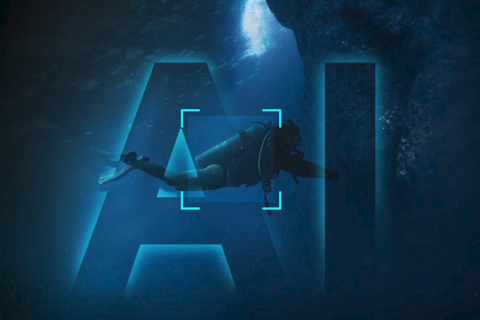
Tech Trends: QYSEA’s Artificially Intelligent Underwater Additions
2024-02-13 - Using their AI underwater image filtering algorithm, the QYSEA AI Diver Tracking allows the FIFISH ROV to identify a diver's movements and conducts real-time automatic analysis.
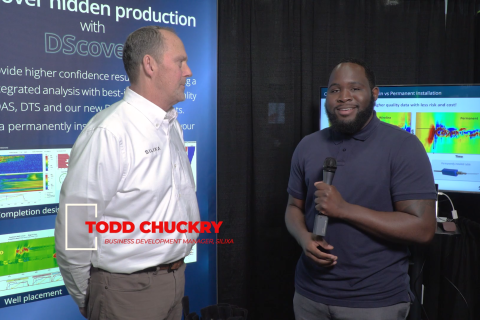
Exclusive: Silixa’s Distributed Fiber Optics Solutions for E&Ps
2024-03-19 - Todd Chuckry, business development manager for Silixa, highlights the company's DScover and Carina platforms to help oil and gas operators fully understand their fiber optics treatments from start to finish in this Hart Energy Exclusive.

CERAWeek: AI, Energy Industry Meet at Scary but Exciting Crossroads
2024-03-19 - From optimizing assets to enabling interoperability, digital technology works best through collaboration.

Cyber-informed Engineering Can Fortify OT Security
2024-03-12 - Ransomware is still a top threat in cybersecurity even as hacktivist attacks trend up, and the oil and gas sector must address both to maintain operational security.