1 Pioneer Natural Resources Co., Dallas, completed the gravel island drillsite for Oooguruk Field off the North Slope in the shallow waters of the Beaufort Sea about eight miles northwest of the Kuparuk River Unit, according to IHS Energy. The company's plans for 2006 include contouring the drillsite, fabricating equipment and modifying a drilling rig for installation during 2007. First oil production is expected in 2008. A rig will be modified and moved to the gravel island next winter to drill between 40 and 60 horizontal wells for Pioneer. Oooguruk wells are expected to produce 15,000 to 20,000 bbl. of oil per day in 2010. 2 In Alaska's Cook Inlet, Escopeta Oil and Gas Corp., Houston, will drill four offshore wildcats on its Kitchen prospect. The #1 East Kitchen is in Section 22-9n-11w, #1 Kitchen is in Section 18-9n-11w, #2 Kitchen is in Section 3-8n-12w and #1 South Kitchen is in Section 18-7n-12w., all on the east side of Upper Cook Inlet. Three drillsites are 10 miles north of Boulder Point, near Nikiski on the Kenai Peninsula. The fourth is nearly two miles west of the shoreline near Nikiski. Escopeta will drill #1 East Kitchen later this year to 17,000 ft. The #1 Kitchen and #2 Kitchen will be drilled in 2007, and #1 South Kitchen is set to drill in 2008. 3 Santa Maria Pacific LLC, Santa Maria, Calif., will drill three wells in Santa Barbara County, Calif. The #20408 Righetti, #20409 Righetti and #40502 Righetti are all in Section 3-9n-35w. The depths and objective formations of these wells were not disclosed. 4 Bill Barrett Corp., Denver, drilled a Uinta Basin discovery in the Lake Canyon area 11 miles southwest of Duchesne, Utah. The #1 DLB 12-15-56, Section 15-5s-6w, in Duchesne County, Utah, produced an average of 300 bbl. of oil a day. The well was drilled 14,325 ft. and cased 11,539 ft., and is a mile west of #13-14-56 Nielsen Marsing, Section 14-5s-6w. 5 Wolverine Gas & Oil Co., Grand Rapids, Mich., staked a wildcat in an undrilled township on the Utah Hingeline six miles northwest of the town of Aurora. Located in Sevier County, Utah, #15-1 Denmark Wash-Wolverine-Federal, Section 15-21s-2w, will be drilled to 14,200 ft. about 13 miles north-northwest of the company's Covenant Field. The venture will be six miles south-southeast of a dry hole completed in 1976 at #1 Monroe-Fee in Section 14-20s-2w, Millard County, Utah. 6 A discovery completed by Forest Oil Corp., Denver, in Sheridan County, Mont., produced 210 bbl. of oil with 95,000 cu. ft. of gas daily. The #1-35 Ostby, Section 35-31n-58e, is producing from Mission Canyon at 8,334-60 ft. It was drilled and cased to a depth of 9,998 ft. In December 2005, the well produced 3,182 bbl. of oil from Mission Canyon in 14 days, an average of about 227 bbl. of oil a day. Forest also staked three locations: #1-34 Ostby, in Section 34-31n-58e; #2-34 Ostby, in Section 34-31n-58e; and #2-35 Ostby, Section 35-31n-58e. 7 EOG Resources Inc., Houston, completed a wildcat in Richland County, Mont., that produced an average oil flow of 138 bbl. per day, with 18,100 cu. ft. of gas. The #1-27H Kermit, Section 27-27n-53e, is seven miles south-southeast of Richey. During February, the wildcat produced 2,764 bbl. of oil and 362,000 cu. ft. of gas in 20 days. The #1-27H Kermit is 1.25 miles northwest of the Frog Coulee Field discovery in Section 35-27n-53e. The closest production is four miles southeast, at #1-5H Millicent in Section 5-26n-54e. The discovery produced 16 bbl. of oil per day. 8 Two wildcats planned by C Energy Inc., Denver, will be in northwestern Williams County, N.D. The #1-33H Andre, Section 33-158n-102w, is 4.5 miles northwest of Good Luck Field. Between 1981 and 1997, that field produced 251,541 bbl. of oil, 123.5 million cu. ft. of gas and 735,821 bbl. of water, primarily from Duperow and Red River, according to IHS Energy. The other wildcat, #1-36H Olson, in Section 36-149n-101w, is 1.5 miles northwest of the Bear Butte Field discovery well. The wildcat is 3.5 miles west-northwest of Buffalo Wallow Field and four miles south-southeast of Alexander Field. 9 Calgary-based Enerplus Resources drilled a wildcat six miles east of Watford City where it discovered a new accumulation in Bakken. Located in eastern McKenzie County, N. D., #20-1-H Titan E.-Gierke, Section 20-150n-97w, produces from a horizontal lateral. Enerplus did not release completion details regarding completion. The nearest Bakken production is six miles southeast in the southernmost well in the North Fork Field area. That well, #12-12 Federal, tested at 24 bbl. of oil a day and was not brought online, according to IHS Energy. 10 GPE Energy Inc., Englewood, Colo., scheduled a wildcat in northwestern South Dakota. The #32-1 Gold Point-State, Section 32-19n-2e, is in an undrilled township 3.5 miles northeast of Camp Crook. Located in Harding County, S.D., the 2,800-ft. well will be drilled a little more than seven miles north-northeast of West Short Pine Hills Field, which has produced 20.1 billion cu. ft. of gas and 17,750 bbl. of water from Shannon. 11 A wildcat drilled by Delta Exploration Co. Inc., Denver, flowed 5 million cu. ft. per day during tests of Mesaverde. This was on the northern flank of the Wind River Basin seven miles northeast of Shoshoni, Wyo., in northeastern Fremont County, Wyo. The #35-13 Copper Mountain Unit, Section 35-39n-93w, bottomed at 19,100 ft. and was completed in two stages in Mesaverde. According to Delta, #35-13 Copper Mountain Unit is the first well in the Howard Ranch area to drill through the entire Mesaverde section. The wildcat is 1.5 miles south of Bonneville Field. 12 Questar Exploration & Production Co., Salt Lake City, will drill a Vermillion Basin wildcat in southern Sweetwater County, Wyo., 46 miles southeast of Rock Springs, Wyo. The #3 Alkali Gulch Unit, Section 3-12n-100w, will be drilled to 14,488 ft. in the Jurassic Morrison. The well is two miles west-southwest of Questar's #1 Alkali Gulch Unit discovery, Section 12-12n-100w. That well was completed last year flowing 3.55 million cu. ft. of gas and 1,467 bbl. of water per day from 10 fracture-stimulated Cretaceous intervals, eight in Baxter between 11,316 and 13,626 ft., one in Frontier from 13,894 to 13,954 ft., and one in Dakota from 14,247-59 ft. 13 Pioneer Natural Resources USA Inc., Dallas, which will drill its third wildcat in Colorado's Sand Wash Basin. The #33-21 Big Gulch, Section 21-7n-93w, is 13 miles west-northwest of Craig in northwestern Colorado in east-central Moffat County, Colo., and projected to 13,500 ft. in Weber. The #33-21 Big Gulch is a half-mile south of Big Gulch Field, which has produced 3.9 billion cu. ft. of gas, 20,000 bbl. of condensate and 13,600 bbl. of water from Mesaverde above 3,500 ft. and Frontier at about 8,600 ft. since its discovery in 1960. The closest production from Weber is 14 miles southeast, in Williams Fork Field. 14 ExxonMobil Corp. will drill nine exploratory tests to evaluate Wasatch and Mesaverde gas zones from a single drillpad about 22 miles southwest of Meeker in western Colorado in Section 15-2s-97w, northern Rio Blanco County, Colo., in #297-15A1 through #297-15A9 Piceance Creek Unit. The company has not released information on the bottom-hole locations. The test wells are to be drilled in the two-mile gap between Love Ranch Field west and Piceance Creek Field east. 15 Wiepking-Fullerton Energy LLC, Englewood, Colo., drilled a Las Animas Arch exploratory test about eight miles west-southwest of Cheyenne Wells in eastern Colorado. The test initially pumped 230 bbl. of 37-degree-gravity oil per day, with no water, on completion in the Mississippian Spergen. The #1 Sara, Section 36-14s-46w, east-central Cheyenne County, Colo., was drilled to 5,675 ft. and is producing through perforations from 5,600-26 ft. The company will drill #1 Sara as a northwest offset to the company's #1 Wesley Codell discovery in Section 31-14s-45w, which was last reported flowing gas at a rate of 3.9 million cu. ft. daily 16 Frontier Drilling LLC, Bloomfield, N.M., received a permit to drill a 5,000-ft. wildcat, #1 Amacker, Section 22-23n-1w, in the northwestern area of Sandoval County, N.M., on the southern flank of Blanco South Field. The closest producer is #1-15 Badland Hills, 1.25 miles south of #1 Amacker. Just 3.5 miles south of #1-15 Badland Hills well, Westerly Exploration Inc., Houston, will drill #34 Romero-Federal, Section 34-23n-1w, to 7,500 ft.
Recommended Reading
Decoding the Delaware: How E&Ps Are Unlocking the Future
2024-05-01 - The basin is deeper, gassier, more geologically complex and more remote than the Midland Basin to the east. But the Delaware is too sweet of a prize to pass up for many of the nation’s top oil and gas producers.
Vital Energy’s 57 Miles of Completed Lateral: A Midland Mega-unit
2024-06-06 - Vital Energy’s 20-well unit in southwestern Glasscock County, Texas, is producing some 18,000 bbl/d from some 300,000 feet of horizontal hole — the equivalent of more than two marathons.
Mighty Midland Still Beckons Dealmakers
2024-04-05 - The Midland Basin is the center of U.S. oil drilling activity. But only those with the biggest balance sheets can afford to buy in the basin's core, following a historic consolidation trend.
Found in Mitchell County, Permian Basin: 2.5-mile Wolfcamp Stepouts
2024-06-06 - Bayswater Exploration & Production has taken its Midland Basin oil play far east into Mitchell County where a high carbonate content “gives us a chance to really compete with the big guys.”
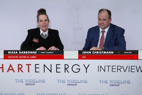
Apache CEO: Longer Laterals Expected as Permian Enters New Era
2024-05-17 - With more than a decade of development in the Midland and Delaware basins, there are more limitations that operators will have to work around, said Apache Corp. CEO John Christmann at Hart Energy's SUPER DUG Conference & Expo.


