1 Louis Dreyfus Natural Gas Corp., Oklahoma City, re-established production in the abandoned Mustang Island Block 774-L Field in Texas state waters with the completion of an Oligocene well flowing 3.8 million cu. ft. of gas and 268 bbl. of condensate per day. IHS Energy Group says the #2 State Tract 774-L, located on Mustang Island Block 774 offshore Kleberg County, was tested on a 20/64-in. choke through perforations at 11,478-11,536 ft. In Goliad County, the company is drilling below 5,250 ft. at a proposed 16,800-ft. wildcat-the #1 Swickheimer in William Reed Survey, A-246. 2 In Texas' Lavaca County, Coastal Oil & Gas Corp., Houston, recorded a flow of 23.931 million cu. ft. of gas, 126 bbl. of condensate and 576 bbl. of water per day at completion of the discovery #1 Weideman. The well, located in John Garelli Survey, A-199, is producing from Eocene Wilcox, perforated between 11,984-12,330 ft. 3 Tulsa-based Unit Corp. reports its wholly owned subsidiary, Unit Petroleum Co., has participated in completion of two discoveries in the upper Texas coast region. In Victoria County, Unit's #1 Keeran flowed 156 bbl. of oil and 269,000 cu. ft. of gas per day on an 8/64-in. choke through perforations at 8,436-66 ft. in Oligocene Frio. Unit, as operator, owns a 68.8% working interest in the well, located in Martin DeLeon Survey, A-74. Unit has 640 gross acres in the area. The company says it has a 25% working interest in the #1 Pruitt, an Upper Frio discovery operated by Allegro Investments Inc., Victoria, Texas, in neighboring Jackson County. The well, located in John J. Linn Survey, A-213, flowed 1.1 million cu. ft. of gas per day on a 9/64-in. choke. Perforations are at 5,262-72 ft. Unit and Allegro have identified several prospects on their 800-acre lease block. 4 Comstock Resources Inc., Frisco, Texas, says a flow gauge of 8.6 million cu. ft. of gas and 677 bbl. of condensate per day was recorded at its #14 W.T. Carter Brothers in Double A Wells Field, Polk County, Texas. The company says the well, which was tested on a 26/64-in. choke through perforations at 13,892-13,944 ft in Upper Cretaceous Upper Woodbine, is its fifth successful well drilled in the field since starting its redevelopment of the field last year. Comstock owns a 49.5% working interest in the new well, in C.W. Thompson Survey, A-563. Comstock also says it's drilling the #1 Vastar Fee, a 17,500-ft. exploratory test on its Ross Prospect south of Double A Wells Field. 5 Two Bossier Sand gas wells completed by Anadarko Petroleum Corp. in Freestone County, Texas, are located near a discovery completed by the company last fall. IHS Energy Group reports the #1 Burgher "D," Cesario Chamar Survey, A-8, tested 11.2 million cu. ft. of gas and 3 bbl. of water per day on a 20/64-in. choke through perforations at 12,909-62 ft. A mile and a half to the northeast, the #2 Burgher "A" was gauged on an open choke flowing 4.843 million cu. ft. of gas and 28 bbl. of water per day from Bossier, perforated between 13,060-13,222 ft. The wells are near Houston-based Anadarko's #1 Burgher "A" Bossier discovery that flowed 2.327 million cu. ft. of gas and 29 bbl. of water per day. In nearby Leon County, in other activity involving Bossier Sand, gas was recovered during testing at the #1 Allison, an indicated discovery being completed by Williams Production Co., Tulsa. Perforations are at 13,870-13,902 ft. at the prospect in Alla Stapleton Survey, A-733. 6 A flow of 1,106 bbl. of oil and 3.789 million cu.. ft. of gas is credited to the #1 Stream 25, an Oligocene Hackberry discovery completed by Houston independent Mayne & Mertz Inc. in Calcasieu Parish, La. The well, located in Section 26-11s-13w, yielded the flow on a 13/64-in. choke through perforations at 14,034-54 ft. 7 Southwestern Energy Co., Fayetteville, Ark., says the #1 Brownell-Kidd, an indicated discovery on its North Grosbec Prospect in Assumption Parish, La., logged approximately 50 ft. of net pay in Upper Discorbis at about 16,950 ft. Southwestern holds a 25% interest in the well, which is operated by Petro-Hunt Corp., Dallas. Production casing has been set across the pay zone and drilling is to proceed to test objectives in Lower Discorbis. The venture, located in Section 27-12s-12e, has a target depth of 21,500 ft. 8 McMoRan Exploration Co., New Orleans, owner of a 28.5% working interest and a 22.9% net revenue interest in the Houston Exploration Co.-operated #1 OCS-G-15212, reports a flow of 3,040 bbl. of oil and 11.1 million cu. ft. of gas per day at the discovery on Vermilion Block 408. The well, in about 380 ft. of water, was drilled to a total depth of 8,000 ft. and encountered 167 net ft. of pay in a single sand. Houston Exploration is based in Houston. 9 A well in Eugene Island Block 266 Field-Lafayette, La., independent Stone Energy Corp.'s #A-7 OCS-G-2898-gave up a flow of 20 million cu. ft. of gas and 1,200 bbl. of condensate per day on a 24.5/64-in. choke, according to IHS Energy Group. Stone encountered 163 net ft. of pay in four sands above 13,000 ft. The well is producing from the deepest of the four sands. It was drilled from platform "A" in the eastern portion of Block 243 to a bottomhole location to the east on Block 242. 10 Viosca Knoll Block 384 is the site of an indicated discovery being tested by Sonat Exploration GOM Inc., Houston. The first drilling on the block, the #1 OCS-G-16541, bottomed at 15,250 ft. in Lower Cretaceous James Lime. Production casing is set at 15,232 ft. Sonat plans to drill two more tests on the block. 11 Mariner Energy Inc., Houston, reports it has made a discovery at its Devils Tower Prospect on Mississippi Canyon Block 773, located in 5,610 ft. of water. Mariner drilled the #2 OCS-G-19996 to a total depth of 15,625 ft. and ran casing after encountering multiple hydrocarbon bearing zones. An appraisal test is planned for the prospect. Mariner, as operator, holds a 50% working interest in the discovery with CNG Producing Co., New Orleans, holding 30%, Pioneer Natural Resources Co., Dallas, 15,83375%, and Westport Oil & Gas Co. Inc., Denver, 4.16625%. 12 An Initial Plan of Exploration filed by Shell Deepwater Development Inc. for its Roy Prospect calls for the drilling of two wildcats. The prospect is made up of Mississippi Canyon Block 988 and Atwater Valley Block 20. The two tests are to be drilled in 4,350 ft. of water a few feet apart in the southwestern portion of Mississippi Canyon Block 988. The initial test is to bottom to the south on adjacent Atwater Valley Block 20. The Roy Prospect is one of two prospects to be drilled this year under an agreement between Chevron USA Production Co. and Shell to share rigs in the deepwater Gulf. Shell's proposed location is about 6 miles northeast of the #1 OCS-G-13198, a 26,000-ft. wildcat on Atwater Valley Block 63 where Texaco E&P Inc. is drilling below 18,000 ft. The site lies in 4,370 ft. of water. Texaco has plans to drill three more tests on the block. 13 A horizontal wildcat drilled by Houston independent Miller Exploration Co. on the south side of the Kola Salt Dome in Mississippi tapped Lower Cretaceous Rodessa and Sligo for a flow of 9.1 million cu. ft. of gas and 456 bbl. of condensate per day. IHS Energy Group reports the #1 Miller-Langston, Section 28-8n-15w, Covington County, was tested on a 26/64-in. choke through perforations between 14,390-14,510 ft. Interest holders include Miller, as operator, with 16.7%, Key Production Co. Inc., New Orleans, with 35.3% and Remington Oil & Gas Corp., Dallas, with 16%. Toreador Royalty Corp., Dallas, has a 5.89% royalty interest. Meanwhile, the Southeastern Oil Review reports Miller is production testing another Covington County wildcat, this one located on the southeastern flank of the Richmond Salt Dome. The indicated discovery is the 16,869-ft. #1 Miller-Fairchild in Section 22-6n-18w. Miller logged multiple hydrocarbon bearing zones before reaching salt. 14 Will-Drill Production Co. Inc.'s #1 Tatum's Camp 9-5 has revived production in Tatum's Camp Field, Lamar County, Miss. The Southeastern Oil Review says the Shreveport company's well is located in Section 9-3n-15w. It yielded 1.979 million cu. ft. of gas and 45 bbl. of condensate per day on a 23/64-in. choke from an openhole interval at 15,657-72 ft. in the Booth Sand of Lower Cretaceous Hosston.
Recommended Reading
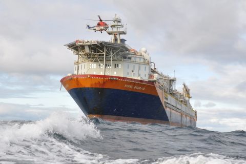
Vår Selling Norne Assets to DNO
2024-05-08 - In exchange for Vår’s producing assets in the Norwegian Sea, DNO is paying $51 million and transferring to Vår its 22.6% interest in the Ringhorne East unit in the North Sea.

SLB OneSubsea JV to Kickstart North Sea Development
2024-05-07 - SLB OneSubsea, a joint venture including SLB and Subsea7, have been awarded a contract by OKEA that will develop the Bestla Project offshore Norway.

EOG: Utica Oil Can ‘Compete with the Best Plays in America’
2024-05-09 - Oil per lateral foot in the Utica is as good as top Permian wells, EOG Resources told analysts May 3 as the company is taking the play to three-mile laterals and longer.
Chevron, Total’s Anchor Up and (Almost) Running
2024-05-07 - During the Offshore Technology Conference 2024, project managers for Chevron’s Anchor Deepwater Project discussed the progress the project has made on its journey to reach first oil by mid-2024.
US Rig Count Makes Biggest Monthly Jump Since November 2022
2024-07-26 - The oil and gas rig count, an early indicator of future output, rose by three to 589 in the week to July 26.