Searcher Seismic expanded its modern offshore data library with the completion of the Gulf of Papua seismic study in Papua New Guinea on Jan. 15.
The Gulf of Papua is a vast area comprising over 187,000 sq km (72,201 sq miles). With only 27 wildcat exploration wells drilled to date in shallow water, much of the region remains underexplored.
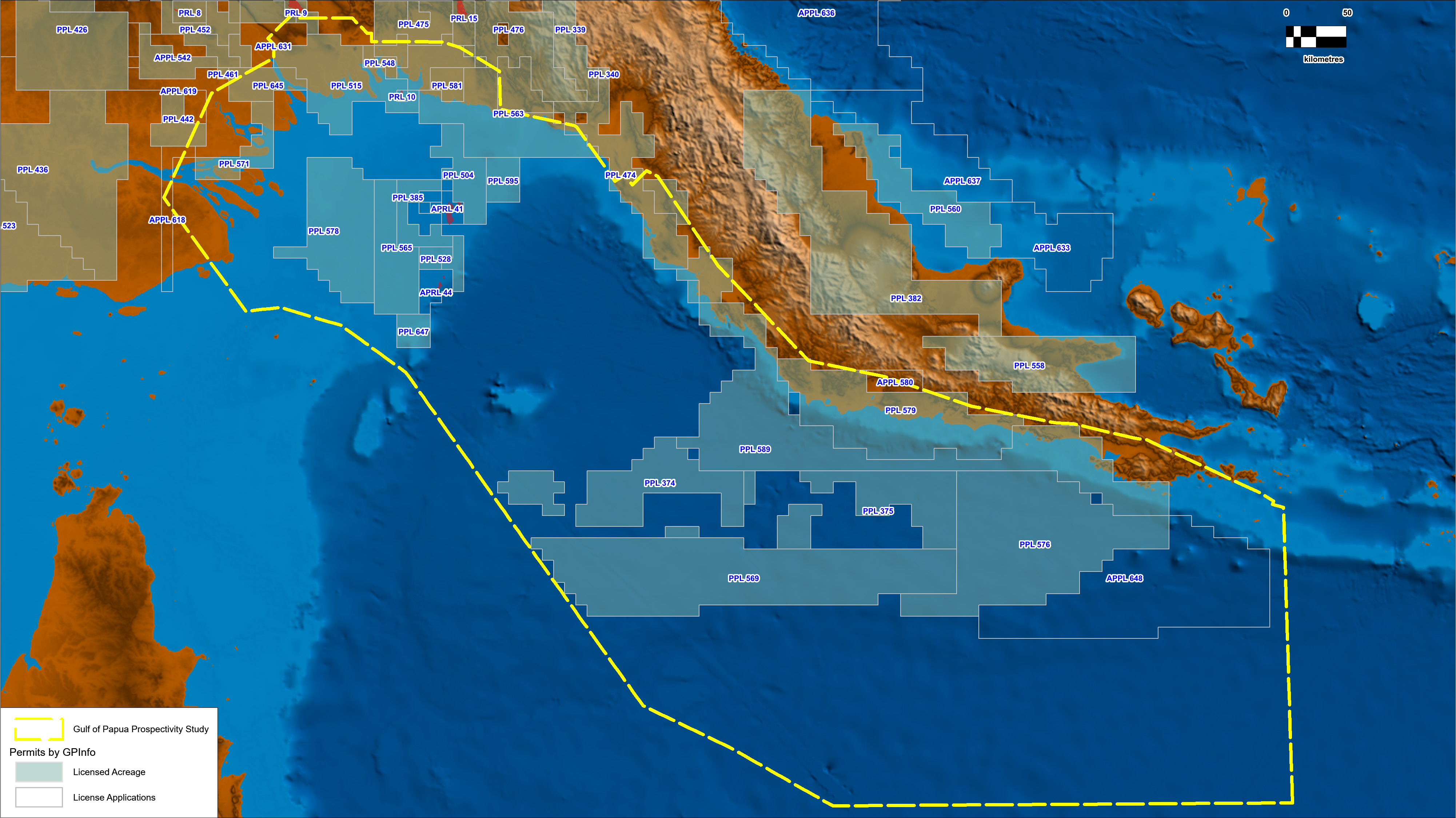
The Gulf of Papua seismic study was undertaken by Discover Geoscience on behalf of Searcher and consists of five main sections; tectonostratigraphic framework, tectonostratigraphic elements, facies and EOD mapping, charge modeling plus play concepts and leads inventory.
The study is being offered to the industry as an integrated multidisciplinary report of the hydrocarbon prospectivity potential across the entire Gulf of Papua utilizing the wealth of data from Searcher’s Gulf of Papua datasets.
Searcher has the most expansive multiclient geoscience dataset available in Papua New Guinea; including 77,910 sq km 2D seismic data (newly acquired and reprocessed), 1,795 sq km 3D seismic reprocessing, 60,690 sq km airborne gravity, magnetic and gradiometry data and a geochemical study covering the entire Gulf of Papua.
“Modern seismic data has enabled deeper imaging of distinctive tectonic packages and basement which has been utilized in the study, leading to the identification of several new plays within the Gulf of Papua,” Simon Crellin, sales director for Searcher, said.
“The study has revealed significant prospectivity in this frontier region. Leveraging high-quality seismic data, drop cores, dredge samples, seep data and geochemical analysis within this study has enabled us to build a comprehensive leads inventory for the Gulf of Papua,” Crellin added.
The Gulf of Papua seismic study is also available alongside the Gulf of Papua seismic datasets.
Recommended Reading

E&P Highlights: April 22, 2024
2024-04-22 - Here’s a roundup of the latest E&P headlines, including a standardization MoU and new contract awards.

Technip Energies Wins Marsa LNG Contract
2024-04-22 - Technip Energies contract, which will will cover the EPC of a natural gas liquefaction train for TotalEnergies, is valued between $532 million and $1.1 billion.
Galp Seeks to Sell Stake in Namibia Oilfield After Discovery, Sources Say
2024-04-22 - Portuguese oil company Galp Energia has launched the sale of half of its stake in an exploration block offshore Namibia.

Aker BP’s Hanz Subsea Tieback Goes Onstream
2024-04-22 - AKER BP’s project marks the first time subsea production systems have been reused on the Norwegian Continental Shelf.