The U.S. Gulf of Mexico (GoM) geology is characterized by highly complex salt geometries that are a challenge to seismic imaging. However, the reward is large for anyone who can find a way to produce reliable subsurface images to explore oil and gas, as the basin is also prolific in hydrocarbon potential at multiple levels, both pre- and post-salt. This prize has driven many previous advances in seismic imaging technology.
From 2D to 3D to Wide Azimuth to multi Wide Azimuth and Coil, the advancements of streamer-based seismic technology have led to the ability to image deeper and with more accuracy with each evolution of acquisition and processing technologies. Recently, automatic velocity model building methods, and in particular full waveform inversion (FWI), introduced another step-change in the subsalt image quality and has refocused the acquisition methods towards what is suited for this technology. This has led to long offset and low frequency acquisition.
To make such a long offset program affordable, a new survey design centered around sparse ocean bottom nodes (OBNs) and simultaneous shooting is presented here. The Amendment survey, acquired in 2019, is the largest multi-client deepwater node survey ever delivered in the GoM with offsets up to 65 km recorded, enabling FWI velocity updates down to 15 km depth. Amendment covers 117 OCS blocks (2,765 square kilometers) with water depths up to 2,070 meters.
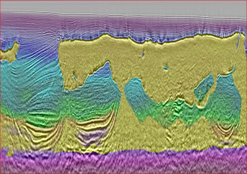
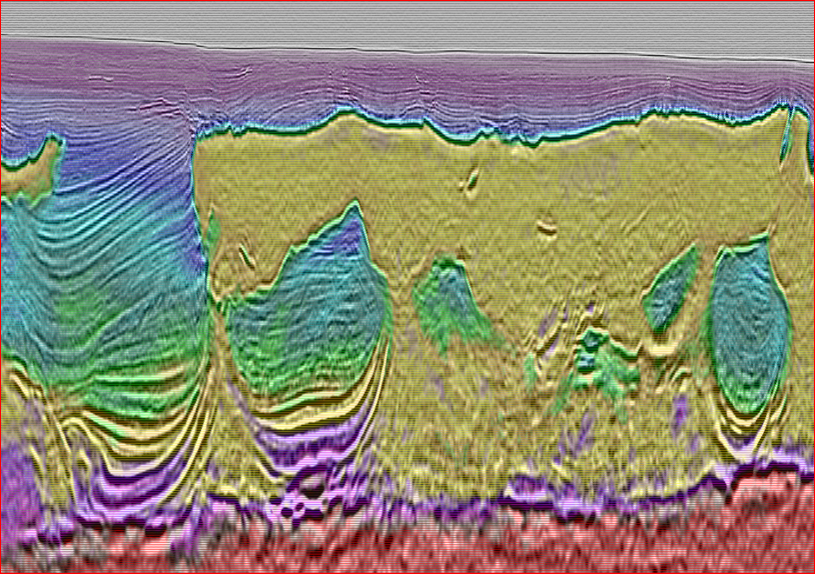
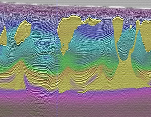
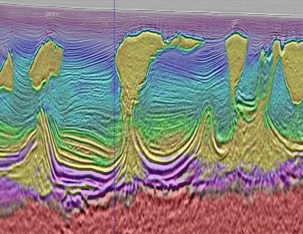
Amendment is the first project to utilize Dynamic Matching Full Wave Inversion (DM-FWI), from TGS, for a high-resolution velocity-model update, which focuses on solving the kinematic difference between input data and synthetic data for both refractions and reflections. With the data residual calculated in localized windows in time and space. The application to the Amendment sparse node dataset with ultralong offsets in the Gulf of Mexico shows its capability to resolve large velocity errors and give significant uplift on the sub-salt image. The imaging uplift achieved in this project is due to the combination of two elements: OBN data provided improved illumination due to the uniform full azimuths and long offset, and a higher fidelity velocity model created by applying FWI to this long offset OBN data.
DM FWI aims to find the optimized velocity model that best matches between internally generated synthetic data and the observed field data. How effective this is depends on how the misfit between the two datasets is represented. Conventional FWI uses the Least-Squares method to represent the misfit, which is measured by the data residual between the recorded seismic data and modelled synthetic data, with a form of normalization to match the energy level between the two datasets for real application. However, the amplitude misfit can become dominated by noise contamination. Since the waveforms of seismic data are localized in both time and space, local window-based methods are preferred to dynamically match the synthetic data to the input data.
Prior to the use of Dynamic Matching FWI on large offset OBN data, acquisition, modelling and imaging techniques have been unable to decipher many details and some of the key controlling fundamental structures. DM FWI applied to long offset sparse node data, such as with the Amendment survey, can correct large scale errors and pick up details on features that were previously unclear. In the shallowest data, slow velocity gas features are accurately captured in the model, and when this happens, the resulting image below heals. Structural kinks are smoothed out. Overall, the geology of this area provides many challenges. However, this technology has delivered a step-change in imaging and revealed some of this information to study and prospecting.
Through Dynamic Matching FWI, Amendment Phase 1 FWI has de-risked the new generation exploration acquisition design for use in other parts of the GoM. Large areas of the GoM remain significantly under-explored due to the particularly challenging combination of salt canopy, uncalibrated sediment velocities, and the resulting poor seismic image quality obtained with the previous generation of acquisition designs and velocity model building technologies. These new generation surveys could unlock further under-explored GoM areas for active prospecting.
This project was acquired in partnership with WesternGeco and processed by TGS.