1 Hexadyne Energy Co., Woodlands, Calif., has staked a wildcat well in Solano County, Calif. The company's #6-1 Feather River, in Section 6-6n-2e, will target an unnamed gas objective. The well is approximately 0.75-mile west of Millar Field and three miles southeast of Dixon, says IHS Energy. 2 Denver-based Cimarex Energy Co. has scheduled two new-field wildcats in sparsely drilled Stanislaus County, Calif. Both wells will seek gas in an unspecified formation. The #1-27 Luz Ardiden, in Section 27-2s-10e, is projected to 4,800 ft. The location is about 15 miles southeast of Lone Tree Creek Field, 19 miles east of McMullin Ranch Field and 9.5 miles northeast of Modesto. The #1-10 Col de Madeleine is projected to 5,300 ft. in Section 10-3s-10e. That well is 18 miles southeast of Lone Tree Creek Field, 18 miles east of McMullin Ranch Field and 8.5 miles northeast of Modesto. 3 A 4,200-ft. wildcat planned by Fair Oil Ltd., Tyler, Texas, is aimed at the White Rim formation in Section 19-20s-9e in western Emery County, Utah. The #1 Otto G. Seal-Federal is in an undrilled township some nine miles east of Ferron and about three miles northeast of the nearest previous drilling, a 4,457-ft. dry hole. The nearest production is above 1,000 ft. about eight miles east in Ferron Field. Nine miles west-northwest an abandoned Kaibab formation oil discovery in Ferron Field was completed pumping 23 bbl. of oil and 23 bbl. of water. 4 Tom Brown Inc., Denver, has scheduled three wildcats in an exploration program near the Big Indian Field discovery in the San Juan County, Utah, segment of the Paradox Basin. The wells are from 27 to 30 miles southeast of Moab. Big Indian Field was opened in 1961 with the Big Indian-USA in Section 33-29s-24e flowing 7.4 million cu. ft. of gas and 81 bbl. of condensate a day from Mississippian between 9,886 and 10,150 ft. It produced 26.6 billion cu. ft. of gas, 179,642 bbl. of condensate and 92,736 bbl. of water before it was abandoned in 1992. Tom Brown's #36-42 Big Indian is projected to 5,740 ft. in Ismay in Section 36-29s-24e. It is a mile northwest of the South Pine Ridge Field discovery well, the #7-6 South Pine Ridge, which has produced 656 million cu. ft. of gas, 7,100 bbl. of condensate and less than 200 bbl. of water between its discovery in 1981 and April 2003. Another Tom Brown wildcat, the #35-24 Big Indian, is in Section 35-29s-24e, and the other well is the #34-11 Big Indian in Section 34-29s-24e. That well will test McCracken at 10,400 ft. 5 Westech Energy Corp., Denver, is engaged in an exploration program in Powder River County, Mont., testing Muddy, Dakota and Minnelusa formations. According to IHS Energy, Westech is drilling the #15-14 Westech-Federal in Section 14-9s-50e, about six miles north of Ute Field in Campbell County, Wyo. That field produces from Muddy and Minnelusa. It has another wildcat scheduled in Section 20-9s-61e to test Muddy and Dakota at 6,500 ft. The company's #13-20 Westech-Federal in Section 20-9s-50e has already been drilled and has been abandoned as a dry hole. 6 Ultra Resources Inc., Denver, and Shell Rocky Mountain Production LLC have completed high-volume producers in continuing exploration along the Pinedale Anticline in the Green River Basin. The Ultra Resources #10-33 Mesa, in Section 33-32n-109w, Sublette County, Wyo., tested at 19.9 million cu. ft. of gas, 225 bbl. of condensate and 933 bbl. of water a day from 18 fractured stages between 8,282 and 13,748 ft., probably in Lance and Mesaverde. Flowing casing pressure was 3,400 psi. The well is 0.75-mile south-southwest of the company's #1-33 Mesa well, which tested at 18.8 million cu. ft. of gas and 300 bbl. of condensate, also from 18 fractured stages. Some three miles southeast, Shell completed its #1-11D Vible flowing 9.3 million cu. ft. of gas, 35 bbl. of condensate and 144 bbl. of water a day from Lance and Mesaverde between 7,477 and 12,646 ft. Shell's well is in Section 11-31n-109w. 7 BP America Production Co. tested 857,000 cu. ft. of gas and 12 bbl. of condensate at day from its #23-1 Luman wildcat, about 15 miles northwest of Wamsutter in the Great Divide Basin in Sweetwater County, Wyo. The well, in Section 23-22n-95w, tested fractured intervals in Lewis between 10,087-97 ft. and in Mesaverde between 10,668 and 10,873 ft. The intervals were tested through a 48/64-in. choke with 250 psi of casing pressure. 8 Anadarko Petroleum Corp., Houston, received a permit to drill a 23,100-ft. wildcat to Mesaverde sands in the Hannah Basin in central Carbon County, Wyo. The #17-2 Durante is in Section 17-22n-82w, about four miles west of Hanna. If it reaches its projected depth, it will be the deepest well ever drilled in the basin. The deepest previous well was about nine miles south. That was a 16,580-ft. dry hole, IHS Energy says. The nearest production is from shallower coalbed-methane wells 11 miles northeast. 9 Smith Oil Properties Inc., Denver, plans a wildcat in the Nebraska panhandle about 10 miles southwest of Bayard in Banner County. The #1 Linda, in Section 10-19n-53w, is scheduled to 5,700 ft. to test J sand. The test is a half-mile west of the Horn Field discovery well, which was completed in 1956 pumping 72 bbl. of oil a day from J sand between 5,062-68 ft. It produced 10,297 bbl. before abandoned. 10 A wildcat scheduled by Antelope Energy Co. LLC, Kimball, Neb., will evaluate D sands on Sioux Ordnance Depot land, about seven miles northwest of Sidney in Cheyenne County, Neb. The #1-33 Federal, in Section 33-15n-50w, will go to about 5,000 ft. The wildcat is within two miles of three fields. Table Field to the east has produced 62,500 bbl. of oil, 106.8 million cu. ft. of gas and 67,900 bbl. of water from D sand since its discovery in 1979. Pecos Field to the south-southwest has produced 891,800 bbl. of oil, 244.5 million cu. ft. of gas and 968,600 bbl. of water from D sand since 1961. Huntsman Field to the southeast, one of the first discovered on the Nebraska side of the Denver-Julesburg Basin, has produced more than 5.5 million bbl. of oil, 33.9 billion cu. ft. of gas and 35.8 million bbl. of water from D and J sands since 1950, says IHS Energy. 11 Devon Energy Corp., Oklahoma City, will drill an Upper Cretaceous wildcat to 4,450 ft. in a remote location on the Axial Basin Uplift about 20 miles southwest of Craig, Colo. It will drill the #1-17 Juniper in Section 17-4n-93w in southeastern Moffat County, some 7 miles from the nearest fields. Maudlin Gulch Field lies to the west-southwest, Wilson Creek to the southwest and Iles Field to the east. All three have produced from Jurassic intervals, but Maudlin Gulch also had Cretaceous Dakota production and Iles produces from Cretaceous Mancos. There is no Niobrara production in the area. 12 Tom Brown Inc., Denver, wants to re-permit to change its objective on a remote wildcat on the eastern flank of the Paradox Basin in Montrose County, Colo., about 25 miles west-northwest of Naturita. The #25-31 Cimarron-Federal is in Section 25-47n-20w. It originally was scheduled to Permian Cutler at 5,500 ft. Tom Brown now wants to drill to both Cutler and to Pennsylvanian Ismay at 10,720 ft. The closest production is from Big Indian Field in San Juan County, Utah, about 10 miles to the northeast. That field produces from Pennsylvanian Hermosa, according to IHS Energy. 13 Cabot Oil & Gas Corp., Houston, is drilling a 10,335-ft. wildcat in San Miguel County, Colo., about 17 miles southwest of Naturita. The #2-7 Hard Left, in Section 7-44n-17w, will test Cutler, Honaker Trail and La Sal prospects. The well is some six miles west-northwest of the Double Eagle Field/Andy's Mesa Field area, where Cabot and Tom Brown Inc. are producing gas from Cutler, Honaker Trail, Ismay and La Sal. 14 Mull Drilling Co. Inc., Wichita, Kan., continues to expand its wildcat program on the Las Animas Arch in Lincoln County, Colo. Its latest planned wildcat is the #1-22 Cottonwood Grazing in Section 22-12s-52w, about a mile southeast of the company's #1-16 Meteor-State, which opened Meteor Field. The new well targets Morrow sand at 6,900 ft. 15 A 6-million-acre area of mutual interest (AMI) has been formed by Magnum Hunter Resources Inc., Irving, Texas, and CDX LLC with CDX Frontier LLC, both of Dallas, covering part of the San Juan Basin. The target for the effort is Upper and Lower Menefee coals within the Mesaverde group. CDX specializes in coalbed-methane production and has its own fleet of purpose-built rigs. The AMI covers portions of McKinley, Sandoval and San Juan counties, N.M. Magnum Hunter also is exercising options for rights to properties in Bernalillo, Catron, Cibola and Socorro counties. The first phase of the effort calls for 25 wells drilled to depths to 3,500 ft. at a total cost of $3 million.
Recommended Reading
Chevron’s Tengiz Oil Field Operations Start Up in Kazakhstan
2024-04-25 - The final phase of Chevron’s project will produce about 260,000 bbl/d.
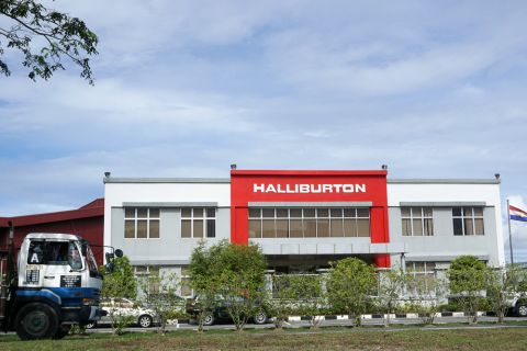
Rhino Taps Halliburton for Namibia Well Work
2024-04-24 - Halliburton’s deepwater integrated multi-well construction contract for a block in the Orange Basin starts later this year.

Halliburton’s Low-key M&A Strategy Remains Unchanged
2024-04-23 - Halliburton CEO Jeff Miller says expected organic growth generates more shareholder value than following consolidation trends, such as chief rival SLB’s plans to buy ChampionX.
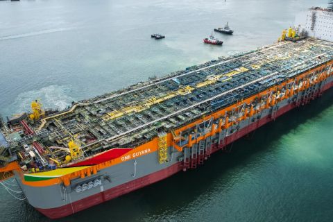
Deepwater Roundup 2024: Americas
2024-04-23 - The final part of Hart Energy E&P’s Deepwater Roundup focuses on projects coming online in the Americas from 2023 until the end of the decade.

Ohio Utica’s Ascent Resources Credit Rep Rises on Production, Cash Flow
2024-04-23 - Ascent Resources received a positive outlook from Fitch Ratings as the company has grown into Ohio’s No. 1 gas and No. 2 Utica oil producer, according to state data.