1 Oxy USA Inc., Tulsa, gauged a flow of gas at the rate of 1.3 million cu. ft. per day during preliminary testing of Pennsylvanian Upper Morrow at the #1 Hentschel "B," a delineation well in a new Hugoton Embayment field, Stevens County, Kan. IHS Energy Group says the well, in Section 8-33s-42w, yielded the flow from 4,553-82 ft. A quarter-mile northwest in Section 5, Dominion Oklahoma Texas Exploration & Production Inc. was last reported testing Upper Morrow through perforations at 4,636-44 ft. and 4,648-54 ft. at the discovery #1-5 Blout. Dominion has drilled two additional tests in Section 5, the #2-5 Blout and #1-5 Williams Trust. A half-mile east of its new producer, Oxy has set pipe on bottom at 5,100 ft. at the #1 Hentschel "B" in Section 9. The company ran a drillstem test at 3,693-3,716 ft. in Pennsylvanian Lansing-Kansas City but has not released details on any recovery. 2 An Oklahoma Panhandle Pennsylvanian deeper-pool discovery, completed by EOG Resources Inc., Houston, producing from Lansing Lime at 4,470-74 ft. and Marmaton at 5,511-18 ft., has given up a flow of 70 bbl. of oil, 573,000 cu. ft. of gas and 20 bbl. of water per day. The #14-1 Randles, drilled in Section 14-2n-17ecm, Texas County, was tested through an open choke. Set up as a 7,500-ft. test to Mississippian, the exploratory test was drilled to a total depth of 7,325 ft. and cased to 5,810 ft. It's in an area of Permian gas production from above 2,700 ft. Elsewhere in the Oklahoma Panhandle, in Beaver County, Cody, Wyo., independent Tex-Ok Energy LP gauged a flow of 349 bbl. of oil and 162,000 cu. ft. of gas per day at the #2 Irene. The well, a workover in Section 25-4n-22ecm, is producing from 7,336-44 ft. in Mississippian Lower Chester Sand. It apparently opens a new Chester Sand reservoir. The well originally produced from Mississippian St. Louis Lime at 7,618-41 ft. 3 The #1-10 Cherie, an exploratory well in Section 10-17n-13w, Blaine County, Okla., has been completed by Oneok Resources Co., Tulsa, flowing at the rate of 143 bbl. of oil, 525,000 cu. ft. of gas and 42 bbl. of water per day. Located in the Eagle City Field area, it's a Morrow discovery that's producing from an openhole interval between 8,723-8,970 ft. 4 A 0.75-mile extension of the Texas Panhandle's Canadian Northwest Field was tested flowing 1.5 million cu. ft. of gas and three bbl. of water per day at completion by Bracken Operating LLC, Oklahoma City. Bracken's successful stepout is the #1082 Nix in Section 82, Block 1, H&TC Survey, A-1465, Hemphill County. IHS Energy Group reports a 16/64-in. choke was used to test a Pennsylvanian Douglas Sand interval at 6,720-66 ft. 5 North Texas' Barnabus Field was extended more than two miles southeast with the completion of the EnCana Oil & Gas (USA) Inc. #5 McMurrey flowing 41 bbl. of oil and 280,000 cu. ft. of gas per day. The first Barnabus Field well in Denton County, the firm's producer tapped Mississippian Lower Barnett Shale, perforated between 8,704-9,040 ft. Testing was carried out using an 18/64-in. choke. The extension is in John Thomas Survey, A-1239. 6 AOG Inc., Norman, Okla., has run production pipe to a total depth of 10,455 ft at the #1 Perrin Air Force Base in Section 12, University Lands (Cecil Thomas) Survey, A-305, Grayson County, Texas. The indicated discovery is on the west side of the Grayson County Airport. It's situated 0.5-mile north of Sherman Field, but apparently separated from the field by a 9,759-ft. dry hole that yielded 200 ft. of slightly oil and gas cut mud during a drillstem test run between 9,178-9,293 ft. Log tops include Pennsylvanian Cordell at 9,252 ft. and Ordovician Viola at 9,512 ft. 7 A new-field opener and a shallower-pool discovery have been completed by King Operating Corp., Addison, Texas, in Eastland County, Texas, reports IHS Energy Group. The opener of Bill Edwards Field is the #1 Eberhart Ranch in Lot 10, James Jett Survey, that tapped Duffer Lime, perforated between 3,204-3,449 ft., for a flow of 29 bbl. of oil and 368,000 cu. ft. of gas per day on a 12/64-in. choke. A quarter-mile west, in Lot 15, the #2 Eberhart Ranch found production in the interval 2,592-2,735 ft. in Pennsylvanian Caddo. The shallower- pool opener was tested on pump for a gauge of 43 bbl. of oil and 95 bbl. of water, with 18,000 cu. ft. of gas, per day. King has drilled four additional tests in the vicinity, all apparently successful. 8 The Spraberry Trend area in Texas' Midland County is the site of a horizontal Devonian discovery finaled by CMS Oil & Gas Co. flowing 1.282 million cu. ft. of gas, 11 bbl. of condensate and 103 bbl. of water per day on a 48/64-in. choke. The #1601H Rock, Section 26, Block 39, T4S, T&P Survey, A-1128, is producing through perforations between 15,882-18,992 ft. It was drilled to a measured depth of 19,061 ft. (true vertical depth 12,314 ft.). 9 The confirmation of the Crane County, Texas, CrownQuest Field opener has been tested by CrownQuest Operating LLC flowing 302 bbl. of oil, 175,000 cu. ft. of gas and 36 bbl. of water per day on an 18/64-in. choke. It's the #2 Crump "48" that was tested through perforations at 6,928-88 ft., 7,000-28 and 7,040-64 ft. in Devonian. The well is in Section 48, Block 32, PSL Survey, A-831, within 0.25-mile southeast of the Midland firm's discovery, the #1 Crump "48" that was completed flowing 298 bbl. of oil, 160,000 cu. ft. of gas and four bbl. of water per day on a 24/64-in. choke. The discovery topped Devonian at 6,520 ft. and is producing through perforations at 6,956-82 ft. and 7,006-20 ft. 10 Tom Brown Inc., Denver, has announced that it's selling about 10 million cu. ft. of gas per day at its horizontal #4H Trees Estate in Reeves County, Texas. The well, at the company's Deep Valley project area, is producing on a 20/64-in. choke from a horizontal Devonian section, perforated between 14,737-15,497 ft. It's in Section 1, Block C4, PSL Survey, A-1300. Tom Brown Inc., as operator through drilling, owns a 50% working interest and ChevronTexaco Corp. owns the other 50%. The company says two additional tests are under way-it's drilling below 2,150 ft. at the #1H Beefmaster (Tom Brown 50% working interest), five miles west of the new producer in Section 15, Block C4, PSL Survey, A-2415, Reeves County. Six miles south, in Pecos County, the company is drilling the horizontal lateral in the Devonian section at the 17,000-ft. #1H Moore-Gilmore (Tom Brown 100% working interest) in Section 10, Block C2, PSL Survey, A-5072. At the #1H Beefmaster, the company intends to drill the vertical and horizontal Devonian section to a measured depth of 18,000 ft. 11 A horizontal well in Beall Field, Ward County, Texas, flowed 23.115 million cu. ft. of gas, 24 bbl. of oil and 30 bbl. of water per day from Montoya, perforated between 13,437-16,985 ft. Ocean Energy Inc. tested the #2H Harding Fee on a 56/64-in. choke, according to IHS Energy Group. The well is in Section 68, Block 34, H&TC Survey, A-750. Measured total depth is 17,175 ft. and true vertical depth is 12,876 ft. 12 Occidental Permian Ltd. has finaled another Permian Wolfcamp producer in Texas' Anton-Irish Field, this one the #2 Snitker that flowed 486 bbl. of oil, 5,000 cu. ft. of gas and three bbl. of water per day. Located in Section 31, Block 1, R.M. Thomson Survey, Lamb County, the new well is producing from an openhole interval between 6,604-6,798 ft. Less than 0.25-mile south, Occidental completed the #1 Snitker last March flowing 412 bbl. of oil, 5,000 cu. ft. of gas and one bbl. of water per day. 13 A New Mexico discovery, completed by Kukui Operating Co., flowed 1.528 million cu. ft. of gas and eight bbl. of condensate per day through perforations in Pennsylvanian Atoka and Morrow between 6,963-7,140 ft. IHS Energy Group reports the #1 Sargent Canyon "31" Federal is in Section 31-19s-21e, Eddy County. The Midland independent used a 14/64-in. choke to test the wildcat. Kukui has proposed the new producing area be named Crooked Canyon Field. Half a mile north, the company has staked the #2 test on the lease. Projected depth is 7,400 ft. 14 In Lea County, N.M., Yates Petroleum Corp., Artesia, N.M., has deepened the #1 Thumbs Up "AZT" State Com from 9,990 ft. to 12,865 ft. in Morrow and set pipe at 12,863 ft. The wildcat is in Section 36-9s-34e. Yates is deepening another Lea County wildcat, the #1 Royal "BAC" State Com in Section 24-10s-34e. The venture has a target depth of 12,400 ft. in Mississippian.
Recommended Reading

Drilling Tech Rides a Wave
2024-01-30 - Can new designs, automation and aerospace inspiration boost drilling results?
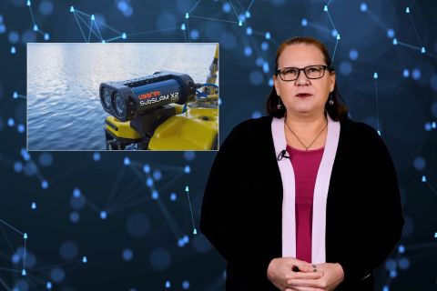
Tech Trends: Autonomous Drone Aims to Disrupt Subsea Inspection
2024-01-30 - The partners in the project are working to usher in a new era of inspection efficiencies.

TGS, SLB to Conduct Engagement Phase 5 in GoM
2024-02-05 - TGS and SLB’s seventh program within the joint venture involves the acquisition of 157 Outer Continental Shelf blocks.

2023-2025 Subsea Tieback Round-Up
2024-02-06 - Here's a look at subsea tieback projects across the globe. The first in a two-part series, this report highlights some of the subsea tiebacks scheduled to be online by 2025.
StimStixx, Hunting Titan Partner on Well Perforation, Acidizing
2024-02-07 - The strategic partnership between StimStixx Technologies and Hunting Titan will increase well treatments and reduce costs, the companies said.