1 Raydon Exploration Inc., Oklahoma City, is drilling a wildcat in Hamilton County, Kan., that's scheduled to go to 5,200 ft. to evaluate Pennsylvanian Morrow. IHS Energy Group reports Raydon's venture-the #1-5R Dikeman in Section 5-23s-41w-is located about 14 miles northeast of the closest previous Morrow production at the abandoned, one-well Helfrich Field. 2 Drilling depth is below 3,050 ft. at the Murfin Drilling Co. #1-3 Hix in Section 3-3s-26w, Decatur County, Kan. Wichita-based Murfin plans to take the wildcat to about 3,950 ft. to test Pennsylvanian Lansing-Kansas City. 3 Two Pennsylvanian sands-Spiro and Middle Hale-yielded gas during production testing at a discovery drilled by Fort Smith-based Stephens Production Co. in Sebastian County, Ark. The #1-23 Fort, Section 23-7n-30w, yielded 1.5 million cu. ft. per day from Spiro, perforated at 9,164-74 ft., and 311,000 cu. ft. per day from Middle Hale, perforated at 7,647-52 ft. IHS Energy Group says the well is located on the previously undrilled 12,331.55-acre Chaffee Arkoma Unit, recently formed within the Fort Chaffee Military Reservation. 4 Arkansas' Yell County has a remote wildcat that's being drilled by Klabzuba Oil & Gas Inc., Fort Worth. Plans call for the #1-17 Olson, Section 17-5n-23w, to be drilled to 9,500 ft. for tests of Pennsylvanian Middle Atoka sands. It's located in a lightly drilled area of the state. 5 O'Neal Drilling Co. Inc., Fort Worth, pumped 67 bbl. of oil and 55 bbl. of water, with 172,400 cu. ft. of gas, per day from two formations at completion of its discovery, the #1-24 Rutherford. Location is in Section 24-4s-5e, Johnston County, Okla. IHS Energy Group reports the wildcat is producing through perforations at 5,324-76 ft. in Mississippian Sycamore and at 5,512-34 ft. in Devonian Woodford. The 7,000-ft. venture was drilled to Ordovician Simpson, topped at 6,900 ft. 6 Mayfield Northeast Field in Beckham County, Okla., is the site of a 17,860-ft. well completed by Sanguine Ltd., Tulsa, flowing 11 million cu. ft. of gas and 23 bbl. of water per day. Sanguine's well is the #2-27 Mandrell in Section 27-11n-25w. It was tested on a 20/64-in.choke and is producing from three perforated intervals in Upper Morrow-at 16,984-88 ft., 17,281-84 and 17,754-65 ft. 7 A Pennsylvanian Cromwell producer completed by Oklahoma City-based Arkoma Holding Corp., located in the middle of a three-quarter-mile gap between two other Coal County, Okla., Cromwell wells, flowed 4.19 million cu. ft. of gas per day. Arkoma's #5-35 Sidmore, located in Section 35-3n-11e, Ashland South Field, flowed through a 32/64-in. choke from five perforated intervals in Cromwell between 7,362-7,538 ft. 8 Alpar Resources Inc., Perryton, Texas, worked over the #1 Hill-Jines and in the process opened a new pool in Section 482, Block 43, H&TC Survey, A-482, Ochiltree County, Texas. The well was recompleted flowing 288 bbl. of oil and 65,000 cu. ft. of gas per day on a 16/64-in. choke. It's producing from an undifferentiated Pennsylvanian Des Moines section perforated at 7,320-50 ft., 7,430-64 and 7,476-86 ft. IHS Energy Group says the well was originally completed in 1962 producing from Upper Pennsylvanian Cleveland at 7,028-69 ft. as part of Dutcher Field. 9 In Texas' Sherman County, Phillips Petroleum Co. stepped out 1/2-mile north of its opener of Anvil Field to drill and complete the #3 Handlin flowing 3.3 million cu. ft. of gas per day on a 24/64-in. choke from Morrow. The extension, and confirmation of the discovery, is located in Section 84, Block 1C, GH&H Survey, A-583. It's producing through perforations at 6,616-38 ft. Phillips established Anvil Field by completing the #2 Handlin flowing 5.24 million cu. ft. of gas per day from Morrow. 10 The Texas Panhandle is soon to get two deep Morrow exploratory ventures, both staked by Amoco Production Co. In Wheeler County. Amoco will drill to 16.500 ft. at the #104 Britt Ranch in Section 4, Block 1, B&B Survey, A-8630. The closest Morrow production is located 1 3/4 miles to the east-northeast. The second test, located in Hemphill County, is the #1 Big Lake 103. It's a deeper-pool wildcat located less than 1/4 of a mile south-southwest of Achilles Field. Amoco plans to drill to a depth of 15,400 ft. at the project in Section 103, Block 41, H&TC Survey, A-209. 11 Big Spring, Texas-based Sharp Image Energy Inc. made a discovery in Throckmorton County, Texas, by completing the #2 Brown-Merrick "261" flowing 154 bbl. of oil and 31,000 cu. ft. of gas per day. The company used a 16/64-in. choke to test through perforations at 3,652-3,702 ft. in Pennsylvanian Strawn Sand at the well located in Section 261 of BBB&C Survey, A-154. 12 Pioneer Natural Resources Co., Dallas, reports Midland independent Meadco Properties' #1 Sugg 1903A, a Permian Wolfcamp discovery in which Pioneer holds a 75% working interest, is flowing its allowable of 240 bbl. of oil and 115,000 cu. ft. of gas per day. Pioneer says the well, which is producing from a depth of about 6,500 ft., is its third Wolfcamp discovery drilled in the past year on the prolific My Way/Lonesome Reef trend incorporating more than 23,000 acres in Irion County, Texas. The new producer is located in Section 1903 of P. Klas Survey, A-443. Pioneer says it has a 100% working interest in the first two discoveries-the #1 Sugg "36," completed in January 1999 for 369 bbl. of oil and 250,000 cu. ft. of gas per day, and the #1 Sugg "46," completed in November 1999 for 515 bbl. of oil and 348,000 cu. ft. of gas per day. The discoveries set up three to four additional tests scheduled to be drilled this year. All of the wells are being drilled on structural buildups defined by 3-D seismic. 13 The Exxon Corp. #1 University Lands "A", Section 42, Block 4, UL Survey, Andrews County, Texas, is an Ordovician Ellenburger discovery that yielded a flow of 157 bbl. of oil and 220,000 cu. ft. of gas per day. IHS Energy Group reports the well is producing through perforations at 10,568-88 ft. The closest comparable production is found almost 2 miles to the north in Means East Field. 14 A horizontal drilling program being carried out by CMS Oil & Gas Co. in the Midland Southwest Field area of Midland County, Texas, has contributed another producing well. At #1703H Garrett "B," CMS tapped Devonian for a flow of 1.626 million cu. ft. of gas, 111 bbl. of condensate and 286 bbl. of water per day. The well in Section 17, Block 39, T2S, T&P Survey, was tested on a 15/64-in. choke from 12,110-16,600 ft. CMS Oil & Gas Co. is the oil and gas exploration unit of Dearborn, Mich.-based CMS Energy Corp. 15 OXY USA Inc., Tulsa, is drilling below 6,150 ft. at #1 RJ "5," a deeper-pool wildcat in the Foster Field area in Ector County, Texas. Projected depth is 10,300 ft. at the venture located in Section 5, Block 42, T2S, T&P Survey, A-110. 16 A 13,150-ft. new-field wildcat being drilled by Yates Petroleum Corp. in Lea County, N.M., is nearing 3,650 ft. The Artesia, N.M., independent's #1 Big Bear "ATN" is in Section 29-15s-35e, nearly 1/2 mile northwest of Townsend Field. 17 Chi Operating Inc., Midland, has completed its third well-the one with the highest flow rate-in Crow Flats Southeast Field, Eddy County, N.M. All are Morrow producers. According to IHS Energy Group, the #1 Midnight Special "9" State Com flowed 2.56 million cu. ft. of gas, 32 bbl. of condensate and 7 bbl. of water per day. Located in Section 9-17s-28e, it was tested on a 12/64-in. choke through perforations between 9,803-88 ft.
Recommended Reading

Exclusive: Chevron New Energies' Bayou Bend Strengthens CCUS Growth
2024-02-21 - In this Hart Energy LIVE Exclusive interview, Chris Powers, Chevron New Energies' vice president of CCUS, gives an overview of the company's CCS/CCUS activity and talks about the potential and challenges of it onshore-offshore Bayou Bend project.
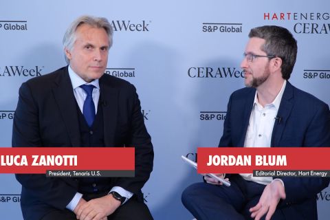
Exclusive: Tenaris’ Zanotti: Pipes are a ‘Matter of National Security’
2024-04-12 - COVID-19 showed the world that long supply chains are not reliable, and that if oil is a matter of U.S. national security, then in turn, so is pipe, said Luca Zanotti, U.S. president for steel pipe manufacturer Tenaris at CERAWeek by S&P Global.
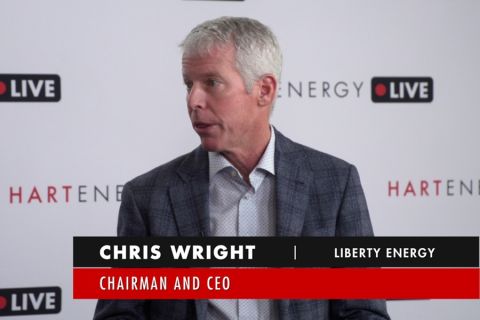
Exclusive: Liberty CEO Says World Needs to Get 'Energy Sober'
2024-04-02 - More money for the energy transition isn’t meaningfully moving how energy is being produced and fossile fuels will continue to dominate, Liberty Energy Chairman and CEO Christ Wright said.
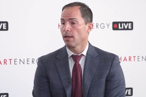
Chesapeake, Awaiting FTC's OK, Plots Southwestern Integration
2024-04-01 - While the Federal Trade Commission reviews Chesapeake Energy's $7.4 billion deal for Southwestern Energy, the two companies are already aligning organizational design, work practices and processes and data infrastructure while waiting for federal approvals, COO Josh Viets told Hart Energy.
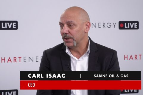
Exclusive: Sabine CEO says 'Anything's Possible' on Haynesville M&A
2024-04-09 - Sabine Oil & Gas CEO Carl Isaac said it will be interesting to see what transpires with Chevron’s 72,000-net-acre Haynesville property that the company may sell.