Sometimes the geologist who discovers an oil field eventually goes on to do other things, leaving the field’s development to the engineers.
But geologists at Range Resources have not turned their backs on the Marcellus. At a special “Discovery Thinking” forum at the recent American Association of Petroleum Geologists (AAPG) annual meeting, William Zagorski, vice president of exploration for Range, gave a presentation titled “Geologic considerations for an evolving North American liquids-rich play.” Zagorski, who also was awarded AAPG’s Norman H. Foster Outstanding Explorer award during the conference, is considered to be the “father of the Marcellus.”
So after almost a decade of developing the play, what’s left to learn? Quite a bit, Zagorski said, at least for those chasing the liquids-rich portion of the play.
“You’ve heard quite a bit about this formation and about the large gas fields,” Zagorski said. “It’s the largest gas field in the US. But you hardly ever hear about the liquids-rich portion. It wasn’t until the [US Geological Survey, USGS] released its latest reserve estimate that someone even said there’s a 3.5-Bbbl liquids field here.
“It got ignored in the hype for the larger gas play, but it’s one of the most economic plays in the US.”
It also was not immediately obvious how best to develop the play, he added, and many aspects of it have proven to be “counterintuitive.” But through the patient application of science, Range is starting to figure it out.
Zagorski said that a typical plot of high-estimated-ultimate-recovery wells in Pennsylvania will focus on the northeastern part of the state. But acreage in the southwestern part of the state has its own advantages in the Btu content of the gas. “We’re not talking about 1,000 Btu gas; we’re talking 1,100 Btu up to 1,400 Btu gas,” he said. “You really have to start thinking about how you equalize these things. There is a lot of financial value in that difference.”
Thickness maps also favor the northeast part of the play, while the trends are more subtle in the southwest. So Range geologists came up with a gamma-ray map based on the belief that this type of map is indicative of total organic content (TOC), which in turn is the porosity matrix system for the Marcellus. The gamma-ray map indicates similar features – trends in the northeast and the southwest have the highest TOC volumes.
“The area down to the southwest – it’s leased,” Zagorski said. “We’re sitting on it.”
Other studies of the area indicate that even though the formation thins to the southwest, porosity and permeability increase, affecting the net-to-gross ratio.
But perhaps the biggest breakthrough came with new imaging technology, primarily focused ion-beam scanning electron microscopy (FIB-SEM). It was through the use of this technology that Range made a simple discovery: Choosing landing zones is not a one-size-fits-all proposition. Landing zones change due to depositional trends and thermal maturity, he said.
By comparing older images to FIB-SEM images, it was obvious that early wells with disappointing results had been landed in the wrong place. Zagorski showed the newer image with its obvious pore system. “Look at what we missed,” he said. “To me this is like ‘Journey to the Center of the Earth.’”
With the added benefit of the FIB-SEM images, wells are being planned to land in the zones of highest porosity and permeability, and the results are confirming the soundness of the technology, with initial production rates and flow rates an order of magnitude higher than the earlier wells.
Range has a clear development plan well into the future. “The ranges of recoveries that we see from the USGS do not take into account things like the upper Devonian shales and the Utica,” Zagorski said. “I think we have a really bright future.”
Recommended Reading
CERAWeek: Tecpetrol CEO Touts Argentina Conventional, Unconventional Potential
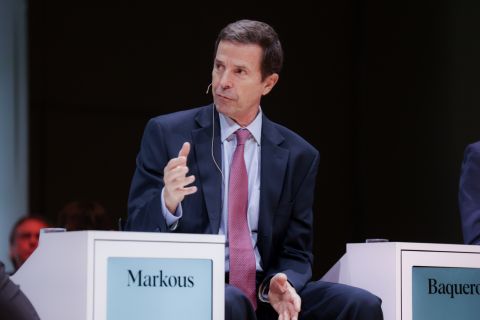
2024-03-28 - Tecpetrol CEO Ricardo Markous touted Argentina’s conventional and unconventional potential saying the country’s oil production would nearly double by 2030 while LNG exports would likely evolve over three phases.

Woodside Brings in the Know-how
2024-04-01 - Woodside Energy Group CEO Meg O’Neill is relying on technical sophistication to guide the Australian giant as it takes on three challenging projects in the U.S. Gulf of Mexico.
Baker Hughes Detects LNG Slowdown Solutions, Global Opportunities
2024-01-26 - Baker Hughes’ fourth quarter earnings call confronts Biden’s halt on LNG permitting with “solve itself” attitude.
ConocoPhillips CEO Ryan Lance Calls LNG Pause ‘Shortsighted’
2024-02-14 - ConocoPhillips chairman and CEO Ryan Lance called U.S. President Joe Biden’s recent decision to pause new applications for the export of American LNG “shortsighted in the short-term.”

Antero Poised to Benefit from Second Wave of LNG
2024-02-20 - Despite the U.S. Department of Energy’s recent pause on LNG export permits, Antero foresees LNG market growth for the rest of the decade—and plans to deliver.