A discovery flowed 163,000 cu. ft. of gas a day for Betsy Production Co., Magnolia, Ark., at its #1 Pickens-Moorehead 14-9 wildcat in eastern Chickasaw County, Miss. The Black Warrior Basin well in Section 14-13s-4e tested through an 18/64-in. choke with 80 psi of flowing tubing pressure from Mississippian Abernathy perforations between 2,663-72 ft. The closest production is 3.25 miles east-northeast in the two-well Boone Church Field. There, #1 McCain 8-16 tested 650,000 cu. ft. of gas a day from Mississippian Lewis from 3,082-92 ft., according to IHS Inc.
Omimex Energy Inc., Fort Worth, Texas, is continuing its Silurian campaign in Ocean County in western Michigan. The company scheduled its second wildcat, #4-30 Fuehring & State-Hart, in Section 30-15n-17w, Hart Township, to Clinton shale at 4,550 ft. about 1.5 miles southwest of the town of Hart. It also will evaluate Guelph and shallower Silurian zones. The nearest production is from #1-24 Bailey, the Golden Field discovery well 1.25 miles northwest. That well tested flowing 2.98 million cu. ft. of gas and 34 bbl. of condensate from Silurian A-1 carbonate perforations between 3,984 and 4,022 ft.
A remote discovery tested 50 bbl. of oil with 20,000 cu. ft. of gas and 35 bbl. of water a day for West Bay Exploration Co., Traverse City, Mich. The #1-1 Janice Roestel, in Section 1-15n-9e in Sebewaing Township in southwestern Huron County, Mich., is in the thumb area of the state's Lower Peninsula. The well flowed from perforations between 2,884-88 ft. in Dundee. The closest production is approximately eight miles southeast in Grant Section 29 Field, which produces oil from Devonian Detroit River at fewer than 3,700 ft. West Bay plans a second remote wildcat, #1-17 Siemen in 17-16n-15e in Sand Beach Township and about eight miles from the nearest production.
A remote northern Illinois Basin wildcat will evaluate zones through Devonian to about 2,200 ft. for Glenfield Oil & Gas LLC, Jemison, Ala. The company will drill #1 Sullivan in Section 8-14n-11w about three miles north-northeast of Paris in eastern Edgar County, Ill. The well is in a lightly drilled area more than 10 miles northeast of production in Dudley Field. That field, discovered in 1948, produced some 4.3 million bbl. of oil from Pennsylvanian intervals shallower than 500 ft. The field still produced almost 5,500 bbl. of oil in December. The closest Devonian production is 11 miles south-southeast. There, Elbridge Field has produced 1.3 million bbl. of oil from a reef play since 1949 from Pennsylvanian at 750 ft., Fredonia at 950 ft. and Devonian at 1,950 ft., according to IHS Inc.
Aurora Energy Ltd., Traverse City, Mich., plans a wildcat to test Trenton for gas in Section 2-28n-4w in White County, Ind. The #A1-2 Gudeman will be drilled to 900 ft. some 3.8 miles north of Monon, Ind., and 8.4 miles west of the nearest production in West Lakeside Field, a Trenton pool.
Clinton sand is the target for wildcat #1 McCracken Property North LLC, which has been permitted in Cuyahoga County, Ohio. M&M Royalty Ltd., North Canton, Ohio, will drill the well to 3,500 ft. to test oil and gas potential. The well, in Independence Township, Shaker Heights Quad, is a mile northeast of the town of Shaker Heights. The nearest production is 2.2 miles south in Cleveland Field, which produces from Clinton.
In the same county, Bass Energy Co. Inc., Fairlawn, Ohio, will drill #1 Aukerman Unit to 3,300 ft. to Clinton sand. The well is in Royalton Township, Berea Quad, less than a mile southwest of North Royalton and 1.4 miles northwest of an unnamed field that produces from Oriskany.
Fortuna Energy Inc., the New York-based subsidiary of Talisman Energy Inc., Calgary, will produce gas at a combined rate of about 30 million cu. ft. a day from two Black River discoveries in south-central New York. The #1 Hulett, near the town of Horseheads in Town of Chemung, Horseheads Quad, Chemung County, was drilled horizontally to a newly defined Upper Black River graben. The well flowed at a rate of 15 million cu. ft. of gas a day with a flowing pressure of 2,800 psi. In neighboring Steuben County, the company expects an initial potential of 15 million cu. ft. a day from its #1 Dzybon near Big Flats in Town of Corning, Big Flats Quad. That well also was drilled horizontally to a new Upper Black River graben.
The 2007 budget for Fortuna Energy Inc., the New York-based subsidiary of Talisman Energy Inc., Calgary, allows $120 million to drill or participate in 25 Trenton-Black River wells this year. Among them, the company plans #1 Conden about three miles south of Candor in Town of Candor, Candor Quad, Tioga County, N.Y. It will be drilled directionally north-northeast to 12,594 ft., or a true vertical depth of 9,704 ft. The closest production is 11 miles south in Stagecoach Field, a Helderberg/Oriskany pool. Fortuna has been a pioneer in the Trenton-Black River in New York and now produces 112 million cu. ft. of gas a day from the play.
Seneca Resources Corp., Houston, plans three wildcats to test Upper Devonian in Glen Hazel Quad in Elk County, Pa. The #38248 Fee-PGC-SGL 25 will be drilled to 2,454 ft. in Section H, Jones Township. That well is 1.4 miles northeast of Speechley production in Glen Hazel Field and 6.8 miles north of St. Marys, Pa. In Section G in Jones Township, the company will drill #28249 Fee-PGC-SGL 25 to 2,825 ft. That well is 1.7 miles north of Glen Hazel Field and 5.6 miles northeast of the town of Johnsonburg. The third well in the series, #38246 Fee-PGC-SGL 25, is projected to 2,400 ft. in Section G, St. Marys Township. This well is 1.5 miles northeast of an unnamed Speechley field and four miles northeast of Johnsonburg.
Clarion County, Pa., will host three new wildcats, all in Section H, Clarion Quad, Monroe Township, and all targeting Upper Devonian gas. Interstate Gas Marketing Inc., Indiana, Pa., will drill #1 J O'Connell to 4,000 ft. approximately 1.5 miles north in an unnamed field that produces from Upper Devonian. William McIntire Coal Oil & Gas, Shelocta, Pa., will drill #1 Clinger and #2 Clinger, both to 5,000 ft. The #1 Clinger is 1.6 miles northwest of New Bethlehem Field, a Devonian pool, and 4.8 miles northeast of Sligo. The #2 Clinger is 1.7 miles northwest of the same field and 4.9 miles northeast of Sligo.
Chesapeake Appalachia LLC, the Appalachian subsidiary of Chesapeake Energy Corp., Oklahoma City, plans two new wildcats in Preston County, W.Va. In Pleasant District, it will drill #626275 Dorothy Cale to Benson sand at 3,633 ft. The well is in Valley Point Quad, 3.6 miles south of Bruceton Mills and 5.1 miles northeast of Wildcat Field, a Tuscarora sand producer. It will drill #626182 Robert Shufelt to Marcellus shale at 7,872 ft. in Brandonville District in the same county. That well is 3.1 miles southeast of Brandonville and 6.2 miles south of an unnamed field that produces from Balltown sand.
Veteran Appalachian producer Cabot Oil & Gas Corp., Houston, plans a wildcat, #M-102 POCA, for a Devonian shale objective at 6,000 ft. The well is in Adkin District, Anawalt Quad, 2.6 miles southeast of the town of Gary in McDowell County, W.Va., and 1.8 miles southwest of an unnamed Maxton field.
Equitable Production Co., Pittsburgh, will drill wildcat #V-536923 W.A. Powers to Devonian at 6,064 ft. as it looks for gas in Wise County, Va. The location is in Gladeville District, Pound Quad, about 5.5 miles northeast of the town of Wise and 1.7 miles northwest of the nearest production in an unnamed field.
Six Devonian-formation wildcats are in the works in Russell County, Va., for Equitable Production Co. The #V-537731 James Gilbert will be drilled to 6,142 ft. in New Garden District, Duty Quad, 1.3 miles east of Pennsylvanian production in Nora Field and 6.7 miles northwest of Cleveland, Va. The remaining wells are in Castlewood District. The #V-537738 Dawson Coal & Coke Co. is projected to 5,985 ft. in St. Paul Quad, 1.4 miles southeast of High Knob field, a Pennsylvanian coal pool, and 4.9 miles north of St. Paul. The #V-537733 Henry Kiser, targeting 5,769 ft., is in Duty Quad, 1.7 miles southeast of Nora Field and six miles northwest of Cleveland.
The #V-537732 WP Grizzle is scheduled to 5,763 ft. in Duty Quad, 1.6 miles southwest of Nora Field and 5.7 miles north of Cleveland. The #V-537735 Dawson Coal & Coke Co. is planned to 5,946 ft. in St. Paul Quad, 1.6 miles southeast of Nora Field and six miles north of St. Paul. The final wildcat, #V-537742 Dawson Coal & Coke Co., will test Devonian at 5,483 ft. in St. Paul Quad, 1.5 miles southeast of High Knob Field and 4.4 miles north of St. Paul, according to IHS Inc.
Mitchell Coomer, Columbia, Ky., will drill a wildcat, #2 Eva Hoover, to Knox at 1,999 ft. in search of oil in Adair County in central Kentucky. The well, in Section 6-F-51e, Amandaville Quad, is 8.5 miles south of the town of Columbia and 1.8 miles southeast of the nearest production from Gradyville East Consolidated Field, a Knox pool.
Quality Natural Gas LLC, Allen, Ky., plans two wildcats to Lower Devonian at 5,800 ft. in Whitesburg Quad in Letcher County, Ky. The #1564 Kelsey Day et al. is in Section 21-H-80e, about 1.1 miles south of an unnamed Devonian field and two miles south of the town of Whitesburg. The #1663 Robert N Wells et al. is in Section 1-G-80e two miles south of an unnamed White Slate field and 3.1 miles southwest of Whitesburg.
Recommended Reading
US Drillers Add Oil, Gas Rigs for First Time in Five Weeks
2024-04-19 - The oil and gas rig count, an early indicator of future output, rose by two to 619 in the week to April 19.
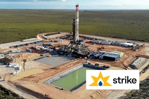
Strike Energy Updates 3D Seismic Acquisition in Perth Basin
2024-04-19 - Strike Energy completed its 3D seismic acquisition of Ocean Hill on schedule and under budget, the company said.

Santos’ Pikka Phase 1 in Alaska to Deliver First Oil by 2026
2024-04-18 - Australia's Santos expects first oil to flow from the 80,000 bbl/d Pikka Phase 1 project in Alaska by 2026, diversifying Santos' portfolio and reducing geographic concentration risk.
Iraq to Seek Bids for Oil, Gas Contracts April 27
2024-04-18 - Iraq will auction 30 new oil and gas projects in two licensing rounds distributed across the country.
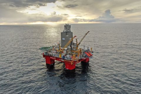
Vår Energi Hits Oil with Ringhorne North
2024-04-17 - Vår Energi’s North Sea discovery de-risks drilling prospects in the area and could be tied back to Balder area infrastructure.