Presented by:
![]()
This article appears in the E&P newsletter. Subscribe to the E&P newsletter here.
As oil and gas operators prepare for increased energy demand and a market-driven upturn in exploration, it is expected that these exploration efforts will continue to move away from traditional, large-scale 3D seismic surveys and toward more targeted and sophisticated programs that integrate multiuse datasets. This trend won’t be driven solely by the desire for reduced schedules and costs, but also by the recognition that the industry must minimize its environmental footprint to the greatest extent possible.
Hydrocarbon seep studies
One way to achieve more effective exploration is through offshore hydrocarbon seep studies. These programs rely on high-quality seabed mapping, geological interpretation and geochemical analyses of sampled material to indicate potential prospectivity of an associated petroleum system. This approach is not new to the world of petroleum exploration, as surface geochemistry and the hunt for seeps has been in common use for land-based exploration since the start of the petroleum industry. Locating seeps in the offshore environment is far more complicated, however, due to difficulties in “seeing” through the water column to map the seabed and identify favorable features for sampling.
As a geo-data specialist with integrated geophysical and geochemical expertise, Fugro has developed—and over time, refined—a proven methodology for offshore hydrocarbon seep studies worldwide. The approach is designed to maximize exploration investments and is scalable for both individual exploration programs and for large regional investigations.
Essential datasets
Good geophysical data are critically important to this work, as seeps are typically discrete point sources on the seabed, with steep lateral chemical gradients.
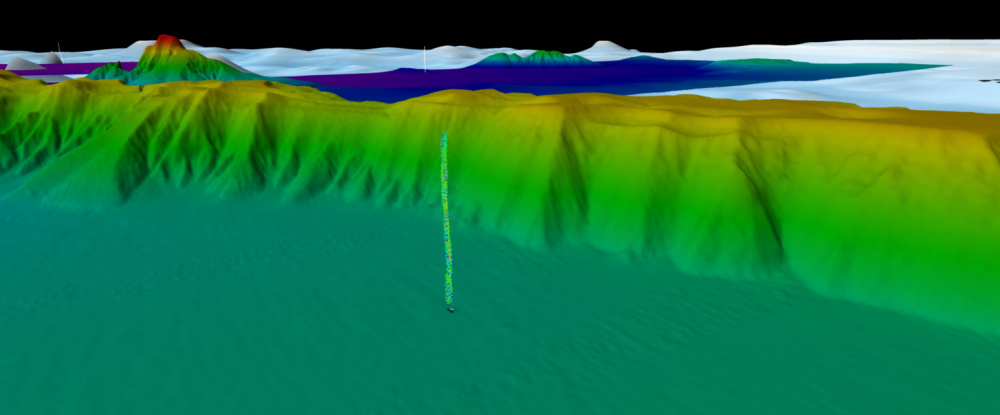
One of the primary tools for identifying seeps on the seabed, as well as gas seeping into the water column, is multibeam echosounder (MBES) technology. MBES data can generate high-quality seabed maps to assist geoscientists in the interpretation of seafloor morphology, including regions of anomalous MBES backscatter caused by hardness or rugosity differences as might be expected from associated chemosynthetic fauna or authigenic carbonates. Additionally, modern MBES systems can be used to identify anomalies in the water column, often caused by rising bubble plumes.
Fugro scientists have proven several new techniques for processing and evaluating datasets. These methods are enabling faster and more accurate analyses of large water column datasets through amplitude stacking and machine learning.
Also, as new fleets of uncrewed surface vessels are becoming more common in the industry, this sort of acquisition can now be accomplished with a much lower risk exposure and carbon footprint.
MBES data only allows interpretation of the seabed and water column, and ultimately those data need to be integrated with seismic data to determine if the identified feature on/near the seabed is connected via a fluid migration pathway that extends to reservoir or source depths. Several studies have shown a significant increase in sampling program success when MBES is integrated with the seismic data, rather than relying on seismic data alone, leading Fugro to recommend the combined procedure for the geophysical and interpretative phase of these programs.
Once the geophysical interpretations have been finalized and a selection of potential seep targets for sampling have been determined, it is important to collect the geochemical samples in a clean, contaminant-free environment. Historically, geochemical samples collected offshore have had challenges caused by the environment on the vessel, with various hydrocarbon-based materials all commonly used by marine crew (oils, greases, lubricants, paints, solvents, etc.). Given the fundamental objective of these surveys to collect a suite of geochemical samples that can help identify and reduce risk, the exploration program ahead of major investments, it is especially important that the sampling be performed by skilled geoscientists in a meticulous fashion.
Shipboard geochemical analyses
Unique to Fugro’s hydrocarbon seep studies is the ability to perform some preliminary geochemical analyses on the samples while at sea. From these initial interpretations, the team can then modify their sampling plans or targets and identify and address any contaminants that may be present in the samples. This application of shipboard geochemistry analyses, along with the ability to rapidly transfer large amounts of digital data to shore-based teams, has added significant value to the overall approach, permitting real-time decisions that help optimize the sampling program and ensure maximum confidence in the final study conclusions.
Extended value of multiuse data
A final point about the value of offshore hydrocarbon seep studies is that their workflows are similar to those undertaken by environmental baseline studies; the seafloor characterization using geophysical data and the geologic/geochemical sampling can allow scientists to proactively assess the environmental impacts of later development in an area.
Fugro is working to add environmental baseline value to seep investigations where possible. For example, specialized cameras can be attached to the coring assemblage for visual inspections of the seabed prior to sampling, while benthic eDNA (environmental DNA) and other microbiological studies can be performed on the samples to further identify the geologic and biologic drivers in a region of interest.
Case study: a collaboration with the Colombian Maritime Authority
Fugro typically performs seep studies to support commercial exploration by oil and gas operators. A twist on that standard is the company’s recent work with the Colombian Maritime Authority (DIMAR) on behalf of Colombia’s National Hydrocarbon Agency (ANH). The Fugro-DIMAR collaboration provides a working example of how seep studies can be used to incentivize investment into a region by a government.
Fugro’s collaboration with DIMAR began in 2019 to better understand the deepwater resource potential offshore Colombia. That year the work was conducted in and around the Beata Ridge area of Colombia’s northern Caribbean territorial waters. The campaign’s success led ANH to fund another study in 2021 and to discuss future projects in other Colombian basins as well.
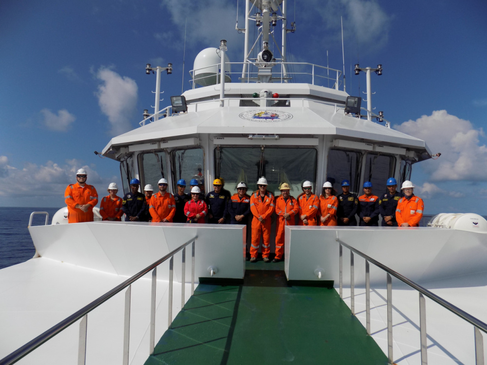
Both the 2019 and the current 2021 project have involved mobilizing Fugro’s personnel and equipment onboard DIMAR’s multipurpose hydrographic ARC Roncador vessel. This mobilization has included two self-contained laboratories and a heat flow probe. An important part of the collaboration is the ongoing information exchange between contractor and client, with Fugro providing both classroom and vessel-based training to DIMAR personnel.
Information such as extent of source rock, thermal maturity and potential for economic development are all valuable deliverables from the seep studies, helping both ANH and DIMAR make strategic decisions about planning their resource development and allocating their assets.
Recommended Reading

E&P Highlights: Feb. 26, 2024
2024-02-26 - Here’s a roundup of the latest E&P headlines, including interest in some projects changing hands and new contract awards.
E&P Highlights: March 4, 2024
2024-03-04 - Here’s a roundup of the latest E&P headlines, including a reserves update and new contract awards.
Rystad: More Deepwater Wells to be Drilled in 2024
2024-02-29 - Upstream majors dive into deeper and frontier waters while exploration budgets for 2024 remain flat.

E&P Highlights: April 8, 2024
2024-04-08 - Here’s a roundup of the latest E&P headlines, including new contract awards and a product launch.

E&P Highlights: Feb. 5, 2024
2024-02-05 - Here’s a roundup of the latest E&P headlines, including an update on Enauta’s Atlanta Phase 1 project.