Since all processes in the subsurface are no less than 3-D, 3-D petroleum systems modeling is becoming an integral part of any prospect evaluation. It integrates different disciplines in the oil and gas industry such as seismic interpretation and analysis, geochemistry, structural modeling, reservoir modeling, economic risking, exploration risking, and pressure analysis. A petroleum systems model is a digital data model of an entire petroleum system in which the interrelated processes and their results can be simulated to understand and predict them. These models are dynamic as they provide a complete record through geologic time.

FIGURE 1. A depth-to-Moho calculation includes upper and lower crustal thickness estimations. (Images courtesy of Robertson, a CGG company)
Petroleum systems modeling is the combination of seismostratigraphy and seismotectonics, well log analysis, biostratigraphy, and geological and geochemical information to model the evolution of a sedimentary basin through time. Petroleum systems modeling is progressively becoming a key tool in the exploration industry as it predicts if, when, and how a reservoir has been charged with hydrocarbons, including the source and timing of hydrocarbon generation, migration, migration loss, volumetrics, trapping, leakage, and hydrocarbon type in the subsurface. The predicted hydrocarbon potential and its relation to stratigraphic and structural traps in the seismic dataset allow the identification of any potential risks that may be present within a given petroleum system.
Building the model
A key part of building any 3-D model is to constrain the geological evolution of the basin. This is done by incorporating boundary conditions into the model in terms of paleolatitudes, paleowater depths, and heat flow variations through time. Advances have been made in the development of tools to constrain the geological evolution and create carefully tailored models specific to certain areas of the globe. For example, Plate Wizard is a plate tectonic model and a geographic information system tool that reconstructs and predicts paleogeographical positions using “rigid” and “deformable” tectonic plates of the Earth. The model is data-constrained for the Mesozoic and Cenozoic eras (ranging from 250 million years ago to present day). The tool has been designed to address some of the important limitations and problems associated with existing plate models. Its aim is to be useful as a base for paleogeographic and paleolatitude mapping; modeling deformation at plate margins; and placing any geological data, project, or problem in a plate-tectonic context. In the context of basin modeling Plate Wizard can be used to track the changes in paleolatitude of each well point.

FIGURE 2. This basin-scale model-building (a) shows stratigraphy; (b) oil (green) and gas (red) accumulations are identified following simulation; and (c) the location of the 3-D cube is indicated within the basin-scale model.
Depth-to-Moho calculation involves forward-modeling the flexural response of the crust-mantle interface due to an estimated load for a range of suitable elastic thicknesses (or crustal strengths). The loading of the crust is estimated from global compilations of sediment thickness and digital elevation models. Moho depths from all elastic thickness scenarios are compared, and the best scenario is then converted to total crustal thickness by calculating the difference between the selected scenario and the digital elevation model.
Final model-building (Figures 2a and 3a) is conducted by incorporating geophysical data such as depth maps from interpreted 2-D and 3-D seismic studies; well logs; temperature data such as bottomhole and distributed temperature data; geochemical data such as vitrinite reflectance, biomarker analysis, source rock type, richness, and quality; and boundary conditions such as crustal thickness, depth to Moho, and paleolatitude and paleowater depth.
One issue that arises during model-building is that of scale. This occurs due to the introduction of data from a number of disciplines such as geophysics, sedimentology, biostratigraphy, and geochemistry. In a case study example a detailed model was incorporated into a basin-scale model to highlight the impact that this can have on the results following simulation (Figure 2c). The detailed model incorporated fault distributions and meter-scale lithological variations, thus providing a highly detailed assessment of the nature of potential hydrocarbon migration, trapping, and accumulation. Comparisons could then be made between accumulation occurrence in the 3-D cube and the same volume of the basin-scale model containing a simplified stratigraphy. It is believed that the information obtained from the 3-D cube can be extrapolated to provide a suitable analogue for potentially similar areas of the basin where seismic coverage is less detailed.
The basin-scale model consists of 60 layers, whereas the 3-D cube consists of 313 layers and so can more closely represent the actual variations in reservoir and seal facies. This leads to a higher number of gas accumulations within the 3-D cube as the oil generated is trapped in a greater number of reservoir and seal combinations where it is cracked to gas (Figures 2b and 3b). The basin-scale model can be interpreted as an oil-prone petroleum system, whereas the detailed cube is predominately gas-prone.
For the exploration industry and new ventures it is important to know the subsurface pressure conditions to anticipate the potential of overpressure within the area.
The basin-scale model that contained lithological variations at a 50-m (164-ft) scale showed no overpressure within the sedimentary package. In contrast, the 3-D cube, containing meter-scale lithological variations, showed overpressure starting at a depth of 1,762 m (5,780 ft) due to successions containing a high shale content. Normal pore pressure increases approximately 1.4 psi/1 m (3.3 ft) of depth, and saturated saltwater generates a gradient of 1.5 psi. According to this, at a depth of 2 km (1.2 miles) a normal pressure should be 2,845 psi, whereas the model predicted a pore pressure of 4,520 psi at this depth. The high predicted pore pressures are related to high sedimentation rates and overburden rocks including shales, mudstones, and resulting compaction. Overpressure can cause a well to become uncontrollable during drilling.

FIGURE 3. A similar process was applied to the 3-D cube (a), which shows stratigraphy, and (b) oil (green) and gas (red) accumulations are identified following simulation and fault (blue) distributions.
Potential applications
Overpressure plays an important role in unconventional plays where mature shales are responsible for increasing pore pressure. Therefore, petroleum systems analysis is playing an increasing role within unconventional resource exploration. Through the use of basin modeling it has become possible to evaluate potential unconventional plays by the incorporation of shale oil and gas, oil shale, and biogenic source intervals as well as by the ability to create unconventional source kinetics. One tool of significant importance is geomechanical analysis on basin stratigraphy to target specific horizons within a basin and determine the rock fracability. For example, it is now possible to identify a potential shale gas play within the petroleum system and calculate the pressure required to fracture the rock within that specific formation. For this detailed information on the pressure regime, thermal conductivity; minimum horizontal stress; and geomechanics data such as porosity/permeability, elastic properties/Poisson’s ratio, plastic properties/tensile strength, and capillary entry pressure/porosity pressure are required. This offers invaluable information in terms of constraint of potential producibility of unconventional plays. In summary:
- Basin modeling is highly influenced by data availability. It is important to establish well-constrained boundary conditions and paleogeometries;
- Determining an accurate heat flow through structures and time is essential as this is reflected in the thermal maturity levels of source rock intervals;
- Detailed kinetics of source intervals are required to accurately predict generated hydrocarbon phases and volumes; and
- Vertical and lateral facies distributions have a great influence on the model as they determine the hydrocarbon migration routes and stratigraphic accumulation occurrence.

FIGURE 4. The pressure vs. depth plot for the basin-scale model (a) is compared to the pressure vs. depth plot for the 3-D cube (b).
This study highlighted the potential variations in results that can be achieved by using differing approaches to model-building. For example, the basin-scale model indicated that there is a predominance in oil accumulations following simulation, whereas the 3-D cube interpreted the petroleum system to contain a predominance of gas accumulations. The basin-scale model also failed to identify overpressure occurrence within the subsurface. Such information is invaluable to the exploration industry. The prediction of sensitive outputs can offer a constraint on exploration activity, leading to an assessment of the potential risk of any petroleum system.
Recommended Reading

Gunvor Group Inks Purchase Agreement with Texas LNG Brownsville
2024-03-19 - The agreement with Texas LNG Brownsville calls for a 20-year free on-board sale and purchase agreement of 0.5 million tonnes per annum of LNG for a Gunvor Group subsidiary.
Texas LNG Export Plant Signs Additional Offtake Deal With EQT
2024-04-23 - Glenfarne Group LLC's proposed Texas LNG export plant in Brownsville has signed an additional tolling agreement with EQT Corp. to provide natural gas liquefaction services of an additional 1.5 mtpa over 20 years.
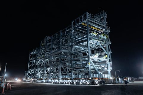
Woodside’s Pluto Train 2 Nears 2026 Start Up with Modules Delivery
2024-02-21 - First 3 of 51 modules have arrived on site in Western Australia for the onshore LNG project that will receive gas from the offshore Scarborough project.

FERC Approves Extension of Tellurian LNG Project
2024-02-19 - Completion deadline of Tellurian’s Driftwood project was moved to 2029 and phase 1 could come online in 2027.

NextDecade Targets Second Half of 2024 for Phase 2 FID at Rio Grande LNG
2024-03-13 - NextDecade updated its progress on Phase 1 of the Rio Grande LNG facility and said it is targeting a final investment decision on two additional trains in the second half of 2024.